
MyTopo
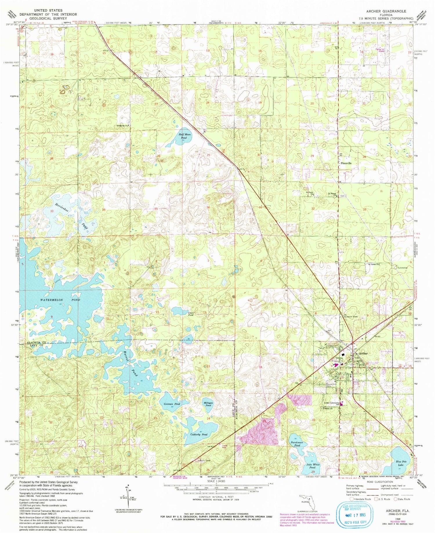
Classic USGS Archer Florida 7.5'x7.5' Topo Map
Couldn't load pickup availability
Historical USGS topographic quad map of Archer in the state of Florida. Map scale may vary for some years, but is generally around 1:24,000. Print size is approximately 24" x 27"
This quadrangle is in the following counties: Alachua, Levy.
The map contains contour lines, roads, rivers, towns, and lakes. Printed on high-quality waterproof paper with UV fade-resistant inks, and shipped rolled.
Contains the following named places: Alachua County Fire Rescue Station 82, Alachua County Library District Archer Branch Library, Archer, Archer Baptist Church, Archer Branch Library, Archer Church of God by Faith, Archer Church of God in Christ, Archer Church of the Nazarene, Archer Elementary School, Archer Emergency Heliport, Archer Family Life Church of God, Archer Forestry Site Tower, Archer Post Office, Archer United Methodist Church, Banks Methodist Church, Barrel Pond, Bethlehem Presbyterian Church, Blue Pete Lake, Church of Christ, Church of Christ of Archer, City of Archer, Cross Creek Baptist Church, Cubberly Pond, First Baptist Church of Archer, First United Methodist Church, Flying Ten Airport, Gosman Pond, Grass Pond, Greater Faith Christian Center, Half Moon, Half Moon Pond, Horseshoe Pond, Jake White Pond, Laurel Hill Cemetery, Maddox Field, Milligan Pond, Mount Pisgah AME Church, Newberry-Archer Division, Parchman Pond, Pinesville, Pineville Church, Saint James Missionary Baptist Church, Saint Joseph Missionary Baptist Church, Saint Mark Cemetery, Saint Marks Church, Saint Paul Baptist Church, Saint Peter's Baptist Church, Saint Peter's Cemetery, Santa Fe Community College - Davis Center, Shiloh Cemetery, Shiloh Missionary Baptist Church, St. Joseph's Episcopal Church, ZIP Code: 32618


