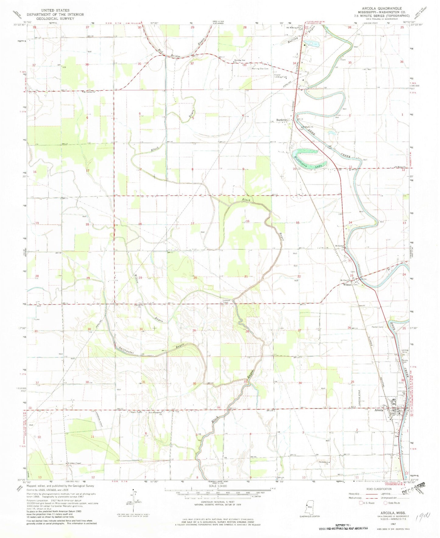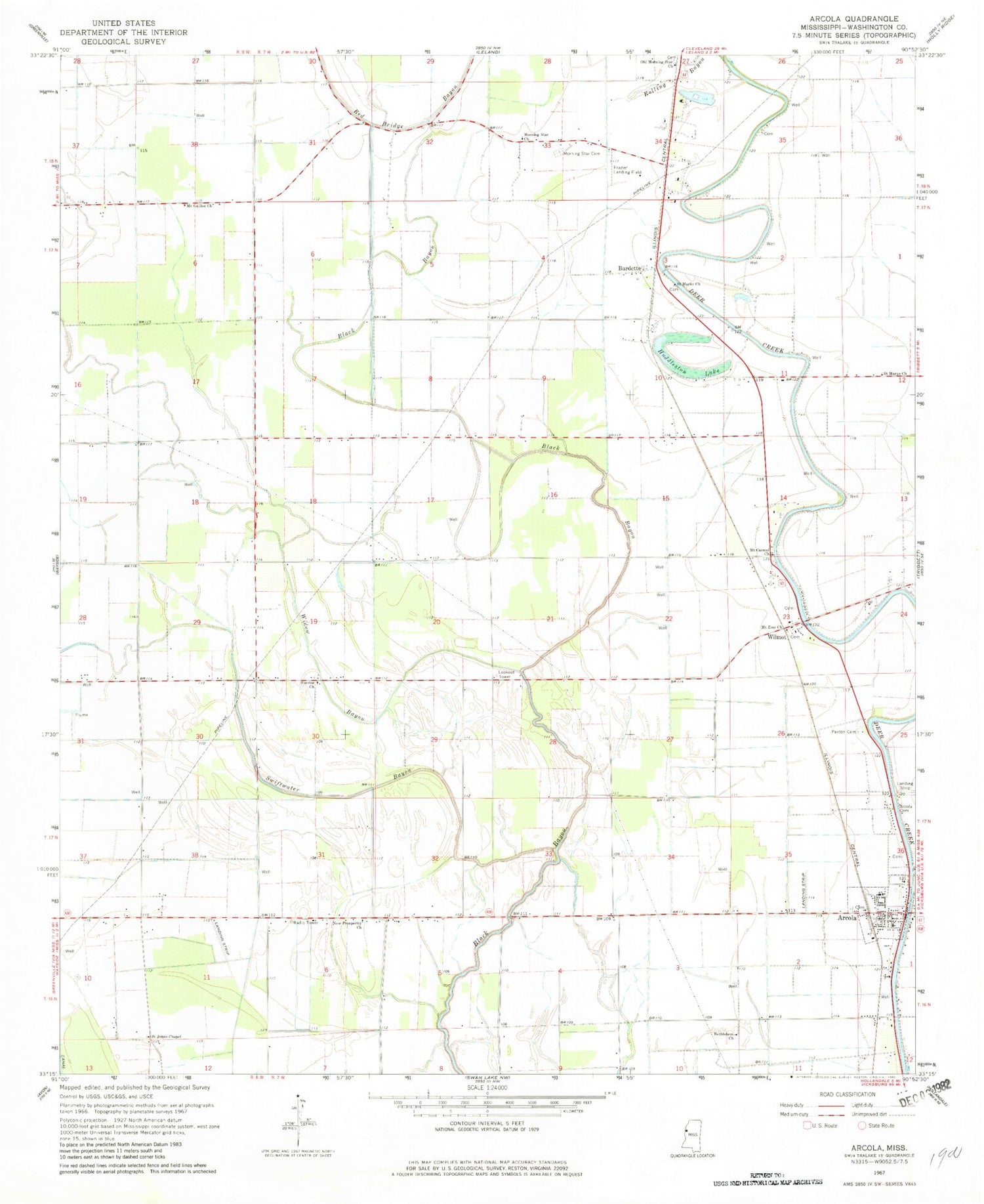
MyTopo
Classic USGS Arcola Mississippi 7.5'x7.5' Topo Map
Couldn't load pickup availability
Historical USGS topographic quad map of Arcola in the state of Mississippi. Map scale may vary for some years, but is generally around 1:24,000. Print size is approximately 24" x 27"
This quadrangle is in the following counties: Washington.
The map contains contour lines, roads, rivers, towns, and lakes. Printed on high-quality waterproof paper with UV fade-resistant inks, and shipped rolled.
Contains the following named places: Abide Airpark, Aldridge, Almy, Aqua Farms Dam, Arcola, Arcola Cemetery, Arcola Post Office, Arcola Volunteer Fire Department, Ballard Lake Dam, Bethlehem Church, Burdette, Hays, Huddleston Lake, Isenberg, Johnston, Jones Chapel, L and W Catfish Ponds Dam, Morning Star Cemetery, Morning Star Church, Mount Carmel Church, Mount Galilee Church, Mount Zion Church, New Morning Star Church, New Prosperity Church, Old Morning Star Church, Paxton Cemetery, Quay, Rolling Bayou, Saint Johns Church, Saint Marys Church, Saint Matthews Church, Sligo Plantation, Sunrise Church, Supervisor District 2, Swiftwater Bayou, Town of Arcola, Washington County, Whitehall Plantation, Widow Bayou, Wilmot, Wingfield Lake Dam, ZIP Code: 38722