

MyTopo
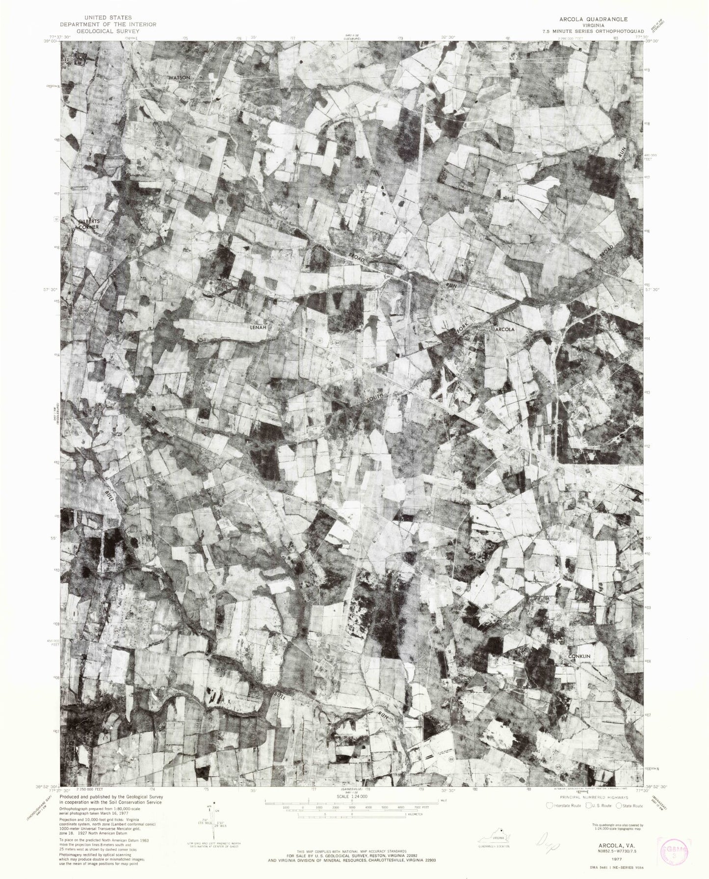
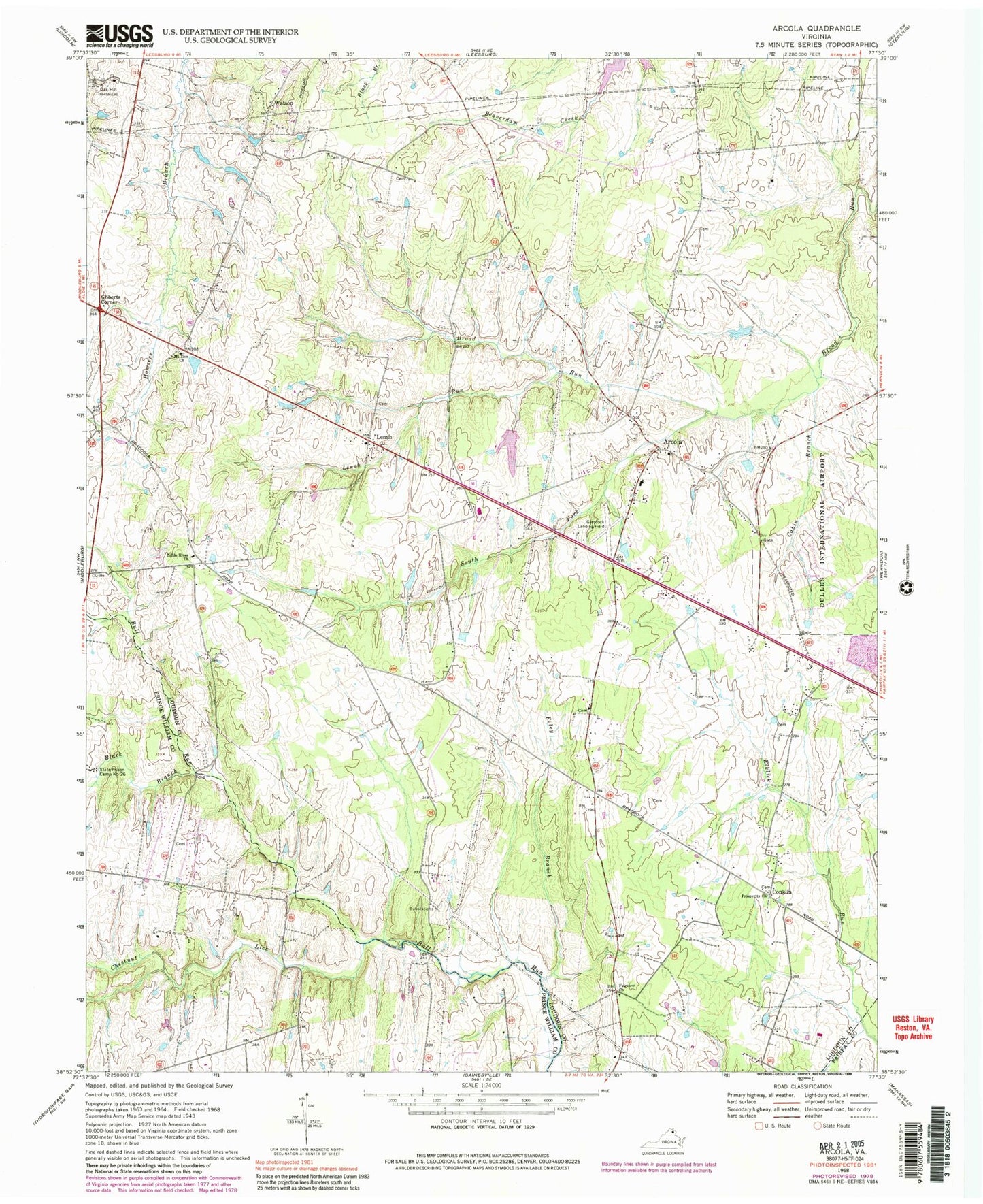
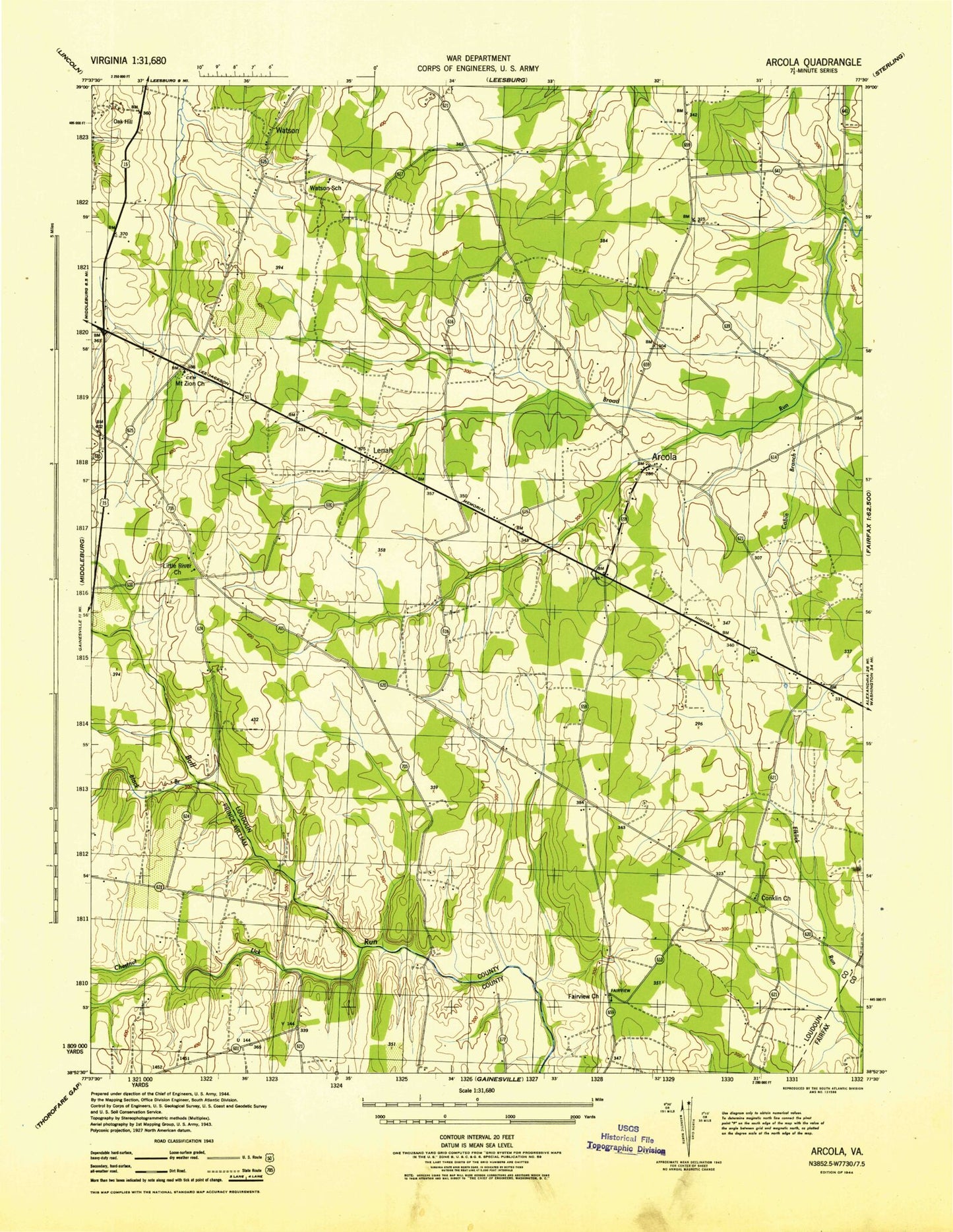
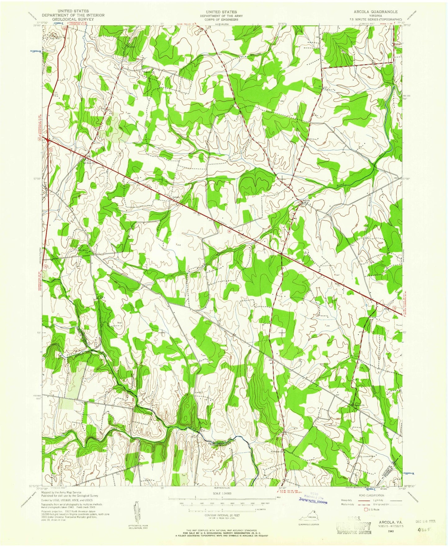
Classic USGS Arcola Virginia 7.5'x7.5' Topo Map
Couldn't load pickup availability
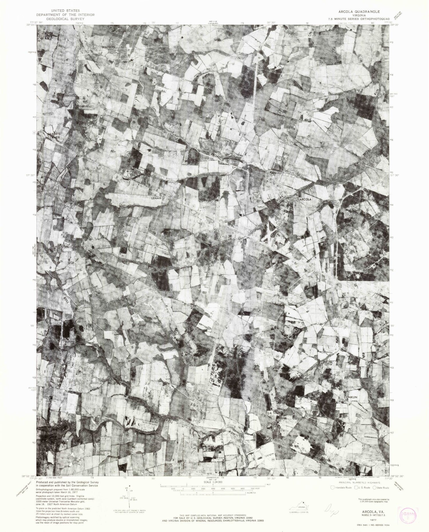
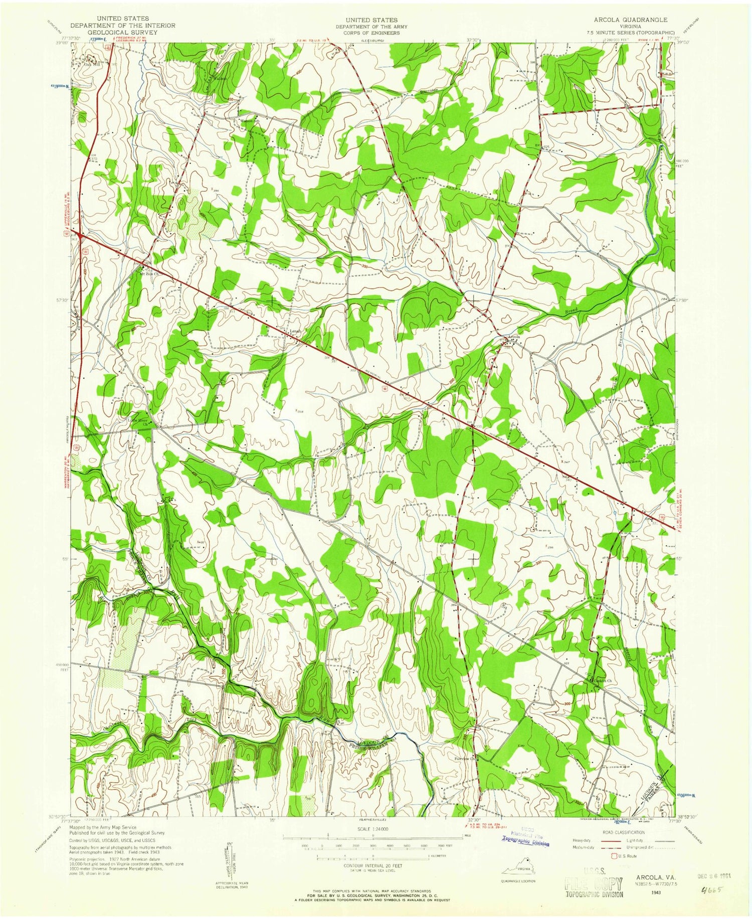
Historical USGS topographic quad map of Arcola in the state of Virginia. Typical map scale is 1:24,000, but may vary for certain years, if available. Print size: 24" x 27"
This quadrangle is in the following counties: Fairfax, Loudoun, Prince William.
The map contains contour lines, roads, rivers, towns, and lakes. Printed on high-quality waterproof paper with UV fade-resistant inks, and shipped rolled.
Contains the following named places: Black Branch, Cabin Branch, Chestnut Lick, Fairview Church, Foley Branch, Lenah Run, Little River Church, Mount Zion Old School Baptist Church (historical), Oak Hill (James Monroe house), Prosperity Baptist Church, South Fork Broad Run, Quail Ridge Dam, Quail Ridge Lake, State Prison Camp Number 26, Arcola, Conklin, Gilberts Corner, Lenah, Watson, Glascock Airport (historical), Smith Airport (historical), South Riding, Acts Church, Arcola Elementary School, Arcola Post Office (historical), Arcola United Methodist Church, Burns Crossroads, Butler, German, Hutchinson, Royville, Swansen, Watson School (historical), Wycuffs Corner, Boxwood Farms, Forest Hills Estates, Hickory Grove Acres, Olde South Estates, Brambleton, Brambleton Golf Course, Brambleton Regional Park, Hutchinson Farm Elementary School, Mercer Middle School, Ish Family Cemetery, Mount Zion Cemetery, Freedom High School, Legacy Elementary School, Briar Woods High School, Pinebrook Elementary School, Loudoun County Fire and Rescue Arcola Station 9, Brambleton Town Center, First Baptist Church Watson, Allen Cemetery, Stone Hill Middle School, Rosa Lee Carter Elementary School, Arcola Community Center (historical), Arcola Slave Quarters (historical), Liberty Elementary School, Creighton's Corner Elementary School, Stone Ridge Village Center, Dulles South Multipurpose Center, Dulles South Public Safety Center, Byrne's Ridge Park, South Riding Golf Club, Arcola Census Designated Place, Brambleton Census Designated Place, Loudoun Valley Estates Census Designated Place, South Riding Census Designated Place, Stone Ridge Census Designated Place, Loudoun County Fire and Rescue Dulles South Public Safety Center Station 19, Ticonderoga Farms, J Michael Lunsford Middle School, Buffalo Trail Elementary School, John Champe High School, Encompass Health Rehabilitation Hospital of Northern Virginia, Community Baptist Church, Gum Spring Library, Rock Ridge High School, Cardinal Ridge Elementary School, Loudoun County Sheriff's Office Dulles South Public Safety Center, Brambleton Middle School, Moorefield, Brambleton Golf Course Dam, Brambleton Library, Brambleton Public Safety Center, Chesterbrook Academy Preschool, Creighton Farms, Gilbert's Corner Regional Park, Goshen Post Elementary School, Hillside Circle Dam, Independence High School, Little River Baptist Church, Madison's Trust Elementary School, Moorefield Station Elementary School, Mt. Zion Historic Park, National Recreation and Park Association, Oak Hill Farm Dam No. 2, Primrose School at Moorefield Station, StoneSprings Hospital Center (historical), Strobel Airfield (historical), The Club at Creighton Farms, Ticonderoga Farms Dam, Washington Immanuel Presbyterian Church, Willard Intermediate School, Willowsford, Black Branch, Cabin Branch, Chestnut Lick, Fairview Church, Foley Branch, Lenah Run, Little River Church, Mount Zion Old School Baptist Church (historical), Oak Hill (James Monroe house), Prosperity Baptist Church, South Fork Broad Run, Quail Ridge Dam, Quail Ridge Lake, State Prison Camp Number 26, Arcola, Conklin, Gilberts Corner, Lenah, Watson, Glascock Airport (historical), Smith Airport (historical), South Riding, Acts Church, Arcola Elementary School, Arcola Post Office (historical), Arcola United Methodist Church, Burns Crossroads, Butler, German, Hutchinson, Royville, Swansen, Watson School (historical), Wycuffs Corner, Boxwood Farms, Forest Hills Estates, Hickory Grove Acres, Olde South Estates, Brambleton, Brambleton Golf Course, Brambleton Regional Park, Hutchinson Farm Elementary School, Mercer Middle School, Ish Family Cemetery, Mount Zion Cemetery, Freedom High School, Legacy Elementary School, Briar Woods High School, Pinebrook Elementary School, Loudoun County Fire and Rescue Arcola Station 9, Brambleton Town Center, First Baptist Church Watson, Allen Cemetery, Stone Hill Middle School, Rosa Lee Carter Elementary School, Arcola Community Center (historical), Arcola Slave Quarters (historical), Liberty Elementary School, Creighton's Corner Elementary School, Stone Ridge Village Center, Dulles South Multipurpose Center, Dulles South Public Safety Center, Byrne's Ridge Park, South Riding Golf Club, Arcola Census Designated Place, Brambleton Census Designated Place, Loudoun Valley Estates Census Designated Place, South Riding Census Designated Place, Stone Ridge Census Designated Place, Loudoun County Fire and Rescue Dulles South Public Safety Center Station 19, Ticonderoga Farms, J Michael Lunsford Middle School, Buffalo Trail Elementary School, John Champe High School, Encompass Health Rehabilitation Hospital of Northern Virginia, Community Baptist Church, Gum Spring Library, Rock Ridge High School, Cardinal Ridge Elementary School, Loudoun County Sheriff's Office Dulles South Public Safety Center, Brambleton Middle School, Moorefield, Brambleton Golf Course Dam, Brambleton Library, Brambleton Public Safety Center, Chesterbrook Academy Preschool, Creighton Farms, Gilbert's Corner Regional Park, Goshen Post Elementary School, Hillside Circle Dam, Independence High School, Little River Baptist Church, Madison's Trust Elementary School, Moorefield Station Elementary School, Mt. Zion Historic Park, National Recreation and Park Association, Oak Hill Farm Dam No. 2, Primrose School at Moorefield Station, StoneSprings Hospital Center (historical), Strobel Airfield (historical), The Club at Creighton Farms, Ticonderoga Farms Dam, Washington Immanuel Presbyterian Church, Willard Intermediate School, Willowsford, Black Branch, Cabin Branch, Chestnut Lick, Fairview Church, Foley Branch, Lenah Run, Little River Church, Mount Zion Old School Baptist Church (historical), Oak Hill (James Monroe house), Prosperity Baptist Church, South Fork Broad Run, Quail Ridge Dam, Quail Ridge Lake, State Prison Camp Number 26, Arcola, Conklin, Gilberts Corner, Lenah, Watson, Glascock Airport (historical), Smith Airport (historical), South Riding, Acts Church, Arcola Elementary School, Arcola Post Office (historical), Arcola United Methodist Church