
MyTopo
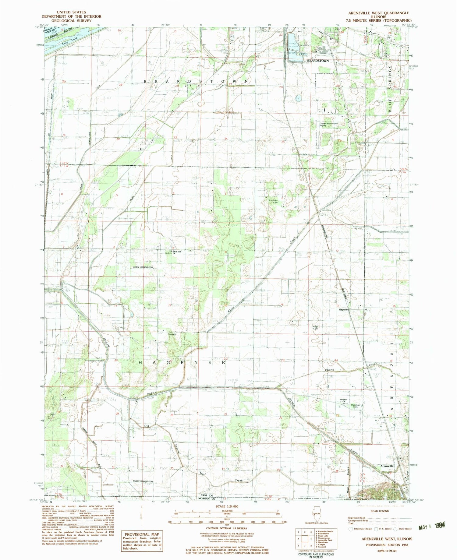
Classic USGS Arenzville West Illinois 7.5'x7.5' Topo Map
Couldn't load pickup availability
Historical USGS topographic quad map of Arenzville West in the state of Illinois. Map scale may vary for some years, but is generally around 1:24,000. Print size is approximately 24" x 27"
This quadrangle is in the following counties: Cass, Morgan, Schuyler.
The map contains contour lines, roads, rivers, towns, and lakes. Printed on high-quality waterproof paper with UV fade-resistant inks, and shipped rolled.
Contains the following named places: Arenz School, Black Oak Cemetery, Black Oak Church, Blackoak School, Clear Creek, Drainage Ditch, Edgewood School, Greater Beardstown Airport, Hackman Cemetery, Hagener, Hagener Townhall, Kinsey RLA Airport, Korsmeyer School, Krohe Airport, Mannel Branch, North Lake Ditch, Old Channel Mud Creek, Pankey Pond Ditch, Prairie Creek, Saint Peters Church, Saint Peters Lutheran Cemetery, Schneider Cemetery, South Beardstown Ditch, Swan Lake School, Township of Hagener, Valley Ditch, Valley Pumping Station, Wagle Cemetery, Wagoner Bridge, Wagoner School, West Point School, ZIP Codes: 62611, 62618


