
MyTopo
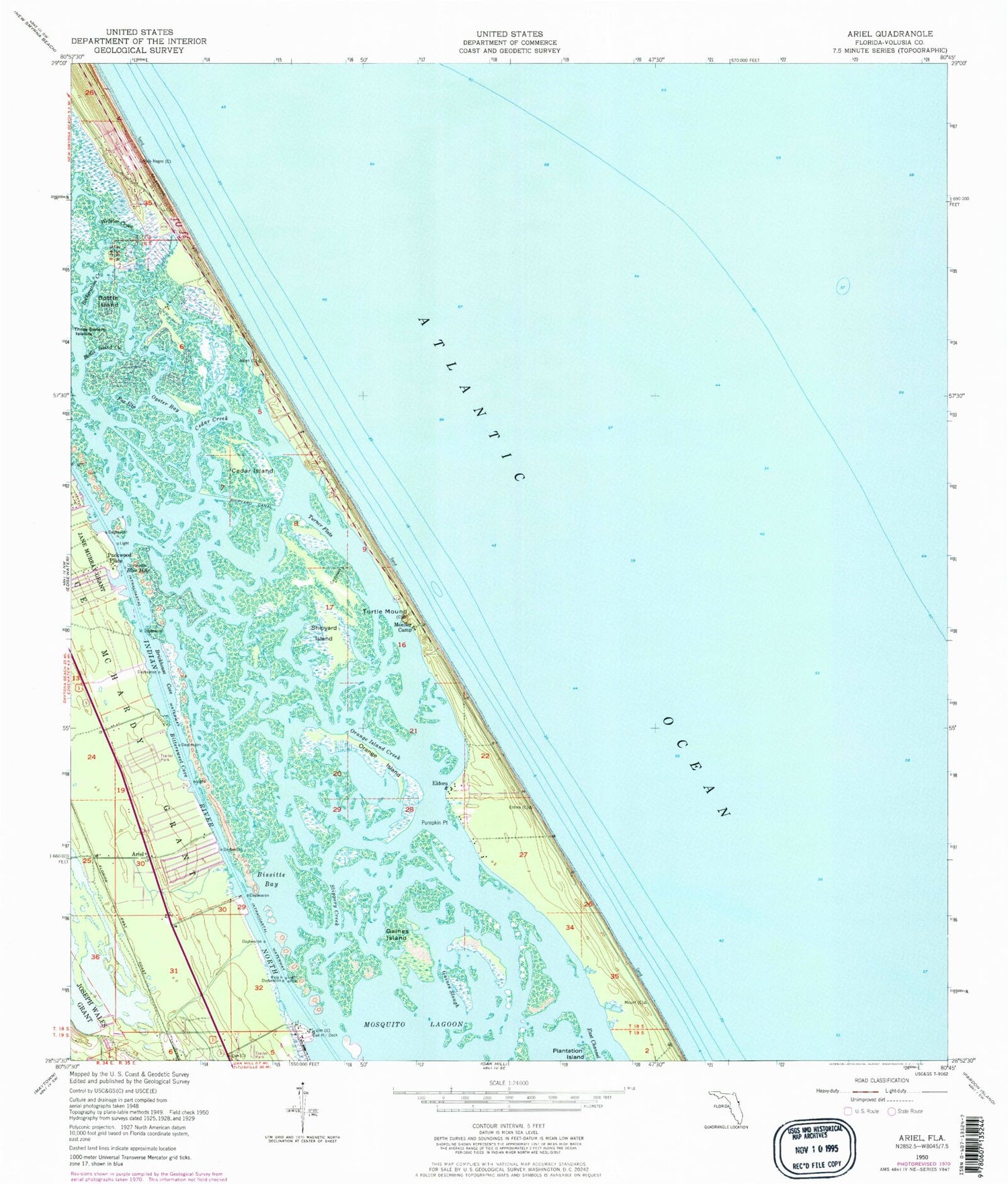
Classic USGS Ariel Florida 7.5'x7.5' Topo Map
Couldn't load pickup availability
Historical USGS topographic quad map of Ariel in the state of Florida. Typical map scale is 1:24,000, but may vary for certain years, if available. Print size: 24" x 27"
This quadrangle is in the following counties: Volusia.
The map contains contour lines, roads, rivers, towns, and lakes. Printed on high-quality waterproof paper with UV fade-resistant inks, and shipped rolled.
Contains the following named places: Bissitte Bay, Bittersweet Cove, Blue Hole, Botheration Creek, Bottle Island, Bottle Island Creek, Brickhouse Cove, Cedar Creek, Cedar Island, Eldora, Fox Slip, Gaines Island, Gaines Slough, Moeller Camp, Oak Hill Dock, Orange Island, Orange Island Creek, Oyster Bay, Pumpkin Point, Shipyard Canal, Shipyard Island, Slippery Creek, Three Sisters Islands, Turner Flats, Turtle Mound, Webster Creek, Ariel, Packwood Place, Bethune Beach, Tully RV Airpark, New Smyrna Beach Division, Volusia County Fire Services Station 21 South Beach, City of Oak Hill, Hacienda del Rio Mobile Home Park, Terra Mar Village Mobile Home Park, Riverwood Park Campground Marina, Riverbreeze Park Mobile Home Park, Oak Hill Church of the Nazarene


