MyTopo
Classic USGS Aripeka Florida 7.5'x7.5' Topo Map
Couldn't load pickup availability
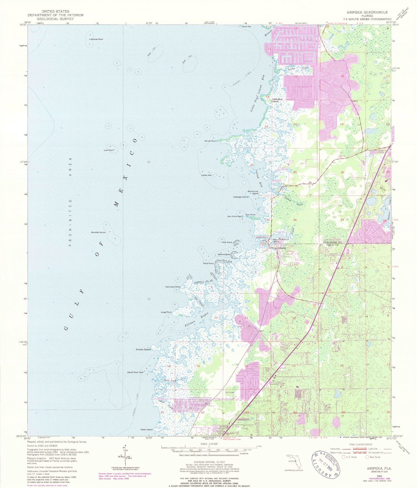
Historical USGS topographic quad map of Aripeka in the state of Florida. Map scale may vary for some years, but is generally around 1:24,000. Print size is approximately 24" x 27"
This quadrangle is in the following counties: Hernando, Pasco.
The map contains contour lines, roads, rivers, towns, and lakes. Printed on high-quality waterproof paper with UV fade-resistant inks, and shipped rolled.
Contains the following named places: Aripeka, Aripeka Census Designated Place, Aripeka Post Office, Bathhouse Island, Bluefish Rocks, Cabbage Island, Cedar Island, Devils Rock Yard, Dinner Point, Fillman Bayou, First Point, Ghost Creek, Gomez Rock, Grace Memorial Gardens, Gun Point, Gun Point Key, Hammock Creek, Hammock Point, Heritage Pines Census Designated Place, Hernando Beach, Hernando Beach Census Designated Place, Hernando Beach Volunteer Fire Department Station 6, Hernando County Sheriff's Office Hernando Beach Substation, Horse Island, Immaculate Conception Church, Indian Bay, Indian Creek, Indian Key, Little Pine Island, Little Pine Island Bay, Long Point, Low Rock, Minnow Creek, Notre Dame Interparochial Catholic School, Palm Island, Rock Yard Creek, Rocky Creek, Second Point, The Cutoff, Third Point, Weekiwachee Gardens, West Hernando Junior High School, Westside Elementary School, ZIP Codes: 34607, 34667, 34679