
MyTopo
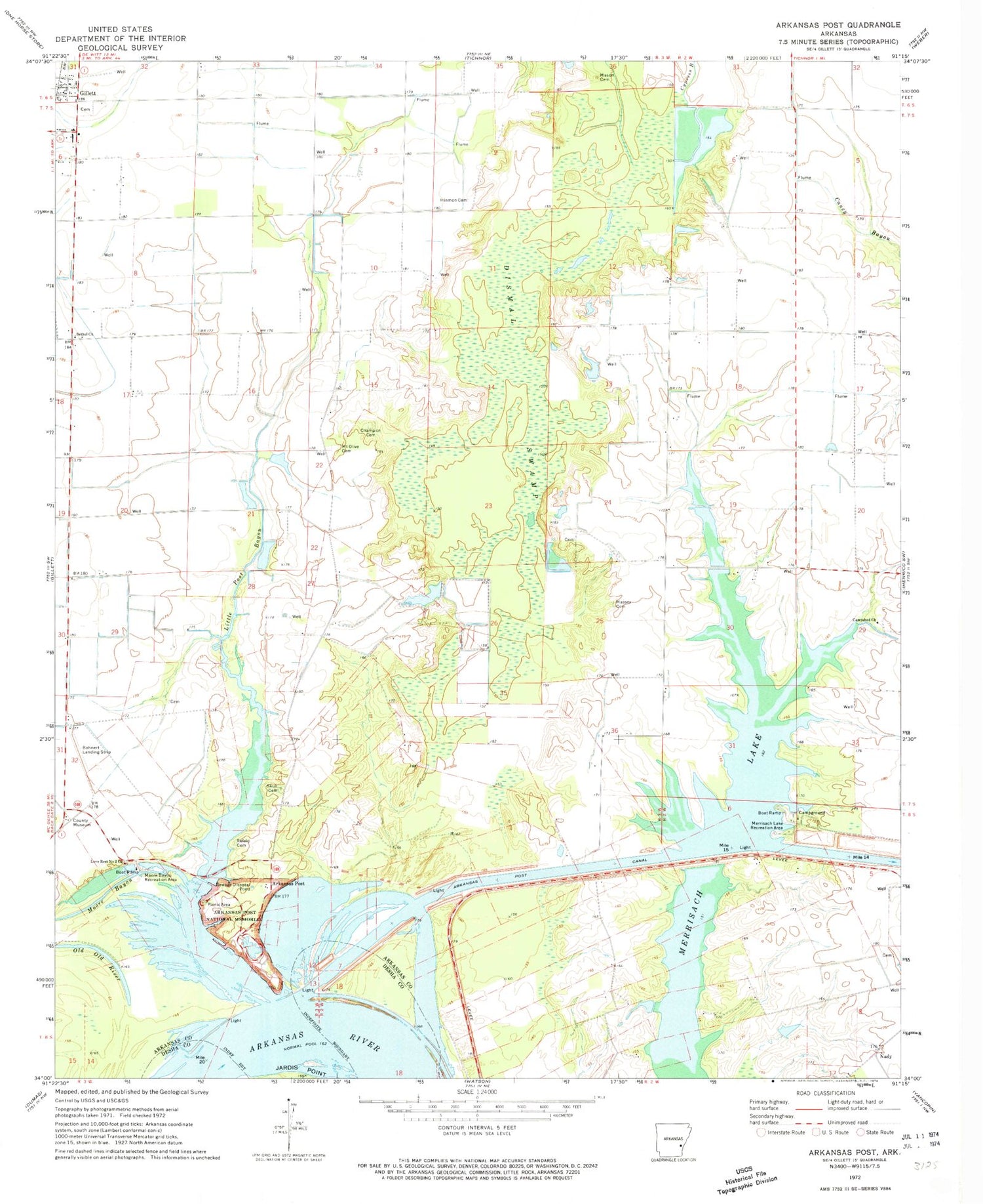
Classic USGS Arkansas Post Arkansas 7.5'x7.5' Topo Map
Couldn't load pickup availability
Historical USGS topographic quad map of Arkansas Post in the state of Arkansas. Map scale may vary for some years, but is generally around 1:24,000. Print size is approximately 24" x 27"
This quadrangle is in the following counties: Arkansas, Desha.
The map contains contour lines, roads, rivers, towns, and lakes. Printed on high-quality waterproof paper with UV fade-resistant inks, and shipped rolled.
Contains the following named places: Alligator Slough, Arkansas, Arkansas Post, Arkansas Post Canal, Arkansas Post National Memorial, Arkansas Post School, Bethel Church, Burr Crossing, Campshed Church, Champion Cemetery, Cox School, Dismal Swamp, Ecores Rouges, Halliburton School, Hinmon Cemetery, Johnsons Store, Little Post Bayou, Love Rest Number 2 Church, Mason Cemetery, Massey Cemetery, Merrisach Lake, Merrisach Lake Recreation Area, Moore Bayou, Moore Bayou Recreation Area, Mount Olive Cemetery, Mount Olive Church, Oak Grove School, Old Old River, Parish Lake, Parish Lake Dam, Park Lake, Post Bayou, Post Bend, Refeld Cemetery, Skull Cemetery, Township of Arkansas, ZIP Code: 72055


