MyTopo
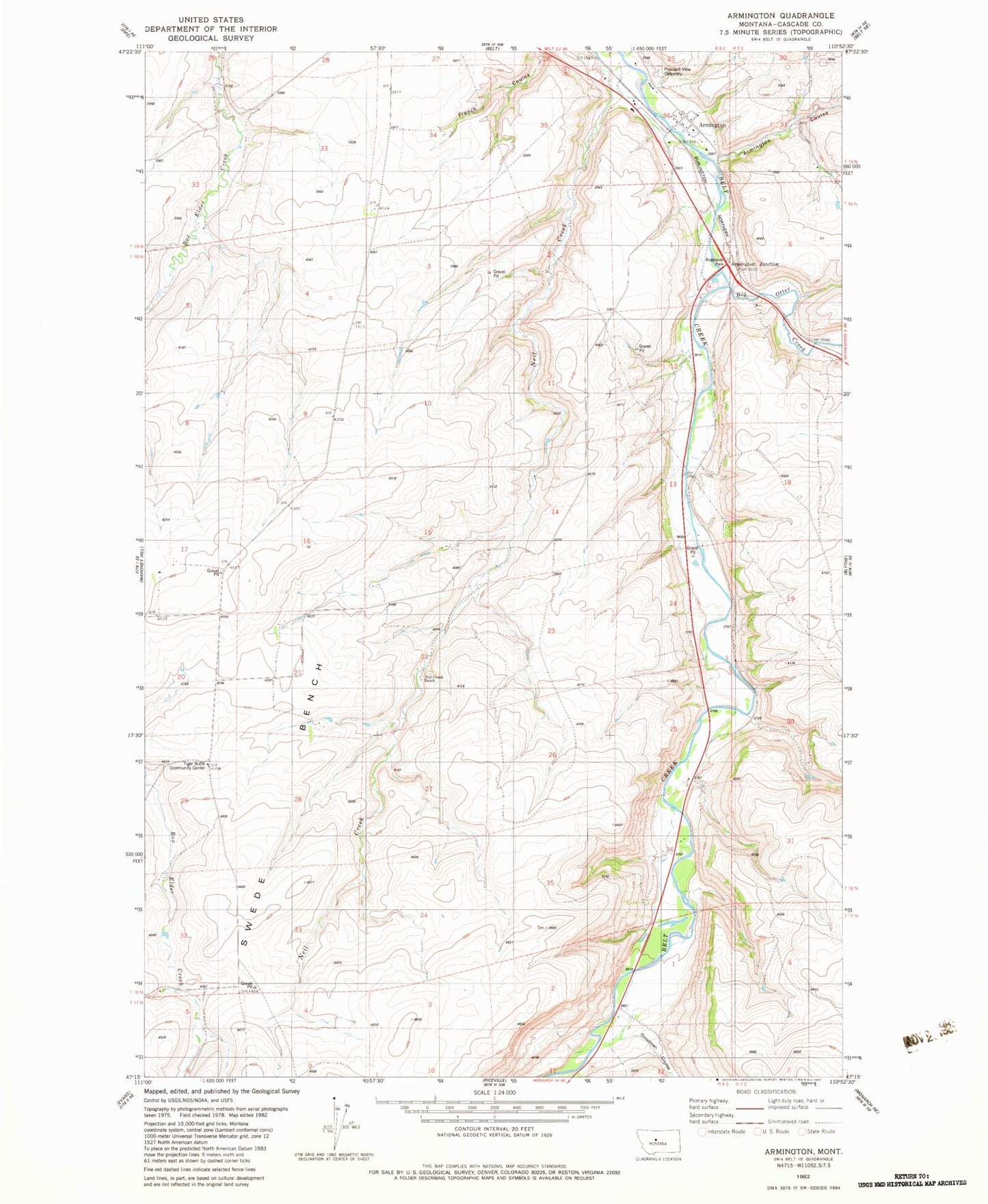
Classic USGS Armington Montana 7.5'x7.5' Topo Map
Couldn't load pickup availability
Historical USGS topographic quad map of Armington in the state of Montana. Map scale may vary for some years, but is generally around 1:24,000. Print size is approximately 24" x 27"
This quadrangle is in the following counties: Cascade.
The map contains contour lines, roads, rivers, towns, and lakes. Printed on high-quality waterproof paper with UV fade-resistant inks, and shipped rolled.
Contains the following named places: 17N06E01C___01 Well, 17N06E01C___02 Well, 18N06E14A___01 Well, 18N06E14C___01 Well, 18N06E15A___01 Well, 18N06E20D___01 Well, 18N06E25D___01 Well, 18N06E28A___01 Well, 18N06E33A___01 Well, 18N06E36____01 Well, 19N06E32A___01 Well, 19N06E32DA__01 Well, 19N06E34____01 Well, 19N06E36ACDA01 Well, 19N06E36DDDC01 Well, Armington, Armington Coulee, Armington Junction, Armington Junction Rest Area, Armington Post Office, Belt Division, Big Otter Creek, Goodman, Goodman Cemetery, Goodman School, Neil Creek, Neil Creek Ranch, Neil Creek School, Peterson School, Pleasant View Cemetery, Siegling, Swede Bench, Tiger Butte Community Center, Voights Spur