MyTopo
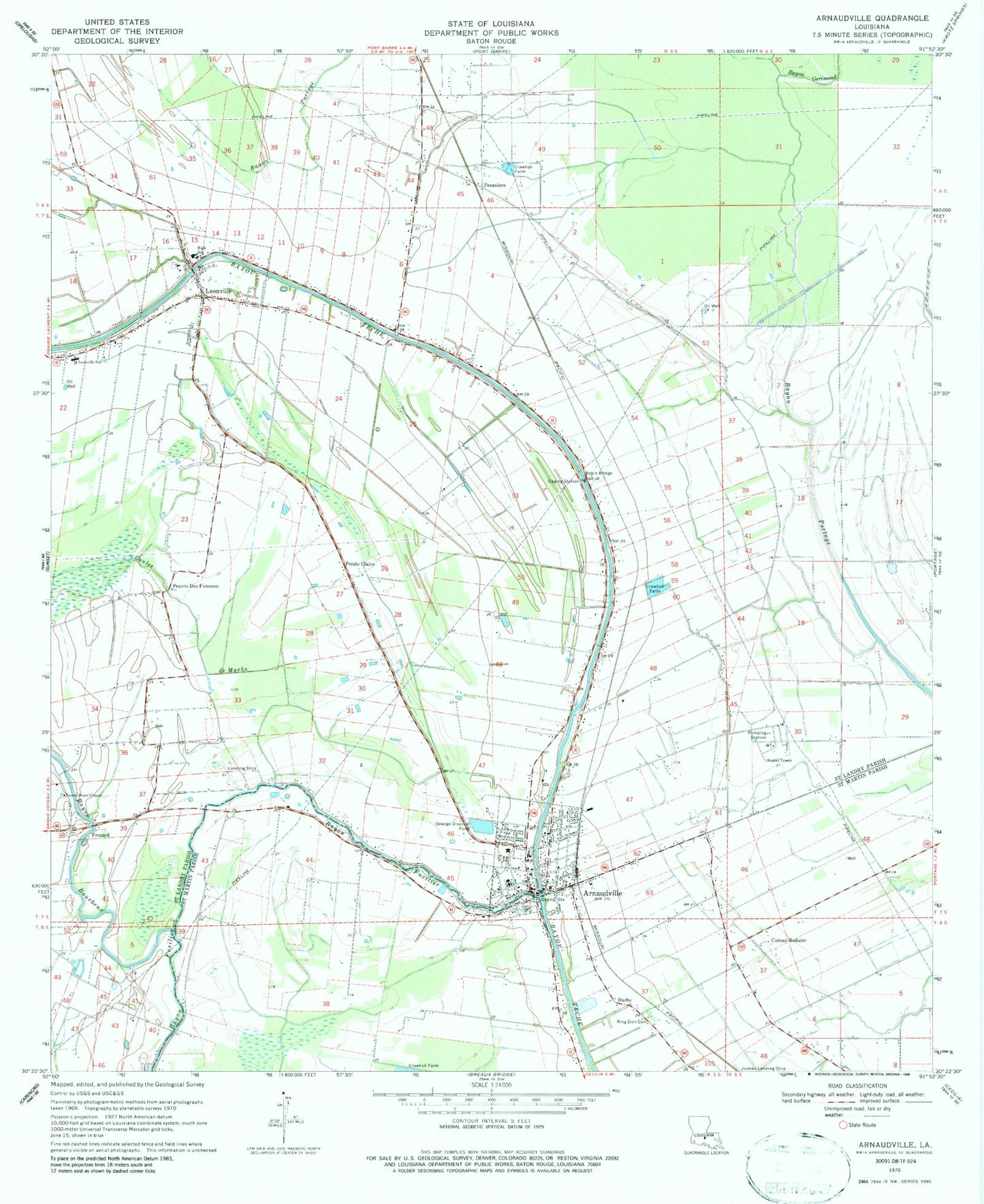
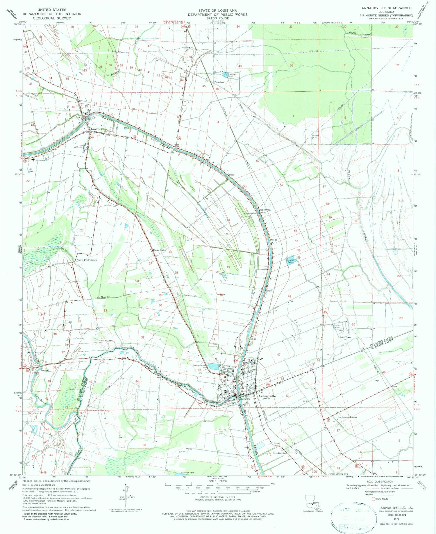
Classic USGS Arnaudville Louisiana 7.5'x7.5' Topo Map
Couldn't load pickup availability
Historical USGS topographic quad map of Arnaudville in the state of Louisiana. Map scale may vary for some years, but is generally around 1:24,000. Print size is approximately 24" x 27"
This quadrangle is in the following counties: St. Landry, St. Martin.
The map contains contour lines, roads, rivers, towns, and lakes. Printed on high-quality waterproof paper with UV fade-resistant inks, and shipped rolled.
Contains the following named places: Arnaudville, Arnaudville High School, Arnaudville Middle School, Arnaudville Oil and Gas Field, Arnaudville Police Department, Arnaudville Volunteer Fire Department, Arnaudville Wastewater Treatment Plant, Bayou Bourbeux, Bayou Fusilier, Bayou Gerimond, Coteau Rodaire, Couvillion Airport, Darby, Frozard, Huron Head Start Center School, J Michael Morrow Memorial Nursing Home, Kipper School, Leonville, Leonville Elementary School, Leonville Head Start Center School, Leonville High School, Leonville Police Department, Leonville Volunteer Fire Department, Leonville Wastewater Treatment Plant, Louisiana Noname 48 Dam, Parish Governing Authority District 7, Pecaniere, Pointe Claire, Prairie Des Femmes, Ring Zion Cemetery, Robin, Robin Bridge, Sacred Heart Chapel, Saint Catherine's Catholic Church, Saint Francis Regis Church, Saint Landry Parish Fire District 5 Prairie Volunteer Fire Department, Saint Leo the Great Church, Saint Luke General Hospital, Saint Luke General Hospital Heliport, Saint Martin Parish Library Arnaudville Bramch, Saint Martin Parish Police Jury, Tim Bullard Memorial Airport, Town of Arnaudville, Town of Leonville, Ward Three, ZIP Code: 70512