MyTopo
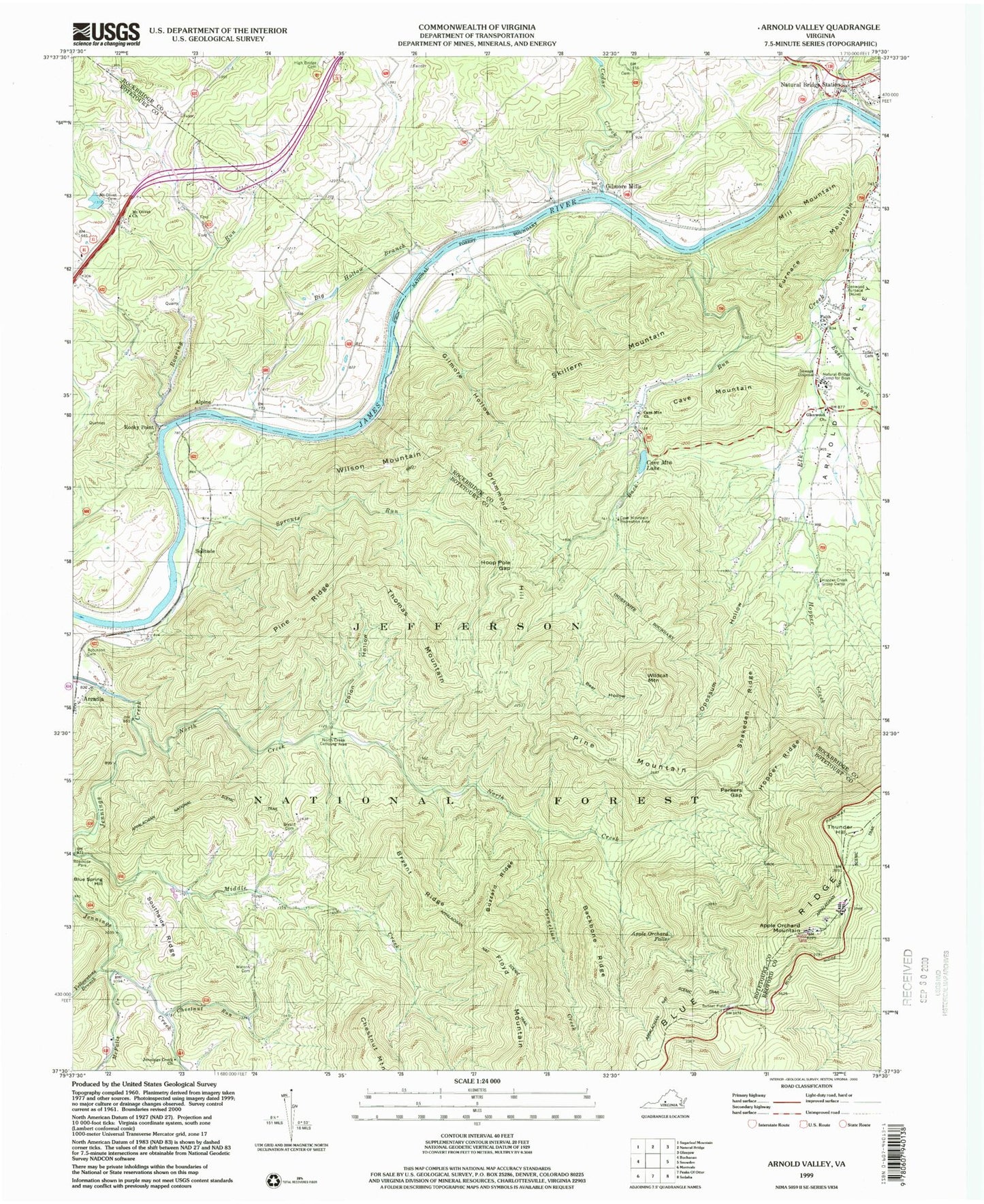
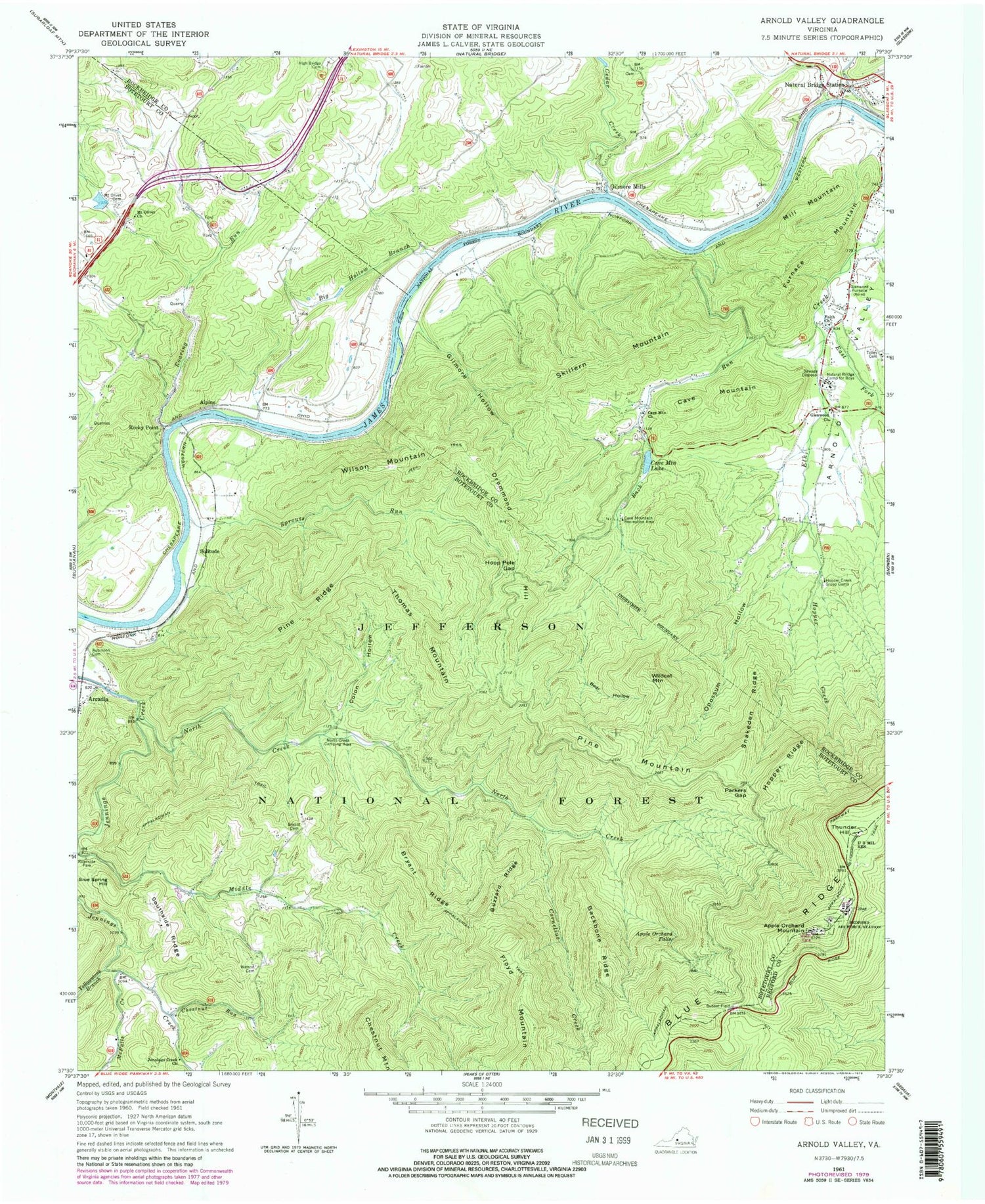
Classic USGS Arnold Valley Virginia 7.5'x7.5' Topo Map
Couldn't load pickup availability
Historical USGS topographic quad map of Arnold Valley in the state of Virginia. Typical map scale is 1:24,000, but may vary for certain years, if available. Print size: 24" x 27"
This quadrangle is in the following counties: Bedford, Botetourt, Rockbridge.
The map contains contour lines, roads, rivers, towns, and lakes. Printed on high-quality waterproof paper with UV fade-resistant inks, and shipped rolled.
Contains the following named places: Apple Orchard Falls, Back Run, Backbone Ridge, Bear Hollow, Big Hollow Branch, Bryant Cemetery, Bryant Ridge, Buzzard Ridge, Cave Mountain, Cave Mountain Church, Cave Mountain Recreation Area, Cedar Creek, Chestnut Run, Colon Hollow, Cornelius Creek, Cove Creek, Crawford Creek, Drummond Hill, East Fork Elk Creek, Faith Church, Furnace Mountain, Gilmore Hollow, Glenwood Church, Glenwood Furnace, High Bridge Cemetery, Hoop Pole Gap, Hopper Creek, Hopper Creek Group Camp, Hopper Ridge, Jennings Creek Church, Little Hellgate Creek, McFalls Creek, Mill Mountain, Mount Olivet Cemetery, Mount Olivet Church, Natural Bridge Camp for Boys, North Creek, North Creek Camping Area, Oppossum Hollow, Parkers Gap, Pine Ridge, Roaring Run, Robinson Cemetery, Yellowstone Branch, Skillern Mountain, Snakeden Ridge, Southside Ridge, Sprouts Run, Sunset Field, Thomas Mountain, Tolley Cemetery, Watson Cemetery, White Oak Ridge, Wildcat Mountain, Cove Mountain Trail, Wildcat Trail, Thunder Hill Shelter, Smith Tract Campground, Colon Hollow Shelter Campground, Middle Creek Picnic Area, Cave Mountain Dam, Alpine, Apple Orchard Mountain, Arcadia, Blue Spring Hill, Gilmore Mills, Natural Bridge Station, Pine Mountain, Rocky Point, Solitude, Thunder Hill, Wilson Mountain, Cave Mountain Lake, Sugarland, Fork Mountain, Lone Field Hill, Munford, Harvey, Natural Bridge District, Bedford Air Force Station (historical), Black Bridge Airport