MyTopo
Classic USGS Arnoldsburg West Virginia 7.5'x7.5' Topo Map
Couldn't load pickup availability
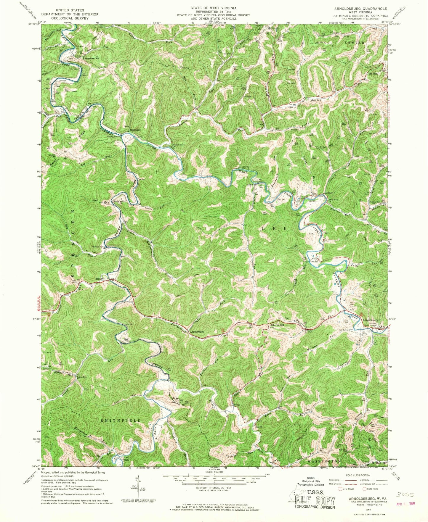
Historical USGS topographic quad map of Arnoldsburg in the state of West Virginia. Map scale may vary for some years, but is generally around 1:24,000. Print size is approximately 24" x 27"
This quadrangle is in the following counties: Calhoun, Roane.
The map contains contour lines, roads, rivers, towns, and lakes. Printed on high-quality waterproof paper with UV fade-resistant inks, and shipped rolled.
Contains the following named places: Adam, Altizer, Anthony Run, Arnoldsburg, Arnoldsburg Baptist Church, Arnoldsburg Cemetery, Arnoldsburg Post Office, Arnoldsburg School, Arnoldsburg Volunteer Fire Department Station 300, Barnes Run, Bee Cemetery, Beech, Beech Fork, Big Run, Bluehead Church, Board Fork, Cabin Run, Carpenter Cemetery, Childrens Learning Center, Clover Run, Coon Cemetery, Coon Fork, Cove Run, Daniels Run, Daniels Run School, Deep Valley School, Dennis Fork, District 4, Dry Hill Cemetery, Dry Hill School, Fairview Cemetery, Fairview Church, Falls Run, Flesher Run, Gibson Cemetery, Hays Cemetery, Henry Fork, Henry Fork Church, Hog Fork, Hollywood Run, Hughes Run, Hur, Hur Cemetery, Husk Cemetery, Island Run, Island Run Church, Island Run School, Jakes Fork, Jesse Run, Jesse Run School, Laurel Run, Laurel School, Laurel Shoal Run, Leatherbark, Leatherbark Creek, Lee Run, Left Fork Barnes Run, Liberty Hill, Liberty Hill Cemetery, Liberty Hill Church, Lick Run, Little Leatherbark Creek, Little Leatherbark School, Louisa Chapel, Lynch School, McCoy Spring, McCume Run, Meadows Cemetery, Middle Fork Daniels Run, Mount Olive Church, Mount Zion Cemetery, Mount Zion Methodist Church, Mulberry Run, Mushroom Run, Orchard Run, Otto, Otto Advent Christian Church, Paintrock Run, Panther Run, Pine Grove School, Pink, Pleasant Valley Church, Pleasant Valley School, Pup Run, Richardson, Right Fork Daniels Run, Right Fork Triplett Run, Road Run, Rocksdale, Rocksdale Bridge, Saul Run, Sinking Spring Run, Slider Cemetery, Spring Run, Starcher Cemetery, Starcher Fork, Steel Run, Stony Point Church, Sugar Run, Triplett Run, Tristan, Walnut Grove Church, Wayne Cemetery, West Fork School, ZIP Code: 25234