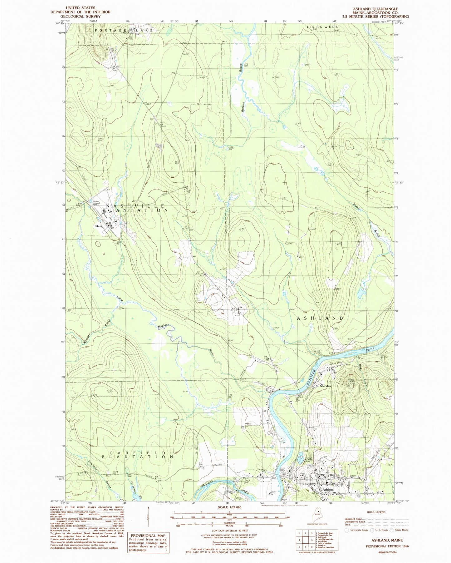
MyTopo
Classic USGS Ashland Maine 7.5'x7.5' Topo Map
Couldn't load pickup availability
Historical USGS topographic quad map of Ashland in the state of Maine. Map scale may vary for some years, but is generally around 1:24,000. Print size is approximately 24" x 27"
This quadrangle is in the following counties: Aroostook.
The map contains contour lines, roads, rivers, towns, and lakes. Printed on high-quality waterproof paper with UV fade-resistant inks, and shipped rolled.
Contains the following named places: Ashland, Ashland Ambulance Service, Ashland Central School, Ashland Community High School, Ashland Community Library, Ashland District School, Ashland Fire Department, Ashland Municipal Cemetery, Ashland Police Department, Ashland Post Office, Dug Brook, Dunn Cemetery, Little Machias River, McCormack Cemetery, Saint Marks Catholic Cemetery, Saint Marks Cemetery, Schoolhouse Brook, Sheridan, Sheridan Post Office, Skerry, Sutherland Cemetery, Webster Brook, Webster Brook Tote Road