MyTopo
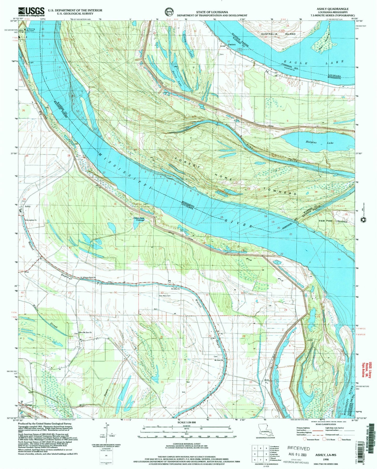
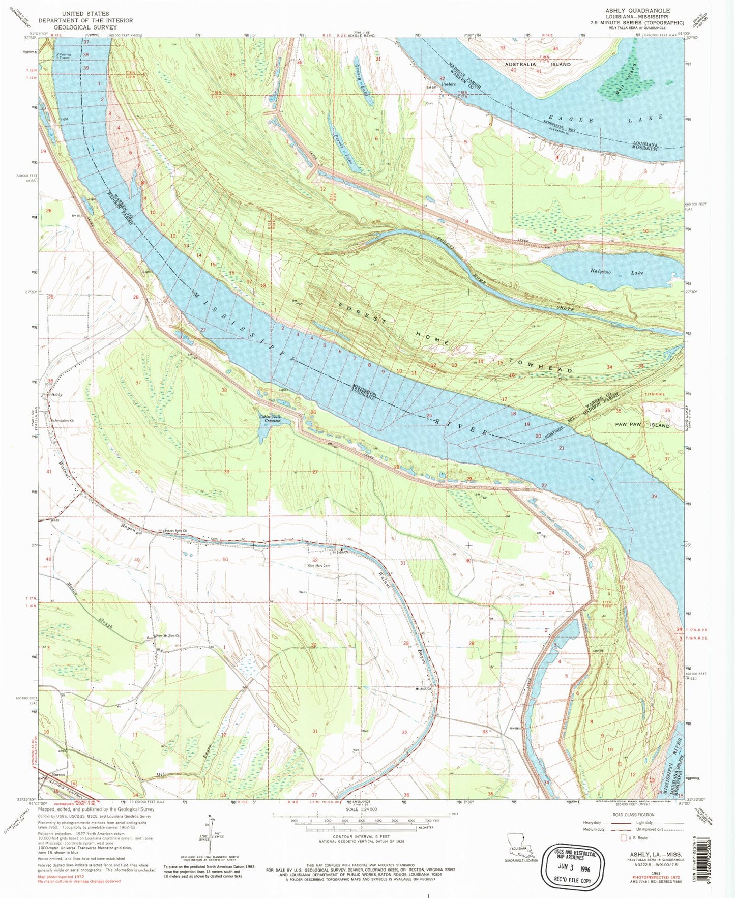
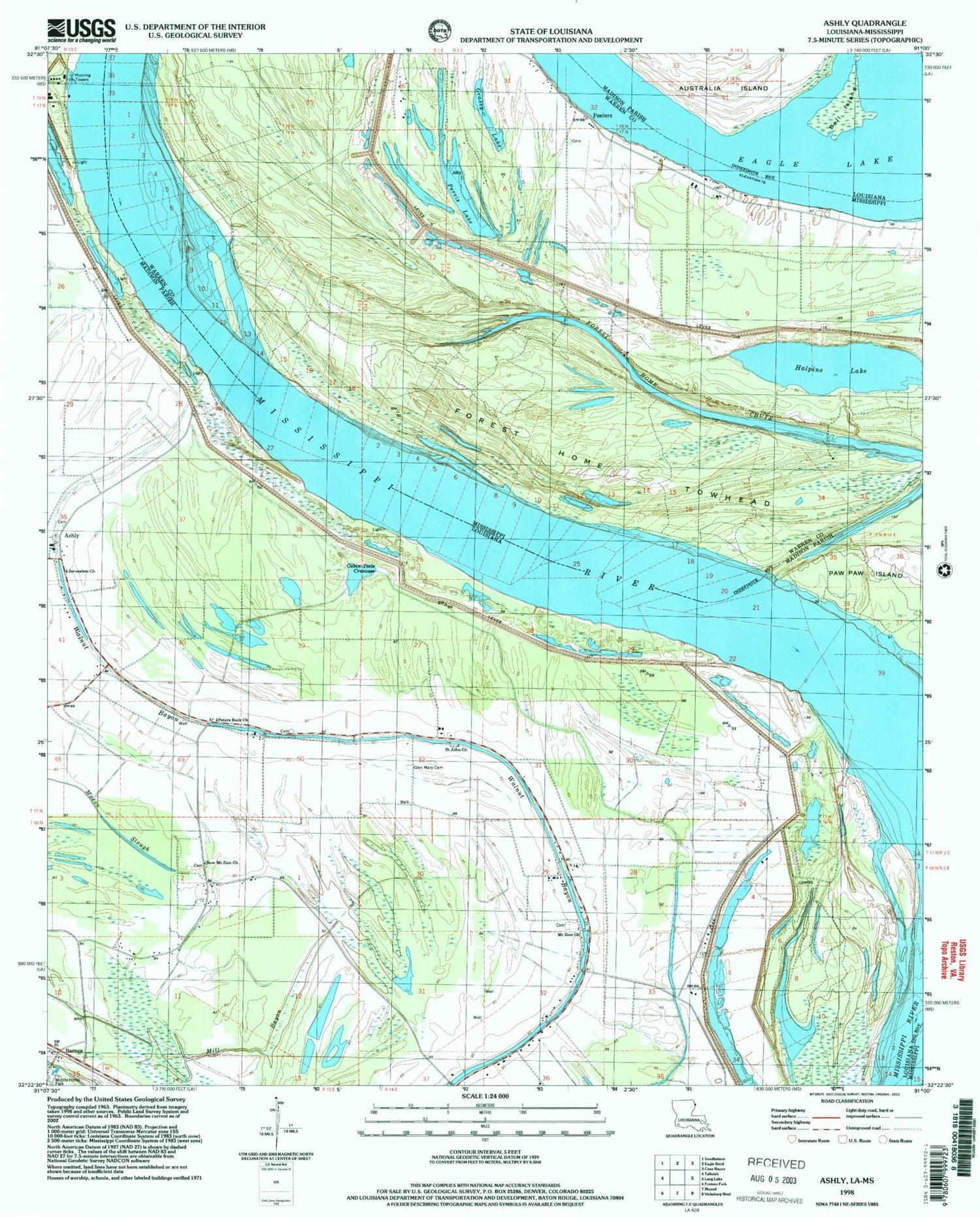
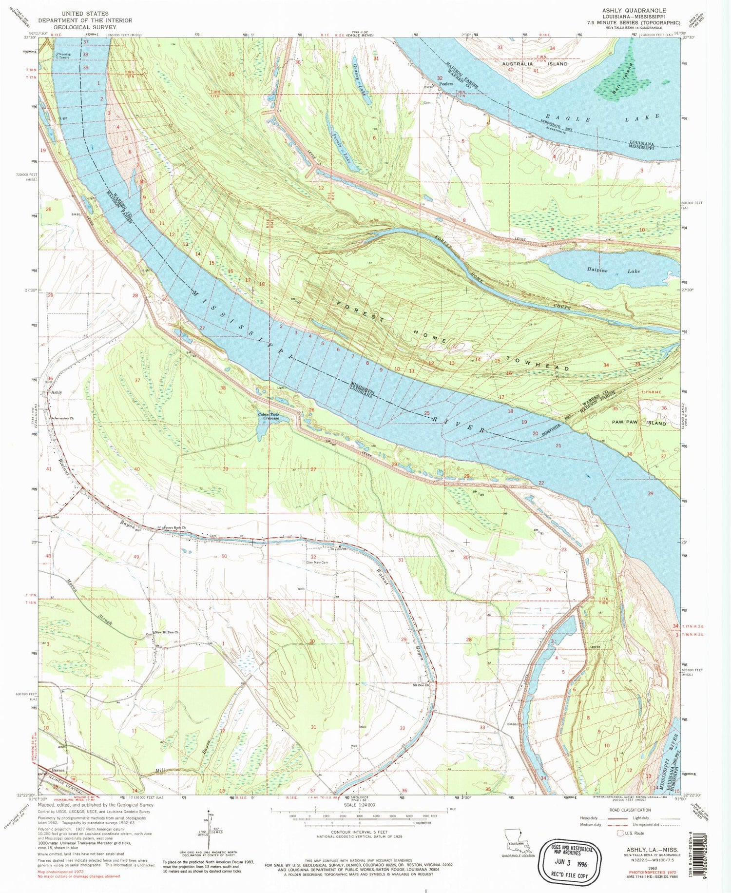
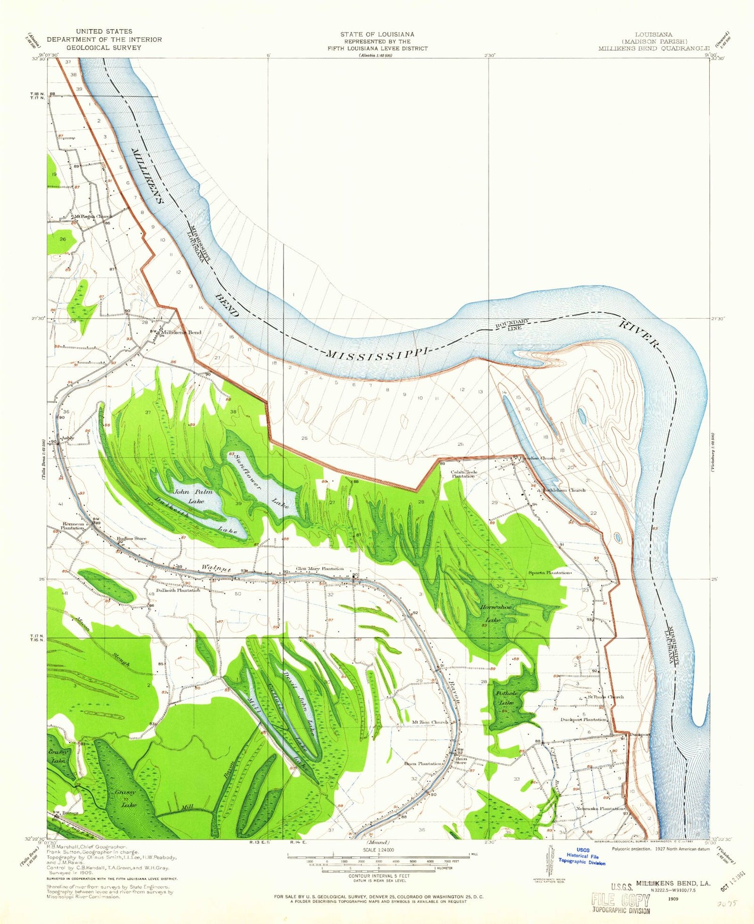
Classic USGS Ashly Louisiana 7.5'x7.5' Topo Map
Couldn't load pickup availability
Historical USGS topographic quad map of Ashly in the states of Louisiana, Mississippi. Map scale may vary for some years, but is generally around 1:24,000. Print size is approximately 24" x 27"
This quadrangle is in the following counties: Madison, Warren.
The map contains contour lines, roads, rivers, towns, and lakes. Printed on high-quality waterproof paper with UV fade-resistant inks, and shipped rolled.
Contains the following named places: Ashley Landing, Ashly, Barnes, Bell Island, Bethlehem Church, Boney Landing, Cabin Teele Crevasse, Cabin Teele Landing, Cabin Teele Plantation, Cattail Lake, Dalkeith Lake, Dalkeith Plantation, Devel John Lake, Duck Port, Duckport Landing, Duckport Plantation, Eagle Lake, Forest Home Chute, Forest Home Landing, Forest Home Plantation, Forest Home Towhead, Glen Mary Cemetery, Glen May Plantation, Grassy Lake, Halpino Lake, Hermean Plantation, Horseshoe Lake, Hughes Store, Huon Plantation, Huon Store, Jerusalem Church, John Palm Lake, Marshall Cutoff, Meredith Plantation, Mill Bayou, Mill Lake, Millikens Bend, Millikin Bend Revetment, Morancy Landing, Mount Pisgah Church, Mount Zion Church, Nebraska Plantation, New Mount Zion Church, Omega Landing, Parish Governing Authority District 1, Peelers, Pervis Lake, Peters Rock Church, Pine Grove Lake, Saint John Church, Saint Pauls Church, Sparta Landing, Sparta Plantation, Sunflower Lake