MyTopo
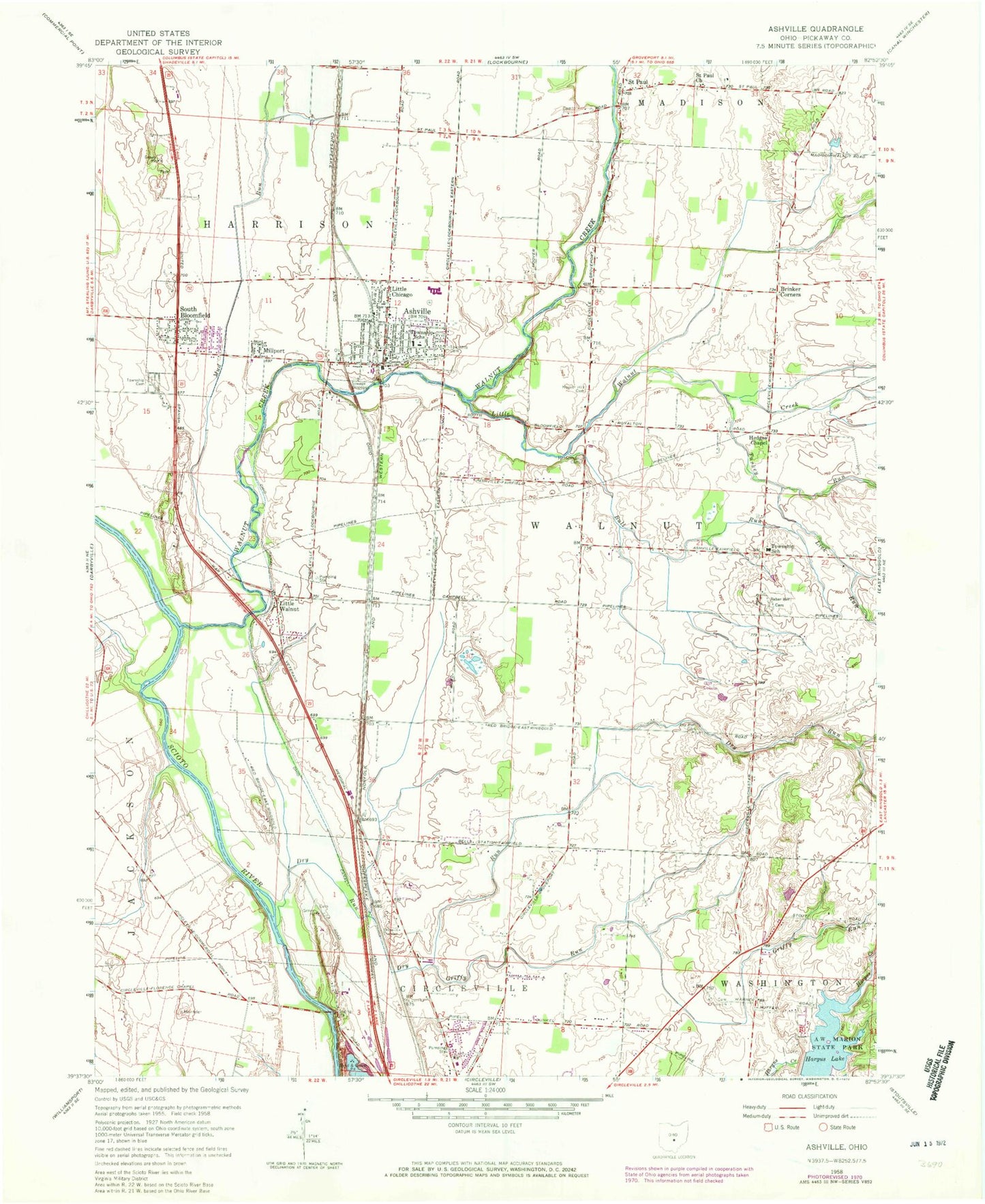
Classic USGS Ashville Ohio 7.5'x7.5' Topo Map
Couldn't load pickup availability
Historical USGS topographic quad map of Ashville in the state of Ohio. Map scale may vary for some years, but is generally around 1:24,000. Print size is approximately 24" x 27"
This quadrangle is in the following counties: Pickaway.
The map contains contour lines, roads, rivers, towns, and lakes. Printed on high-quality waterproof paper with UV fade-resistant inks, and shipped rolled.
Contains the following named places: A R Duvall Cemetery, A W Marion Memorial, A W Marion State Park, Ashton Crossing, Ashton Village, Ashville, Ashville Cemetery, Ashville Church of Christ in Christian Union, Ashville Elementary School, Ashville Police Department, Ashville Post Office, Ashville Primary School, Bells, Bowsher Cemetery, Brandon Court, Bridlewood, Brinker Corners, Bull Run, Bushwhack School, Cromley, Dresbach Farms, Dry Run, Dry Run Cemetery, Dry Run School, Elm Grove School, Fairview, First English Lutheran Church, Gray, Greenfield School, Griffith, Griffy Run, Hagerty, Hargus Lake, Hargus Lake Dam, Hargus Lake Trail, Harrison Township Cemetery, Harrison Township Fire Department, Hedges Chapel, Hoover Hill Cemetery, Island School, Lick Run, Little Chicago, Little Walnut, Little Walnut Creek, Millport, Mount Herman Cemetery, Mud Run, Nebraska, Nebraska Post Office, Nebraska School, Ohio State Highway Patrol - Circleville Patrol Post, Peters School, Pleasantview Farm, Reber Hill Cemetery, Renick School, Rhoads, Robs Trailer Park, Saint Paul, Saint Paul Church, Saint Paul Post Office, School Number 2, School Number 4, Scioto Estates, South Bloomfield, South Bloomfield Police Department, South Bloomfield Post Office, South Bloomfield United Methodist Church, Squawroot Nature Trail, Stages Pond State Nature Preserve, Suburban Village, Sunnyside School, Teays Valley High School, Teays Valley Middle School, Tedrows Mobile Home Park, Township of Harrison, Township of Walnut, Turkey Run, Upper Lansdowne Golf Course, Village of Ashville, Village of South Bloomfield, Voorheis, Walnut Creek, Walnut Elementary School, Ward Corners, WNRE-AM (Circleville), Wolfe Pond, Wolfe Pond Dam, Zimmerman Farms, Zion Church, Zion United Methodist Church, ZIP Code: 43103