MyTopo
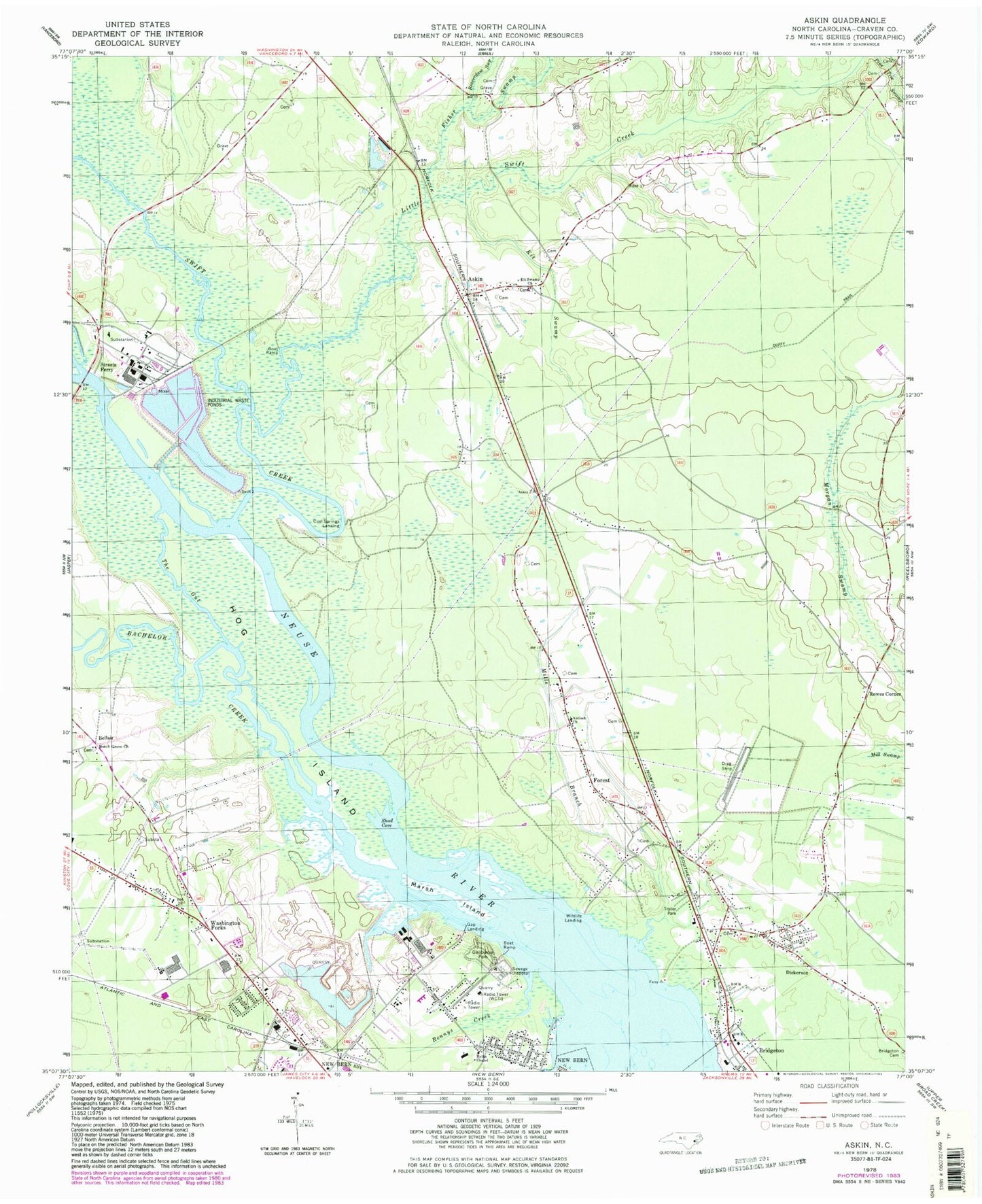
Classic USGS Askin North Carolina 7.5'x7.5' Topo Map
Couldn't load pickup availability
Historical USGS topographic quad map of Askin in the state of North Carolina. Map scale may vary for some years, but is generally around 1:24,000. Print size is approximately 24" x 27"
This quadrangle is in the following counties: Craven.
The map contains contour lines, roads, rivers, towns, and lakes. Printed on high-quality waterproof paper with UV fade-resistant inks, and shipped rolled.
Contains the following named places: Antioch Church, Askin, Bachelor Creek, Bayview Nursing Center, Beach Grove Church, Beaverdam Swamp, Beech Grove Mobile Home Park, Bellair, Blackmans Creek, Colonial Mobile Home Park, Cool Springs Landing, Dickerson, Duffy Trail, Fisher Swamp, Forest, Gap Landing, Gatlin Beach, Glenburnie Park, Gracie Farm Road Mobile Home Park, Hog Island, Jack Smith Creek, Kit Swamp, Kit Swamp Church, Little Swift Creek, Little Swift Creek Volunteer Fire Department, Little Swift Creek Volunteer Fire Department Main Station, Marsh Island, Mills Branch, Morgan Swamp, New Bern Quarry, New Bern Wastewater Treatment Plant, Pinetree Creek, Rennys Creek, Rowes Corner, Ruths Chapel, Sandy Ridge Mobile Home Park, Shad Cove, Streets Ferry, Swift Creek, The Gut, Town of Bridgeton, Tri - Community Volunteer Fire Department - Main Station, Washington Forks, WBIC-AM (New Bern-James City), WCTI Radio Tower, West of New Bern Volunteer Fire Department - Station 2, Weyerhaeuser Company Fire Station, Wildlife Landing, Woodrow, WRNB-AM (New Bern), WSFL-FM (Bridgeton), WSFL-FM (New Bern)