MyTopo
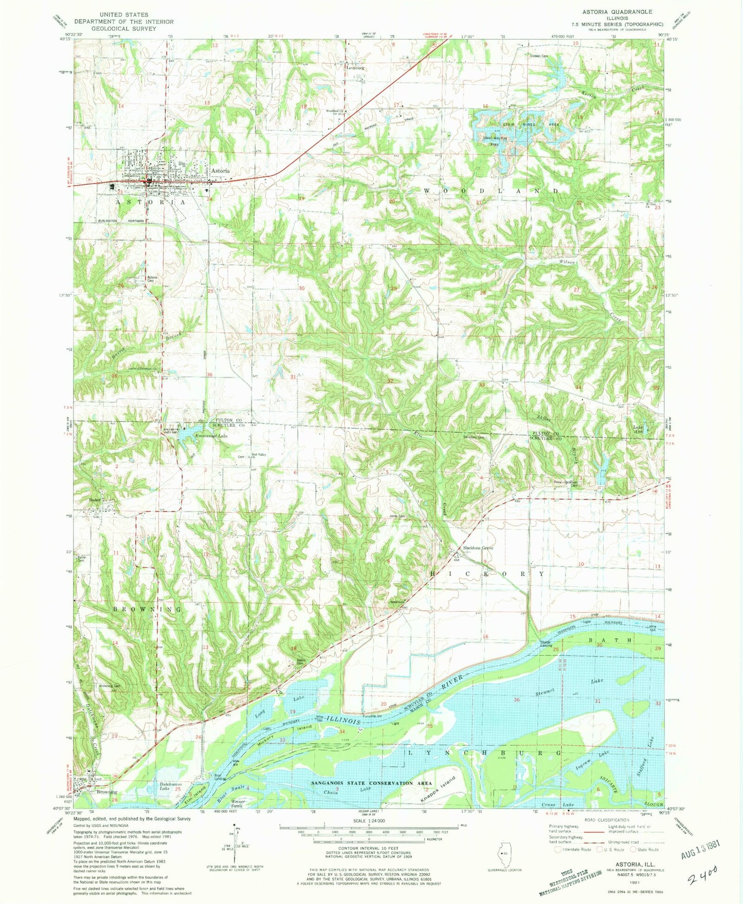
Classic USGS Astoria Illinois 7.5'x7.5' Topo Map
Couldn't load pickup availability
Historical USGS topographic quad map of Astoria in the state of Illinois. Map scale may vary for some years, but is generally around 1:24,000. Print size is approximately 24" x 27"
This quadrangle is in the following counties: Cass, Fulton, Mason, Schuyler.
The map contains contour lines, roads, rivers, towns, and lakes. Printed on high-quality waterproof paper with UV fade-resistant inks, and shipped rolled.
Contains the following named places: Astoria, Astoria Cemetery, Astoria Community High School, Astoria Fire Protection District Station 1, Astoria Post Office, Bader, Bates Cemetery, Briney Lake, Briney Lake Dam, Briney Lake Dam Number 1, Briney Lake Number 1, Browning, Browning Cemetery, Browning Elementary School, Browning Fire Department, Browning Post Office, Camp Immanuel Lake Dam, Chain Lake, Cooper School, Crossroads School, Dixon Branch, Dunkard Brethren Church, Dutchmans Creek, Dutchmans Lake, Elm Creek, Elm Island, Emmanuel Lake, Good Hope School, Hickory Island, Hickory School, Hickory Slough, Ingram Lake, Izaac Walton Park, J R Briney and Sons Airport, Jones Cemetery, Knapps Island, Lake Ann, Lakeview School, Leesburg, Long Lake, Lookout School, McClung School, Motes Chapel, Mount Zion Cemetery, Mount Zion Primitive Baptist Church, Mud Valley Cemetery, Mud Valley Church, Panther Slough, Price Cemetery, Salisbury Cemetery, School Number 16, Sharps Landing, Sheldons Grove, Sheldons Grove Cemetery, Skiles Branch, South Fulton Cemetery, Stewart Lake, Sugar Grove Church, Sugar Grove School, Summum Sixteen Cemetery, Town of Astoria, Township of Hickory, Township of Woodland, Village of Browning, Woodland Cemetery, Woodland Church of the Brethren, ZIP Codes: 61501, 62624