MyTopo
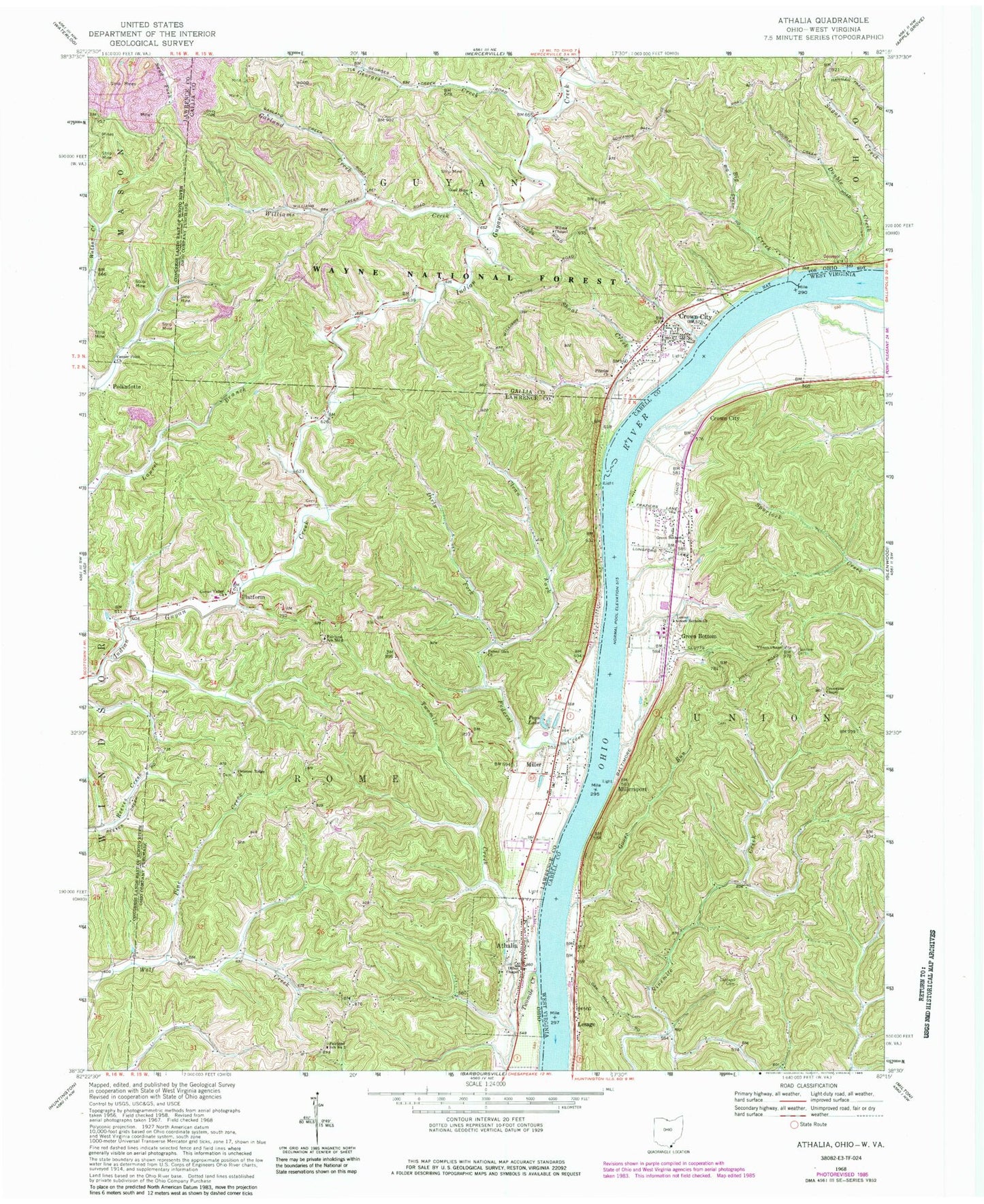
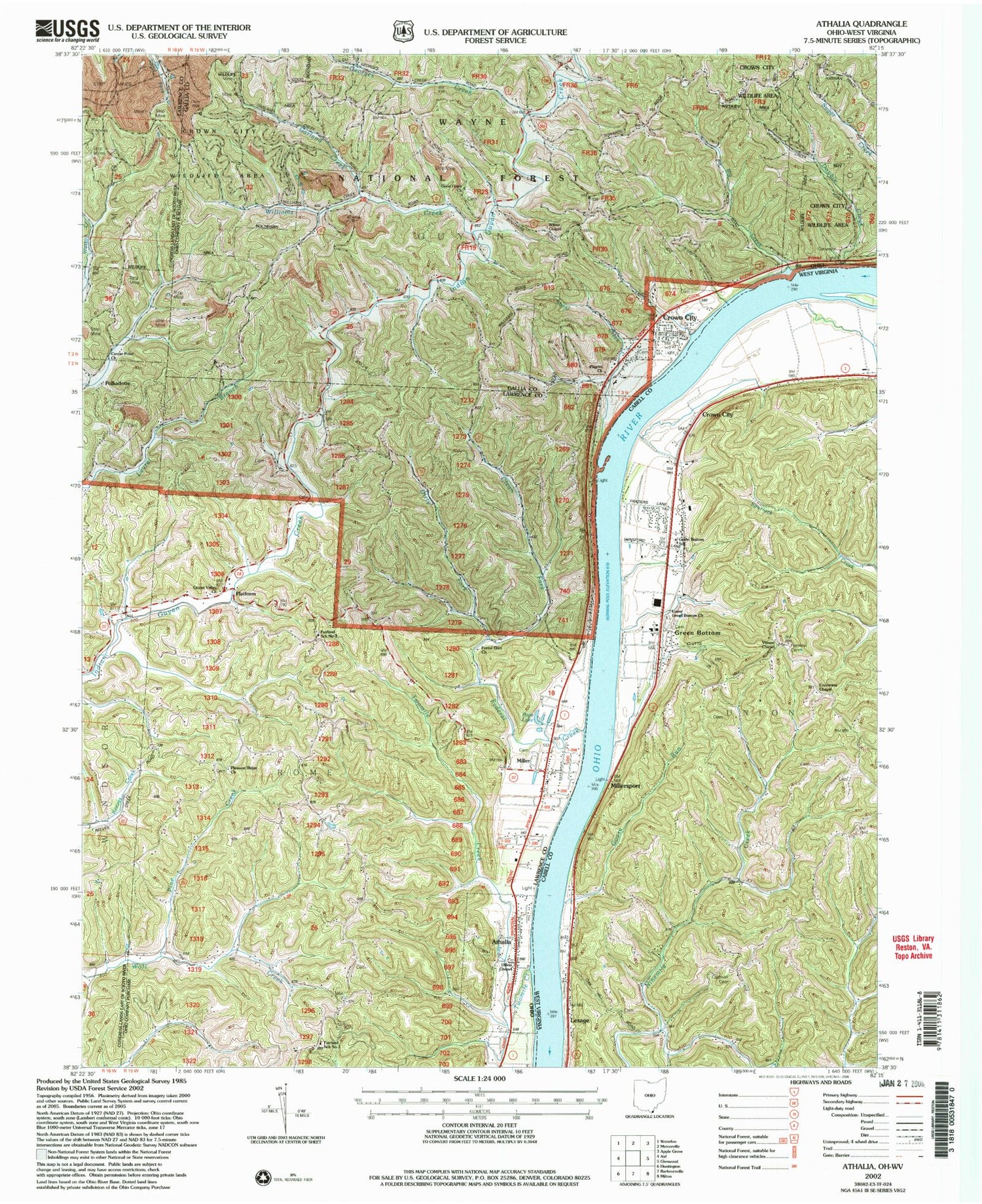
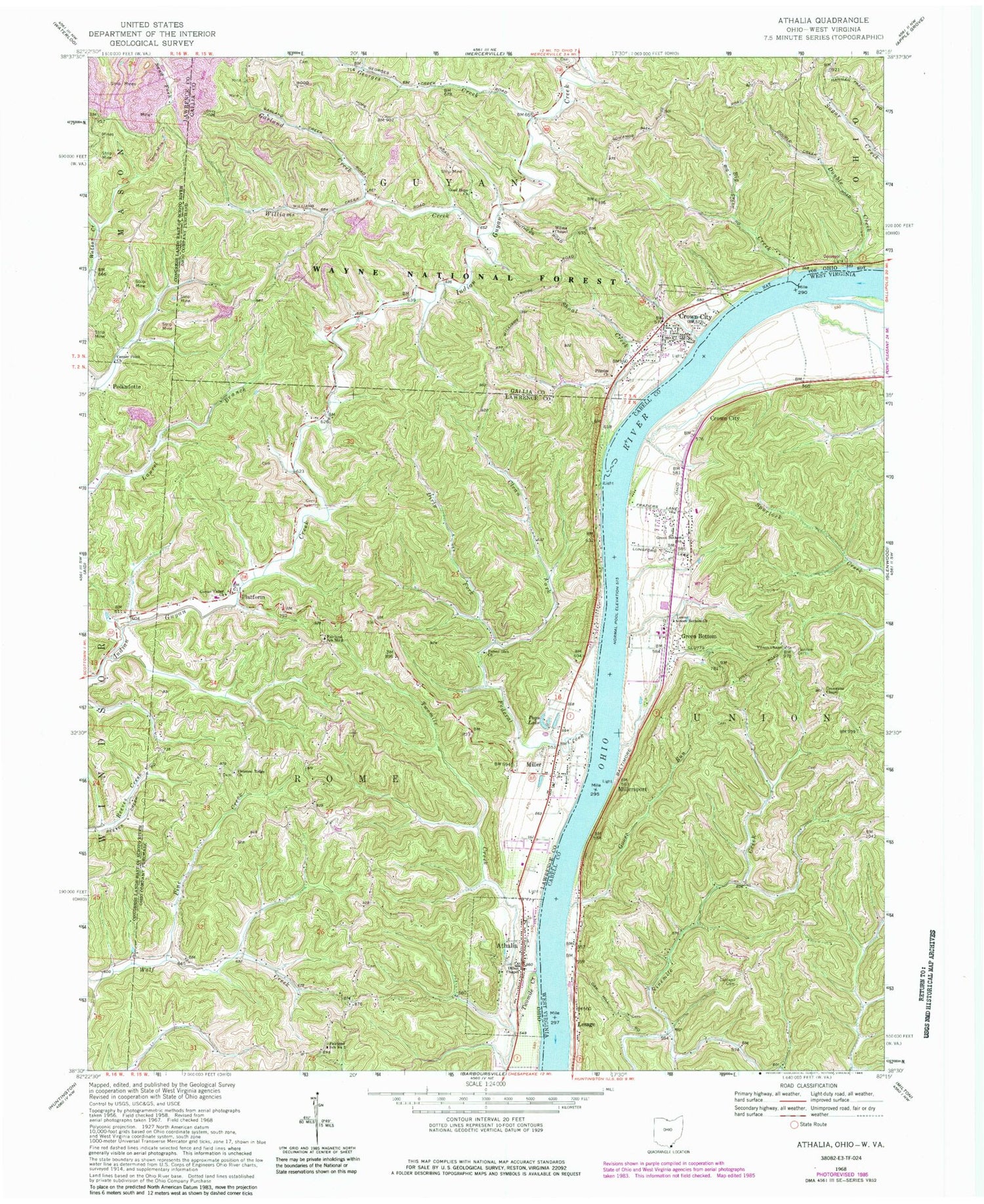
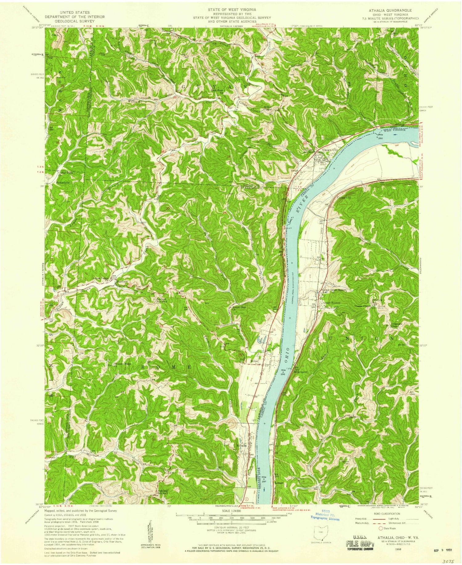
Classic USGS Athalia Ohio 7.5'x7.5' Topo Map
Couldn't load pickup availability
Historical USGS topographic quad map of Athalia in the states of Ohio, West Virginia. Map scale may vary for some years, but is generally around 1:24,000. Print size is approximately 24" x 27"
This quadrangle is in the following counties: Cabell, Gallia, Lawrence.
The map contains contour lines, roads, rivers, towns, and lakes. Printed on high-quality waterproof paper with UV fade-resistant inks, and shipped rolled.
Contains the following named places: Athalia, Athalia Rural Branch Post Office, Bay Bottom, Bay Hollow, Big Creek, Caldwell Cemetery, Calloway Cemetery, Center Point Church, Clean Fork, Cottonwood Landing, Cremeans Chapel, Crown City, Crown City Cemetery, Crown City Fire Department, Crown City Methodist Church, Crown City Post Office, Dillon Chapel, Dirty Fork, Double Creek, Fairland School Number 3, Fairland West Middle School, Fairview Cemetery, Federal Creek, Forest Glen Church, Garland Creek, Georges Creek, Good Hope, Good Hope Cemetery, Good Hope Church, Goose Run, Green Bottom, Green Bottom School, Greenbottom Cemetery, Guyan Valley Church, Halley Cemetery, Lesage, Little Double Creek, Lower Green Bottom Church, Miller, Miller Cemetery, Miller Census Designated Place, Miller Post Office, Millersport, Pilgrim Church, Pine Creek, Platform, Platform Post Office, Pleasant Ridge Cemetery, Pleasant Ridge Church, Polkadotte, Polkadotte Post Office, Pops Lake, Rome Volunteer Fire Department Station 2, Scottown Cemetery, Shoal Creek, Simms Run, Township of Rome, Twomile Creek, Village of Athalia, Village of Crown City, Vinson Chapel, Williams Creek, Wilma Chapel, ZIP Code: 25537