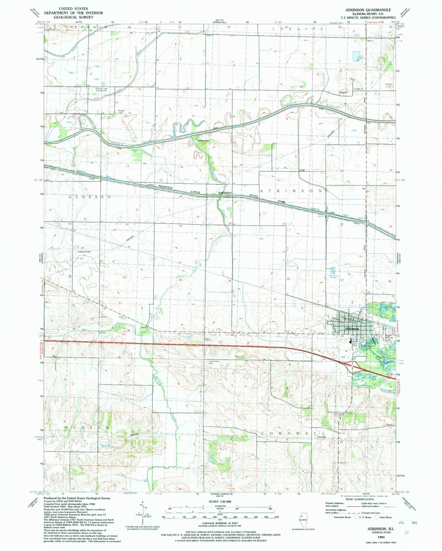
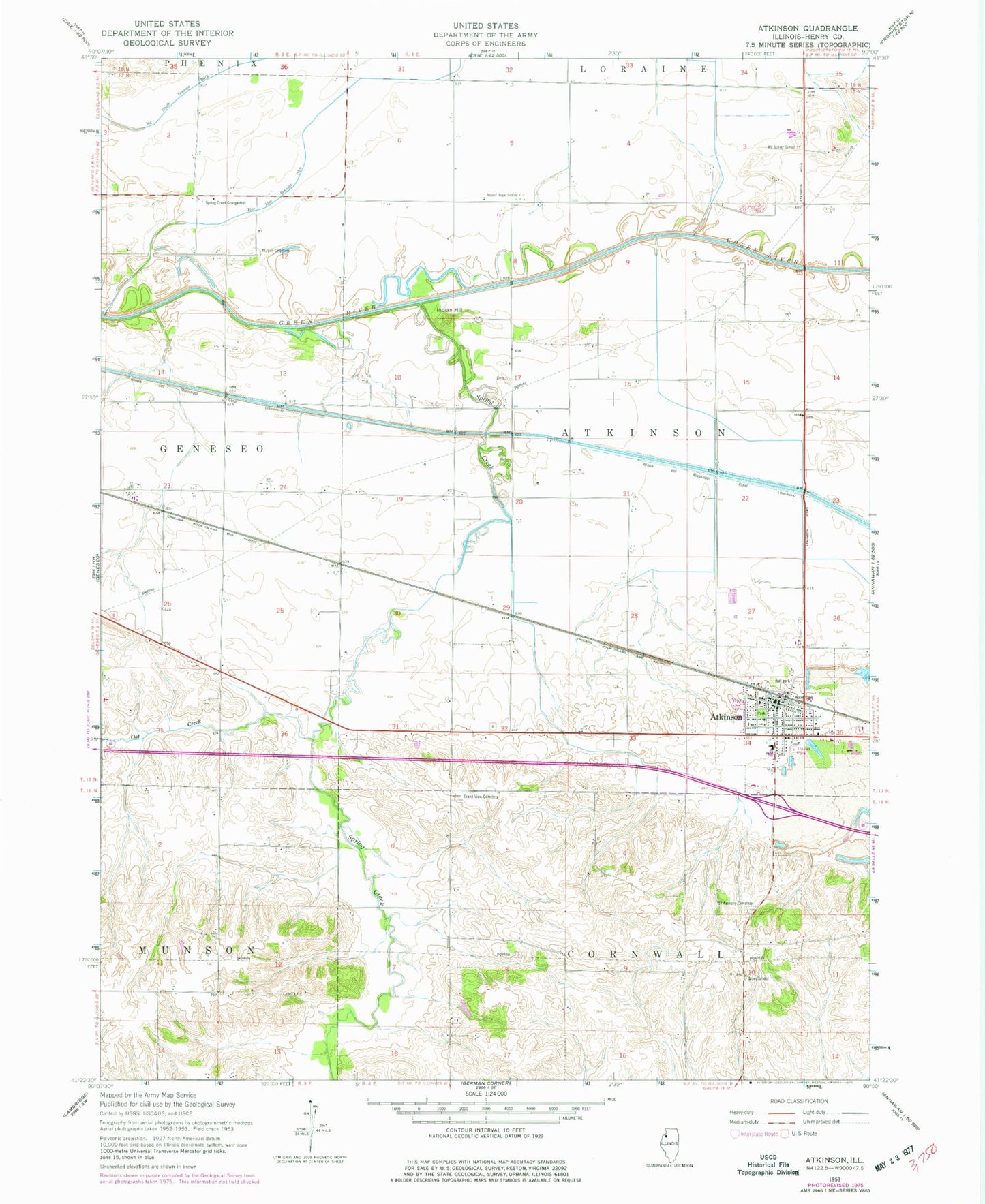
MyTopo
Classic USGS Atkinson Illinois 7.5'x7.5' Topo Map
Couldn't load pickup availability
Historical USGS topographic quad map of Atkinson in the state of Illinois. Map scale may vary for some years, but is generally around 1:24,000. Print size is approximately 24" x 27"
This quadrangle is in the following counties: Henry.
The map contains contour lines, roads, rivers, towns, and lakes. Printed on high-quality waterproof paper with UV fade-resistant inks, and shipped rolled.
Contains the following named places: Atkinson, Atkinson Fire Protection District, Atkinson Grade School, Atkinson Post Office, Atkinson United Church of Christ, Bass School, Blue Joint Ditch, Bluff Road School, Gen-Airpark, Grand View Cemetery, Grand View School, Grove School, Hartman Mine, Indian Hill, Jackson School, Mizpah Cemetery, Mount Hope School, Mount Sunny School, Oak Creek, Saint Anthony Cemetery, Saint Anthonys Catholic Church, Spring Creek, Spring Creek Cemetery, Spring Creek Grange Hall, Spring Creek Mine, Spring Creek School, Town of Atkinson, Township of Atkinson, ZIP Code: 61235