MyTopo
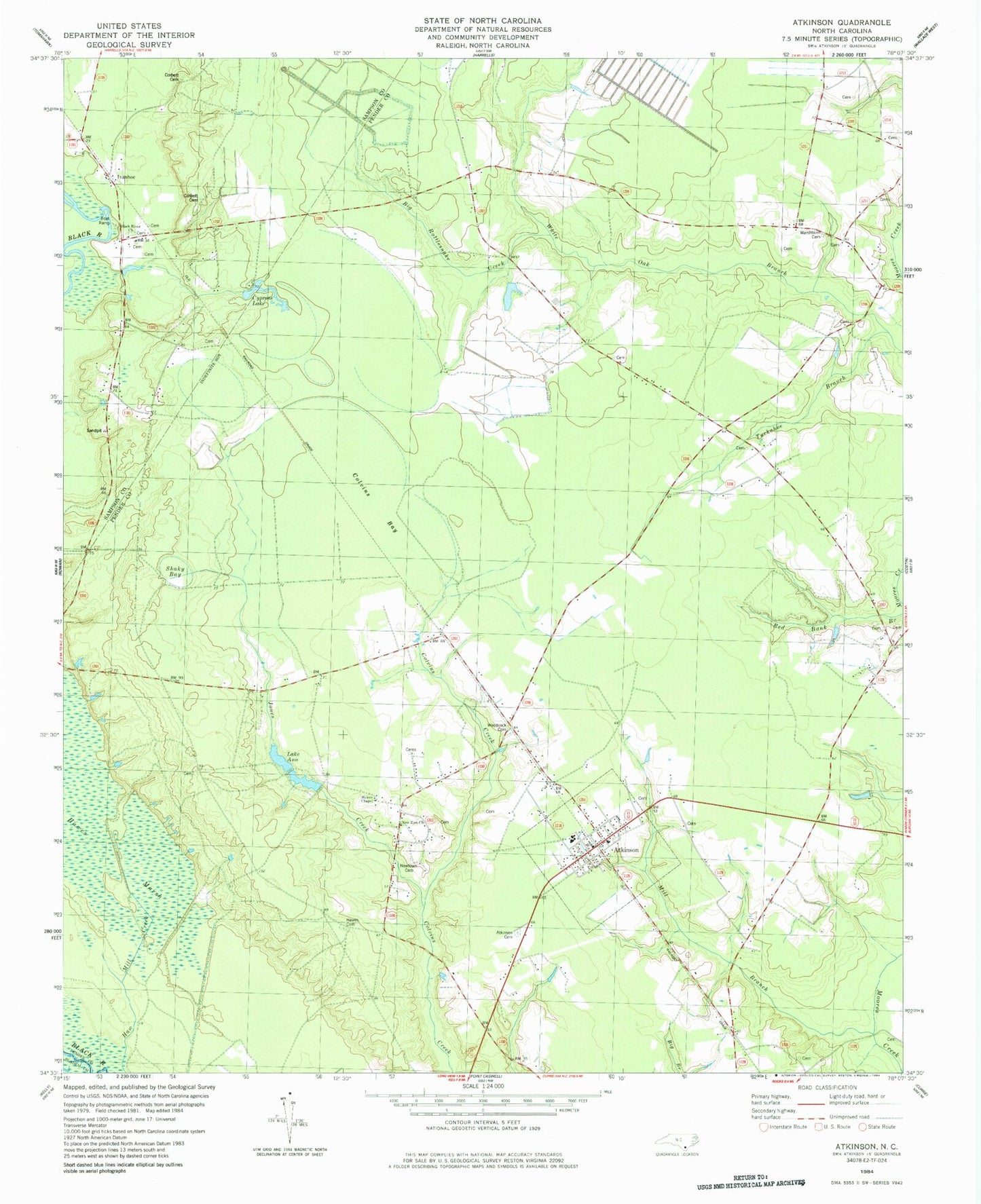
Classic USGS Atkinson North Carolina 7.5'x7.5' Topo Map
Couldn't load pickup availability
Historical USGS topographic quad map of Atkinson in the state of North Carolina. Map scale may vary for some years, but is generally around 1:24,000. Print size is approximately 24" x 27"
This quadrangle is in the following counties: Bladen, Pender, Sampson.
The map contains contour lines, roads, rivers, towns, and lakes. Printed on high-quality waterproof paper with UV fade-resistant inks, and shipped rolled.
Contains the following named places: Atkinson, Atkinson Cemetery, Atkinson Fire Department, Atkinson Middle School, Atkinson Post Office, Atkinson School, Big Rattlesnake Creek, Black River Presbyterian Church, Colvins Bay, Corbett Cemetery, Crab Branch, Cypress Lake, Halfway Branch School, Hawes Cemetery, Hawes Chapel, Hawes Marsh, Ivanhoe, Ivanhoe Census Designated Place, Ivanhoe Post Office, Jones Creek, Lake Ann, Marshburn Cemetery, Mill Branch, Mill Creek, New Zion Church, Newtown Cemetery, Reb Kee, Saint Marys Church, Shaky Bay, Town of Atkinson, Township of Caswell, Tuckahoe Branch, Woodcock Cemetery, ZIP Code: 28421