MyTopo
Classic USGS Atlanta Louisiana 7.5'x7.5' Topo Map
Couldn't load pickup availability
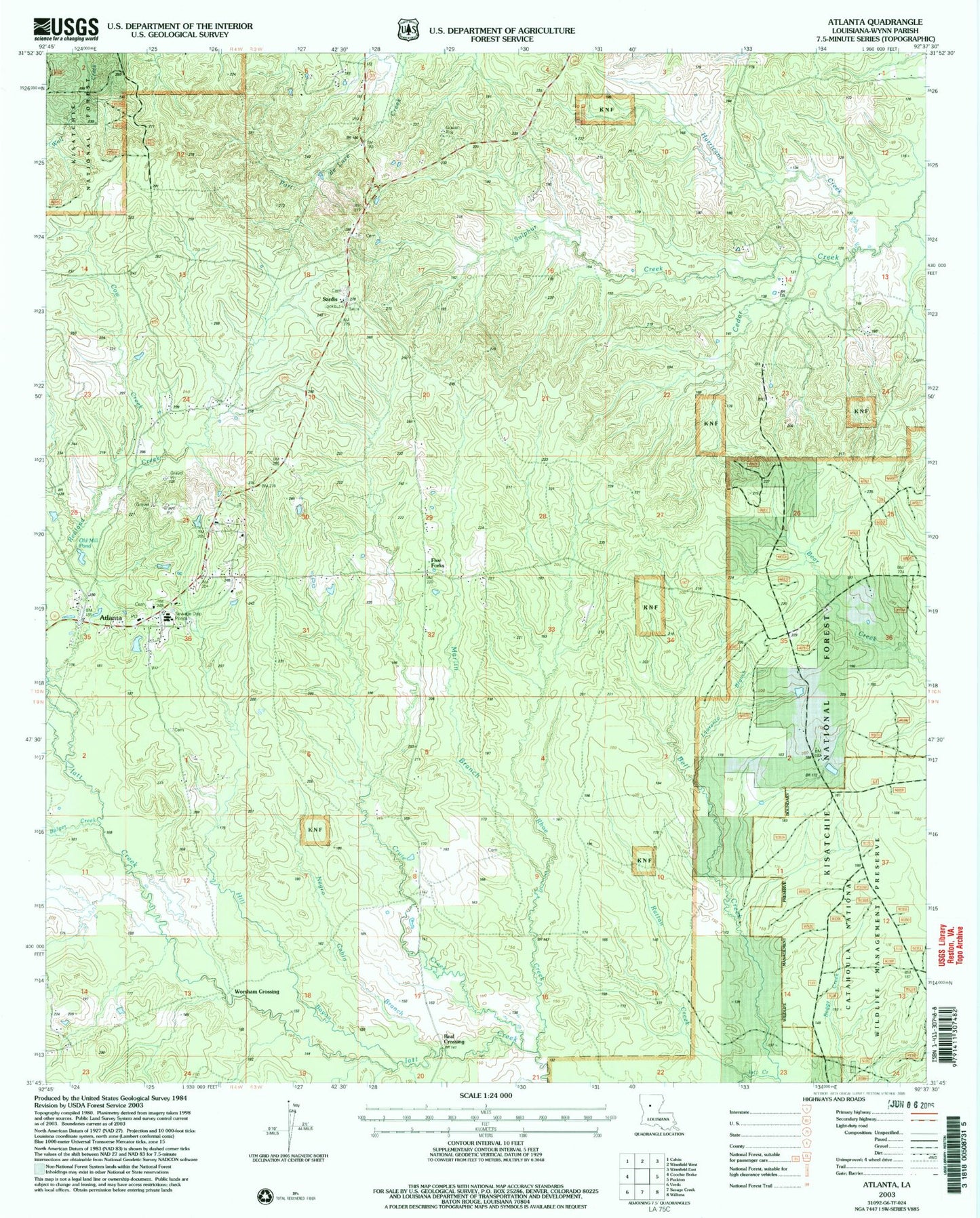
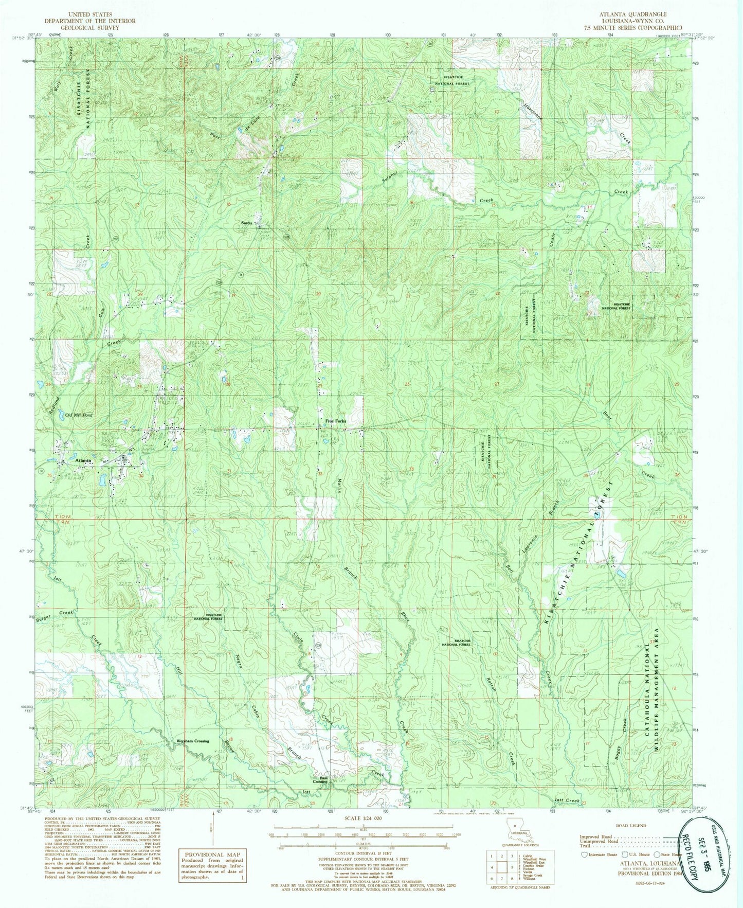
Historical USGS topographic quad map of Atlanta in the state of Louisiana. Map scale may vary for some years, but is generally around 1:24,000. Print size is approximately 24" x 27"
This quadrangle is in the following counties: Winn.
The map contains contour lines, roads, rivers, towns, and lakes. Printed on high-quality waterproof paper with UV fade-resistant inks, and shipped rolled.
Contains the following named places: Alonzo, Antioch Cemetery, Atlanta, Atlanta Gas Field, Atlanta High School, Atlanta Post Office, Beal Crossing, Bell Creek, Bulger Creek, Cedar Creek School, Cow Creek, Cruie Creek, Five Forks, Five Forks Gas Field, Hill Bayou, Iatt Creek Oil Field, Lawrence Branch, Macedonia Church, Marlin Branch, Ninth Ward School, Old Mill Pond, Prairie Home, Ratton Creek, Redland Creek, Rhoe Creek, Sardis, Sardis Church, Sardis Lookout Tower, Sulphur Creek, Sulphur Creek Gas Field, Swindelly Cemetery, Village of Atlanta, Ward Six, Whitford, Worsham Crossing