MyTopo
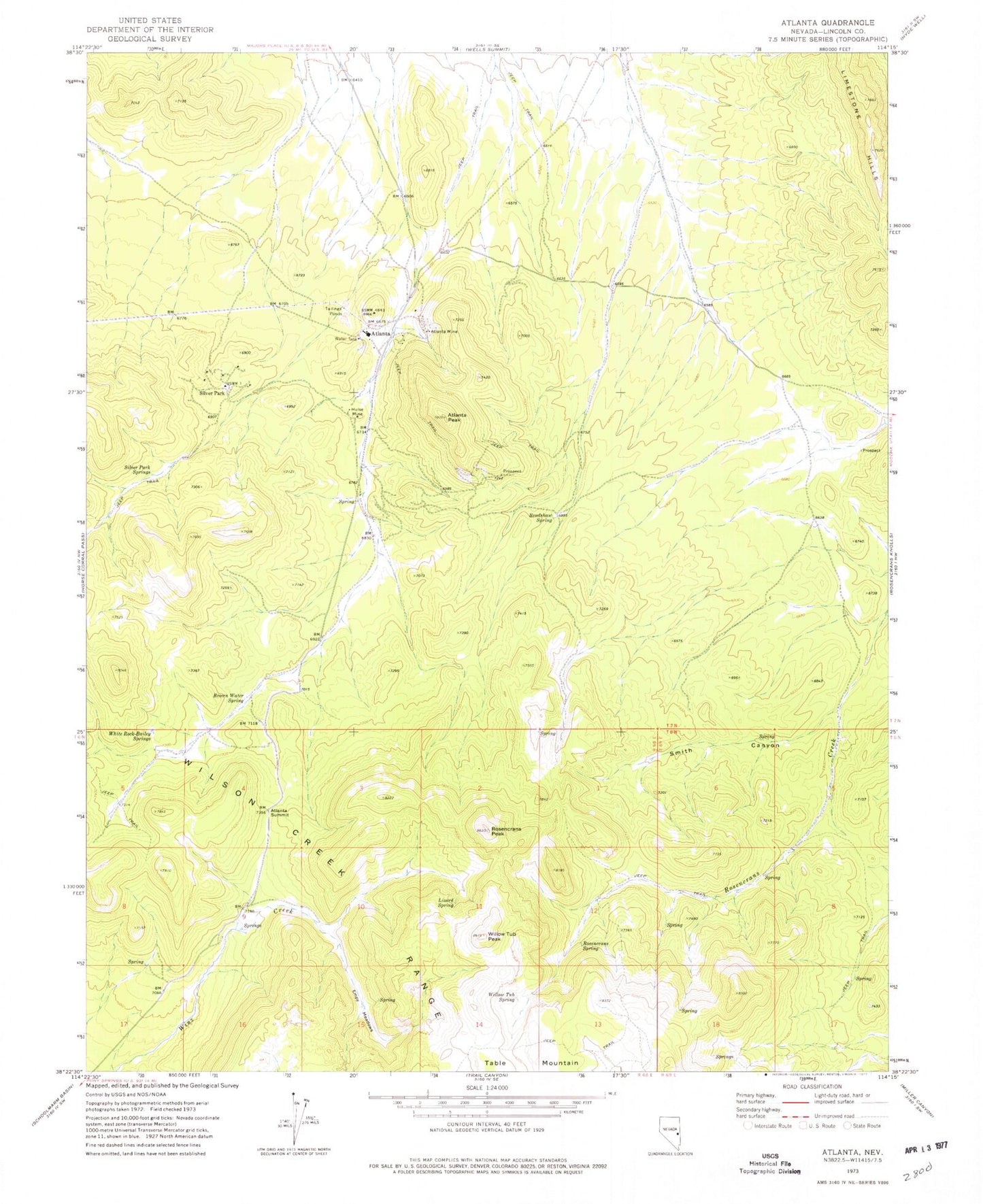
Classic USGS Atlanta Nevada 7.5'x7.5' Topo Map
Couldn't load pickup availability
Historical USGS topographic quad map of Atlanta in the state of Nevada. Map scale may vary for some years, but is generally around 1:24,000. Print size is approximately 24" x 27"
This quadrangle is in the following counties: Lincoln.
The map contains contour lines, roads, rivers, towns, and lakes. Printed on high-quality waterproof paper with UV fade-resistant inks, and shipped rolled.
Contains the following named places: Atlanta, Atlanta Mine, Atlanta Mining District, Atlanta Peak, Atlanta Post Office, Atlanta Summit, Basket Spring, Bradshaw Mine, Bradshaw Spring, Brown Water Spring, Democracy Mine, Easter Mine, Empy Meadows, Hulse Mine, Lizard Spring, Meadow Spring, Mineral Hill, Moonshine Spring, Rosencrans Peak, Rosencrans Spring, Silver Park, Silver Park Mine, Silver Park Springs, Smith Canyon, Solo Joker Mine, West Fork Rosencrans Creek, White Rock-Bailey Springs, Willow Tub Peak, Willow Tub Spring, Wilson Creek