
MyTopo
Classic USGS Auburn Mississippi 7.5'x7.5' Topo Map
Couldn't load pickup availability
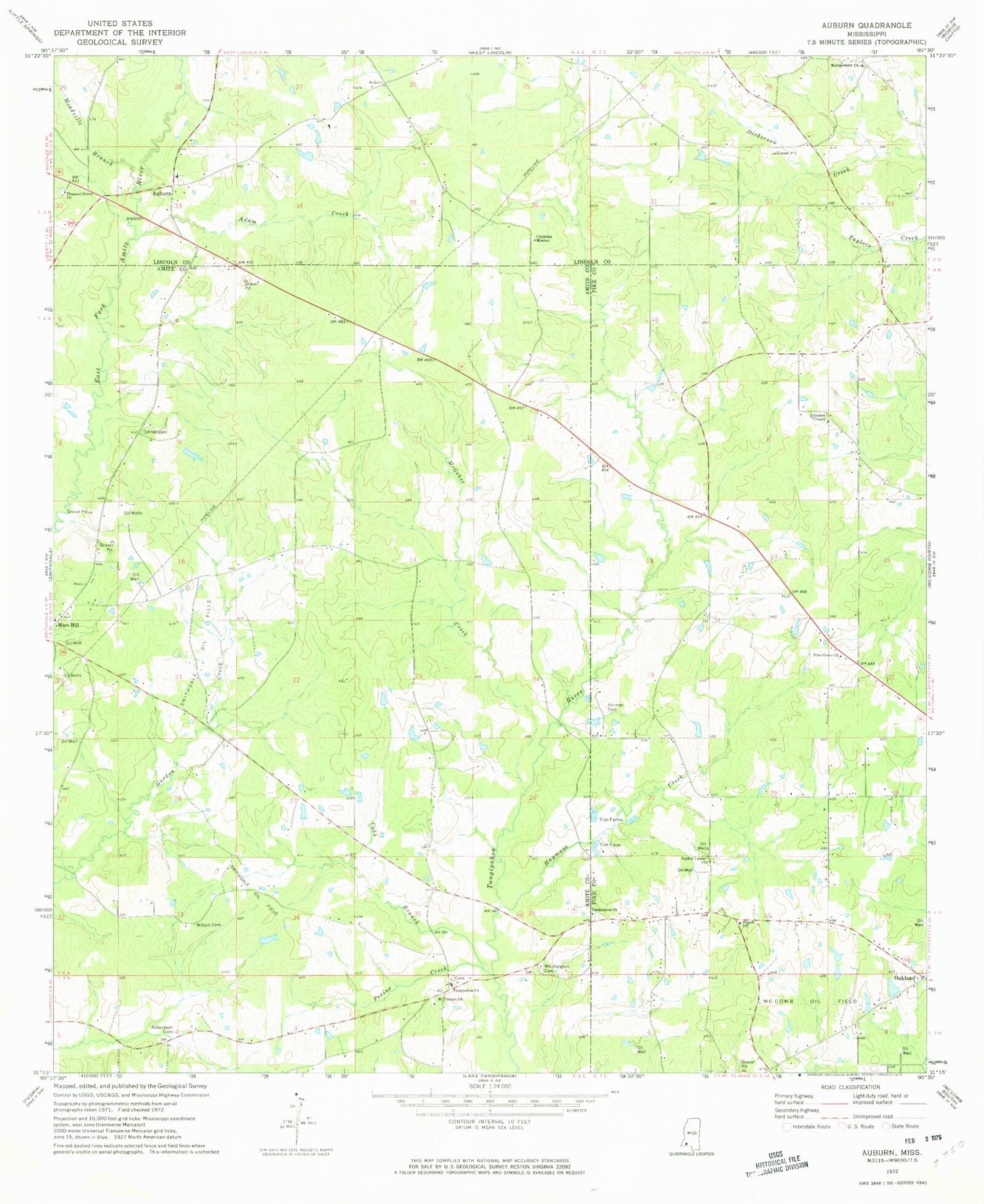
Historical USGS topographic quad map of Auburn in the state of Mississippi. Map scale may vary for some years, but is generally around 1:24,000. Print size is approximately 24" x 27"
This quadrangle is in the following counties: Amite, Lincoln, Pike.
The map contains contour lines, roads, rivers, towns, and lakes. Printed on high-quality waterproof paper with UV fade-resistant inks, and shipped rolled.
Contains the following named places: Adam Creek, Adams Church, Auburn, Chisholm Mission, Cobb Branch, Everett Cemetery, Fairfield Post Office, Garner Cemetery, Hayman Cemetery, Haymans Creek, Hewitt Gordon Cemetery, Holmes Cemetery, Huett Store, Johnson Chapel Cemetery, Johnston Chapel, Mars Hill Baptist Church, McGehee Creek, Meadville Branch, Montgomery Church, Mount Canaan Church, Oakland, Parsons Cemetery, Pevine Creek, Pine Grove Church, Pine Grove School, Pine Hill School, Pisgah Church, Pleasant Grove Church, Robertson Cemetery, Smithdale Field, Smithdale Oil Field, Tangipahoa, Tangipahoa Baptist Church, Tangipahoa Cemetery, Tangipahoa Church, Terrell Cemetery, Turner Cemetery, Whittington Cemetery, Wilson Cemetery


