MyTopo
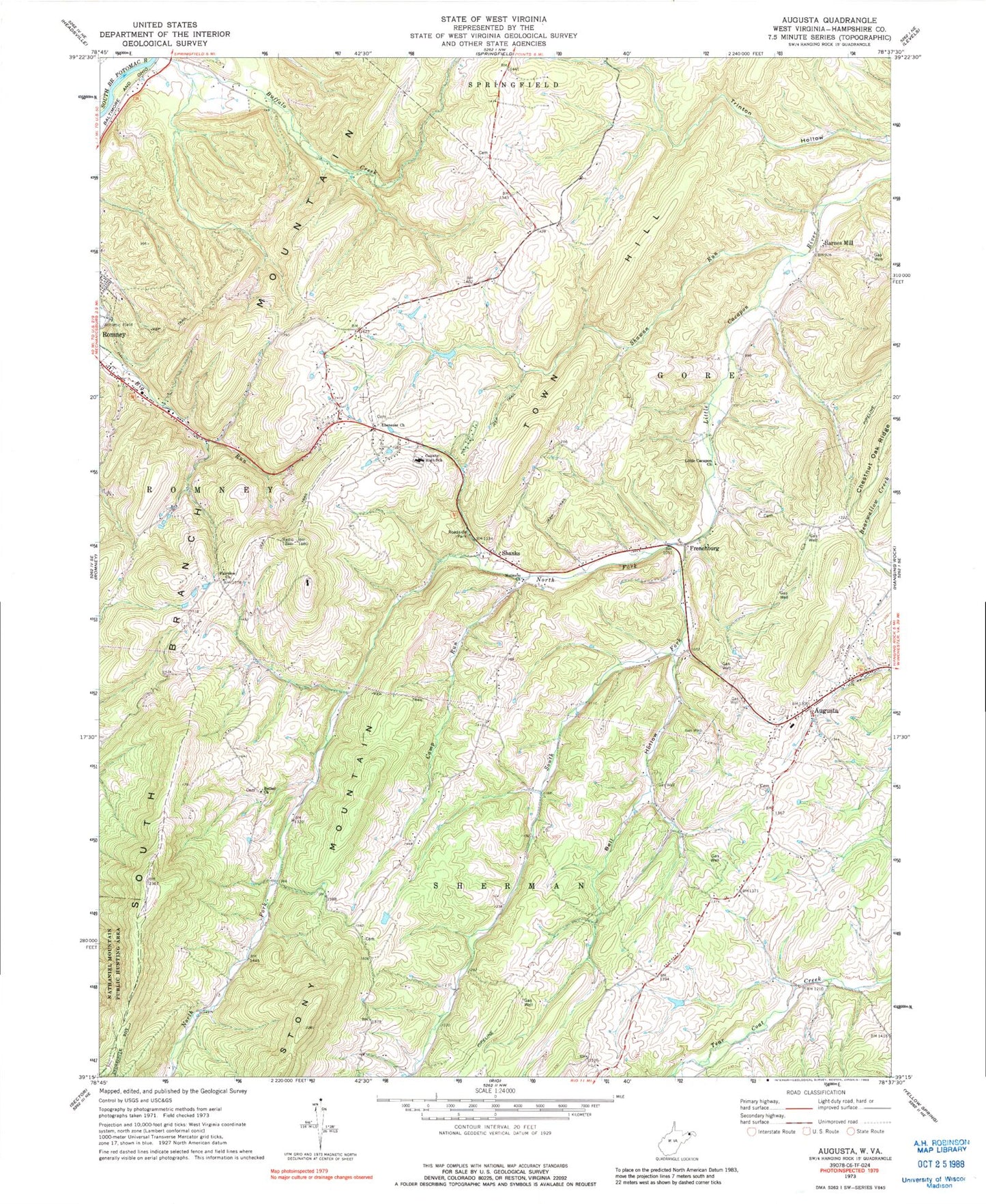
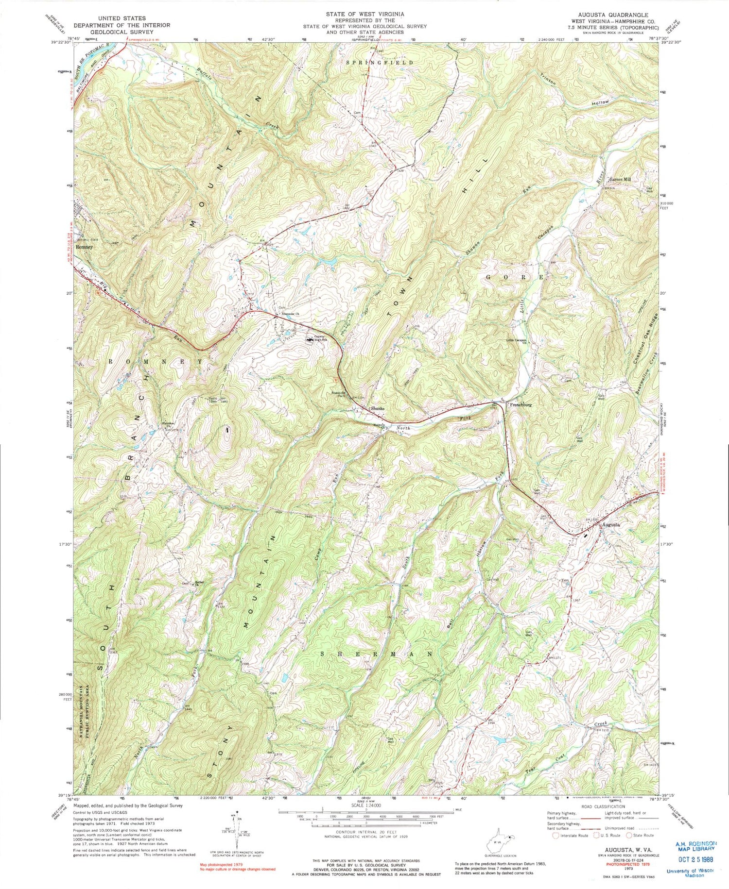
Classic USGS Augusta West Virginia 7.5'x7.5' Topo Map
Couldn't load pickup availability
Historical USGS topographic quad map of Augusta in the state of West Virginia. Map scale is 1:24000. Print size is approximately 24" x 27"
This quadrangle is in the following counties: Hampshire.
The map contains contour lines, roads, rivers, towns, and lakes. Printed on high-quality waterproof paper with UV fade-resistant inks, and shipped rolled.
Contains the following named places: Augusta, Augusta Cemetery, Augusta Elementary School, Augusta Post Office, Augusta Volunteer Rescue Squad Company 13, Barnes Mill, Bell Hollow, Bethel Church, Boone Farms Lake Dam, Bryn School (historical), Camp Run, Chestnut Grove School (historical), Cleveland School (historical), Davey School (historical), Ebenezer Cemetery, Ebenezer Church, Everett Fruit Farm Spring, Fairview Church, Frenchburg, Hampshire County Career Training Center, Hampshire High School, Hampshire Memorial Hospital, Highview School (historical), Holiness Church, J M Chick Buckbee Juvenile Detention Center, JM Chick Buckbee Juvenile Center, Little Cacapon Church, Little Capon School (historical), Lost Mountain Airport, North Fork Little Cacapon River, Old Bethel Church Cemetery, Potomac Highlands Regional Jail, Ridgedale School (historical), Romney Middle School, Shady Grove School (historical), Shanks, Shanks Post Office, Shanks Roadside Park, Shawan Run, South Fork Little Cacapon River, Stonewall School (historical), Stony Mountain, Town Hill, Victory School (historical), Walnut Grove School (historical), Willow Tree School (historical), WJJB-FM (Romney)