MyTopo
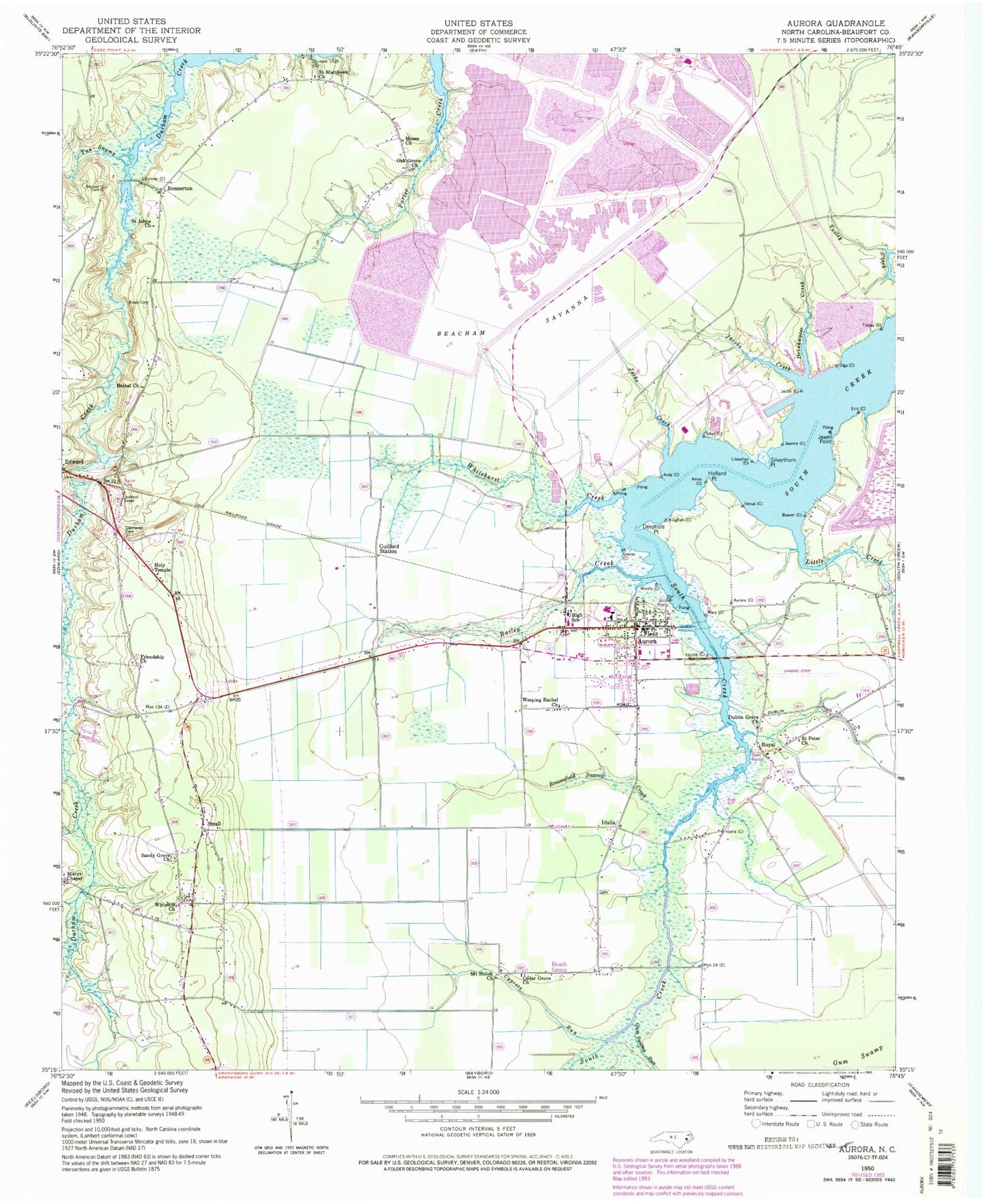
Classic USGS Aurora North Carolina 7.5'x7.5' Topo Map
Couldn't load pickup availability
Historical USGS topographic quad map of Aurora in the state of North Carolina. Map scale may vary for some years, but is generally around 1:24,000. Print size is approximately 24" x 27"
This quadrangle is in the following counties: Beaufort.
The map contains contour lines, roads, rivers, towns, and lakes. Printed on high-quality waterproof paper with UV fade-resistant inks, and shipped rolled.
Contains the following named places: Aurora, Aurora Fossil Museum, Aurora High School, Aurora Police Department, Aurora Post Office, Aurora Volunteer Fire Department, Aurora Wastewater Treatment Plant, Bailey Creek, Beach Grove, Beacham Savanna, Bethel Church, Bonner Cemetery, Bonnerton, Broomfield Swamp Creek, Cedar Grove Church, Cypress Run, Deephole Point, Drinkwater Creek, Dublin Grove Church, Friendship Church, Guilford Station, Gum Swamp Run, High Hill Cemetery, Holland Point, Holy Temple, Hookers Chapel, Idalia, Jacks Creek, Jacobs Creek, Jewell Point, Lee Cemetery, Little Creek, Marys Chapel, Moses Church, Mount Olive Church, Mount Shiloh Church, Oak Grove Church, Oakhaven Cemetery, Philip Chapel, Rowe Cemetery, Royal, S W Snowden Elementary School, Saint John Missionary Baptist Church, Saint Johns Church, Saint Matthews Church, Saint Peter Church, Saint Stephen Church, Sandy Grove Church, Silverthorn Point, Small, Tan Swamp, Town of Aurora, Township of Richland, Weeping Rachel Church, Whitehill Church, Whitehurst Creek, ZIP Codes: 27806, 27821