MyTopo
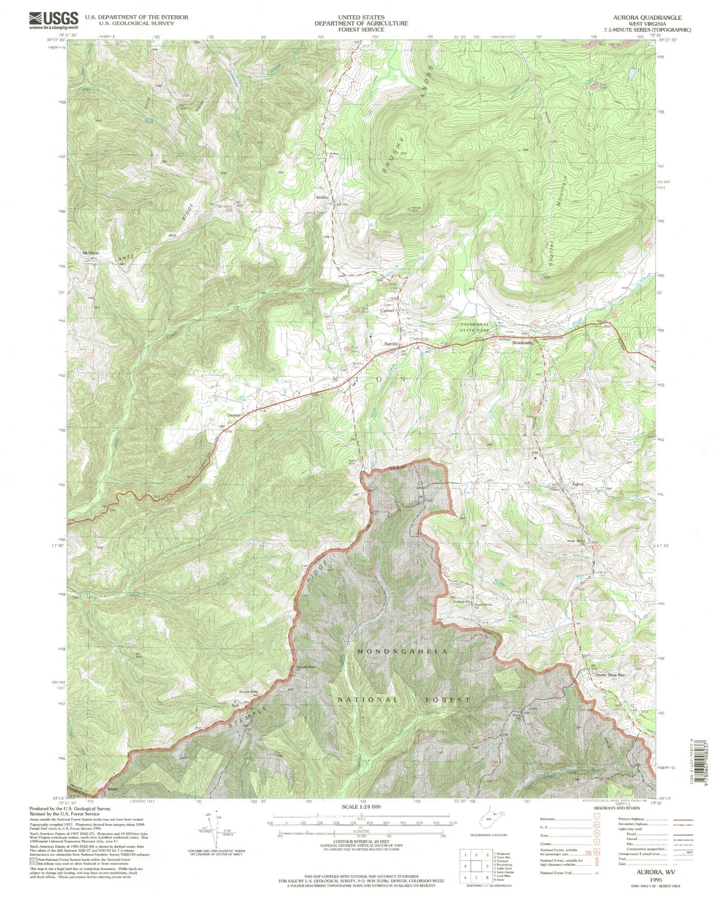
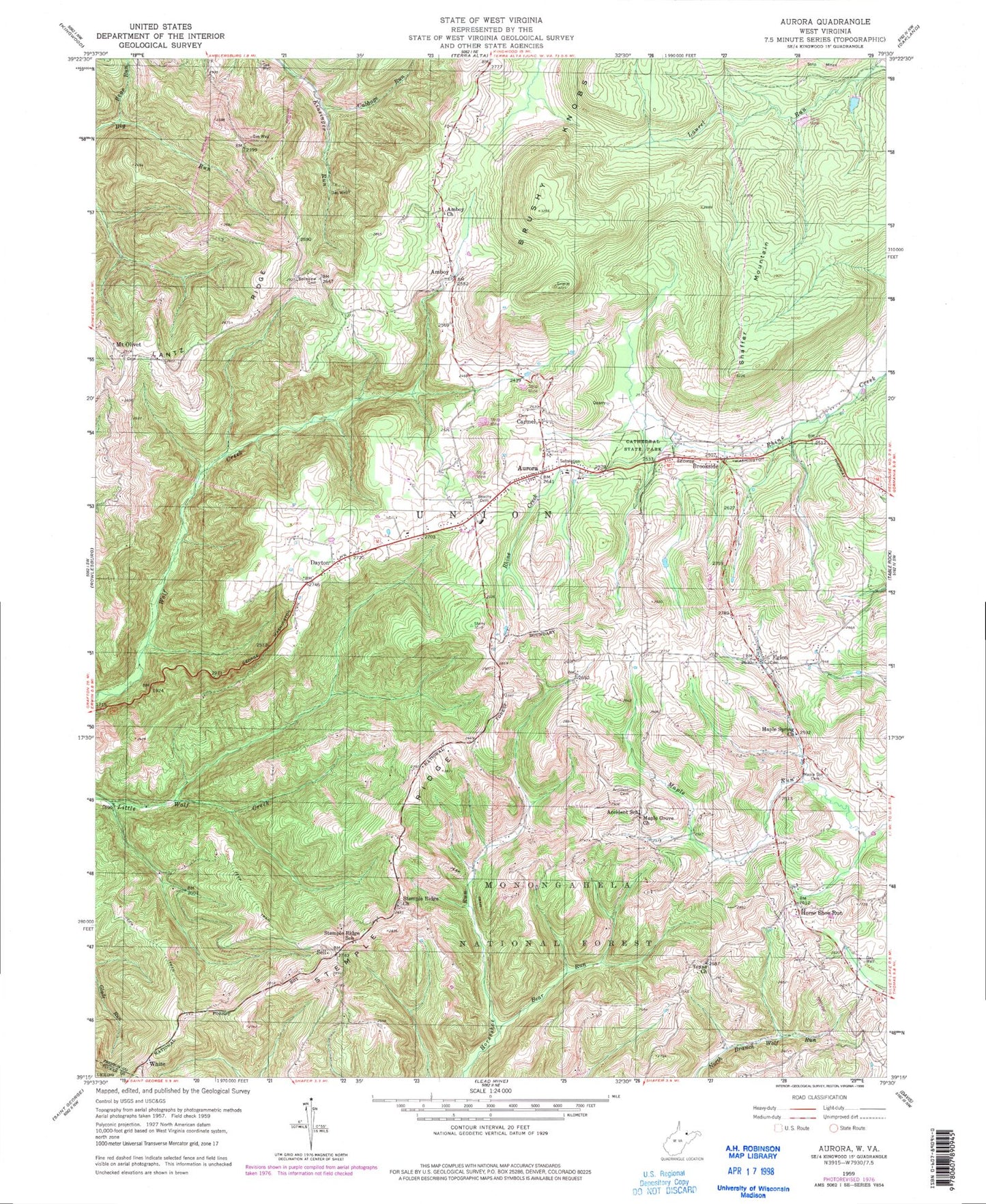
Classic USGS Aurora West Virginia 7.5'x7.5' Topo Map
Couldn't load pickup availability
Historical USGS topographic quad map of Aurora in the state of West Virginia. Typical map scale is 1:24,000, but may vary for certain years, if available. Print size: 24" x 27"
This quadrangle is in the following counties: Preston, Tucker.
The map contains contour lines, roads, rivers, towns, and lakes. Printed on high-quality waterproof paper with UV fade-resistant inks, and shipped rolled.
Contains the following named places: Accident Cemetery, Accident School (historical), Amboy Church, Beachy Cemetery, Bear Run, Bear Run, Belleview Cemetery, Brookside, Cabbage Run, Cathedral State Park, Eglon, Horse Shoe Run, Lantz Ridge, Maple Grove Church, Maple Spring Cemetery, Maple Spring Church, Mount Olivet, Sell, Shaffer Mountain, Stemple Ridge, Stemple Ridge Church, Stemple Ridge School (historical), Texas Church, Thunderstruck Run, White, Amboy, Brushy Knobs, Dayton, Aurora, Carmel, Amboy School (historical), Aurora Elementary School, Aurora Post Office, Aurora United Methodist Church, Belleview School (historical), Boiling Spring, Breedlove (historical), Bretside School (historical), Brookside Brethren Church, Cash Valley School (historical), Eglon Post Office, Forest Dale School (historical), Grange Hall School (historical), Hockert School (historical), Horse Shoe Run Post Office, Lace White Spring, Old Indian Spring, Saint Pauls Lutheran Church, Elmer Grimm Lake Dam, Union District (historical), Aurora Volunteer Fire Department, Mount Grove Volunteer Fire Department, Union Ambulance Service, Aurora Census Designated Place, Cathedral State Park Museum