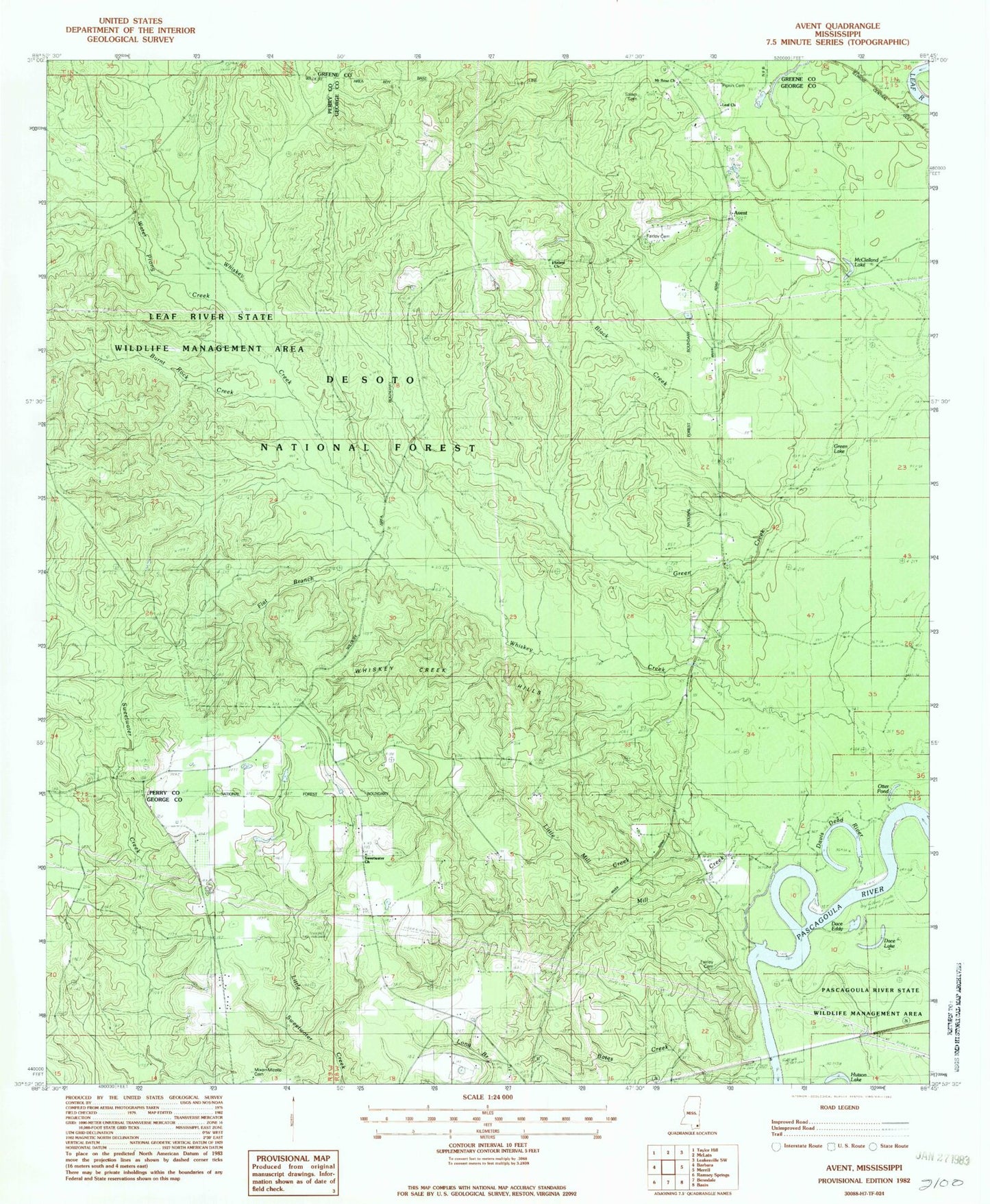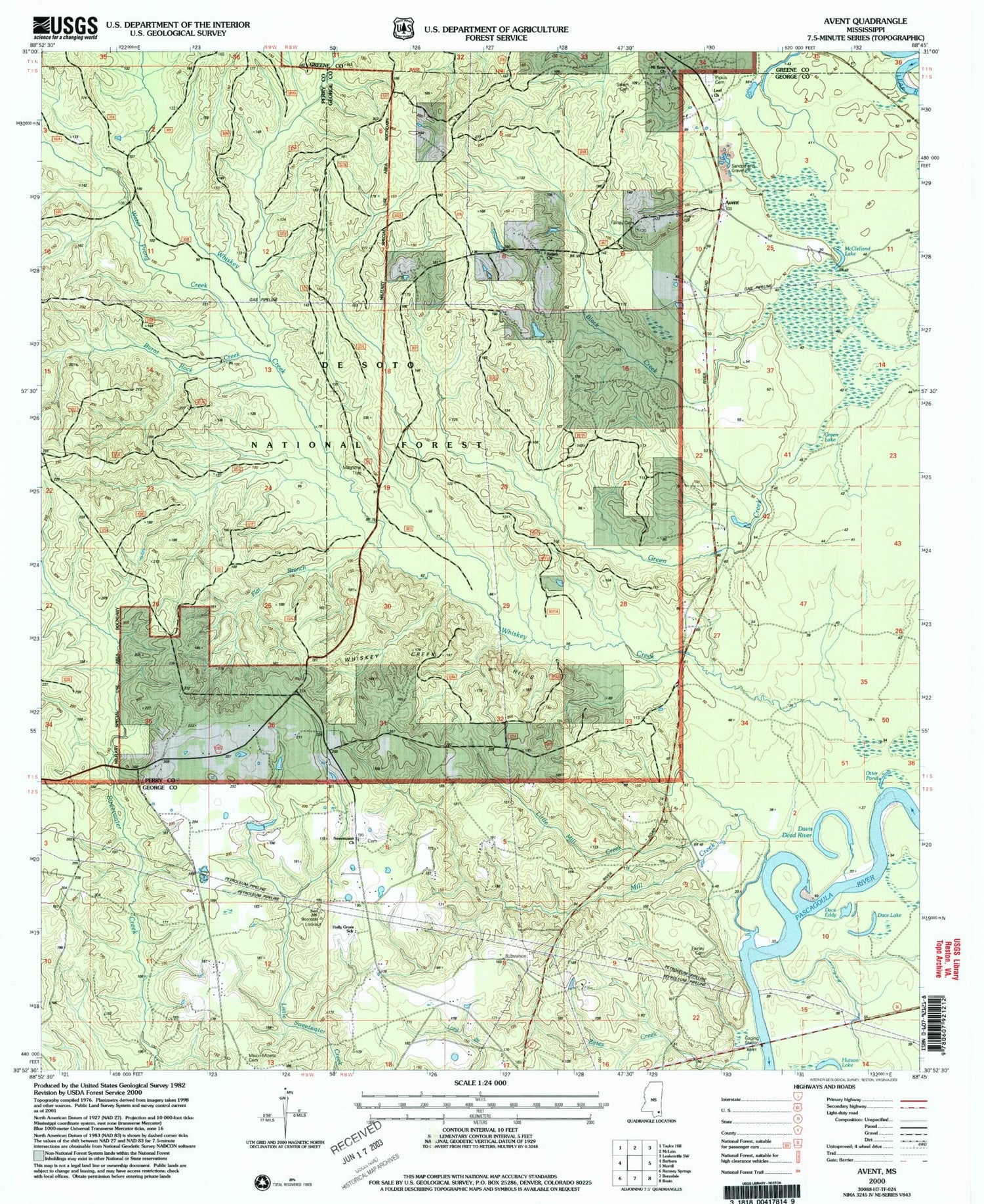
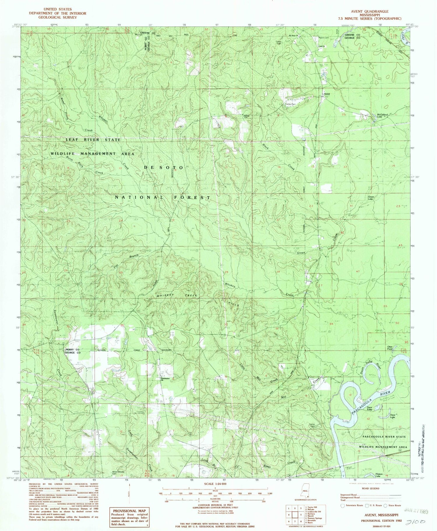
MyTopo
Classic USGS Avent Mississippi 7.5'x7.5' Topo Map
Couldn't load pickup availability
Historical USGS topographic quad map of Avent in the state of Mississippi. Map scale may vary for some years, but is generally around 1:24,000. Print size is approximately 24" x 27"
This quadrangle is in the following counties: George, Greene, Perry.
The map contains contour lines, roads, rivers, towns, and lakes. Printed on high-quality waterproof paper with UV fade-resistant inks, and shipped rolled.
Contains the following named places: Avent, Benndale Fire Tower, Black Creek, Black Lake, Burnt Rock Creek, Cox Chapel, Dace Eddy, Dace Lake, Davis Dead River, Fairley Cemetery, Fairley Ferry, Flat Branch, Green Creek, Green Lake, Holly Grove School, Hutson Lake, Leaf Church, Little Mill Creek, McClelland Lake, Mill Creek, Mixon - Mizelle Cemetery, Mount Rose Church, Mount Rose School, New Life Baptist Church, Otter Pond, Pascagoula River Mississippi Highway 26 Bridge, Pipkin Cemetery, Salem Cemetery, Salem Church, Salem School, Salem Volunteer Fire Department, Sweetwater Church, Water Prong Creek, Whiskey Creek, Whiskey Creek Hills