MyTopo
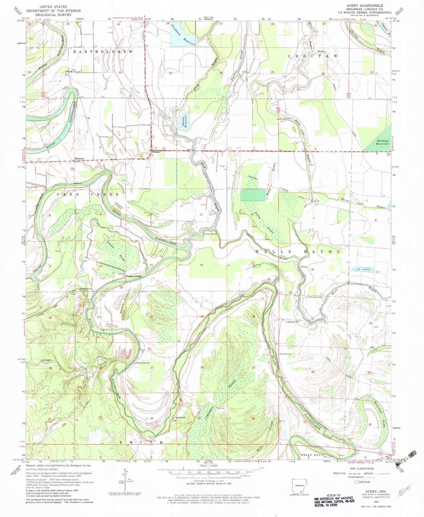
Classic USGS Avery Arkansas 7.5'x7.5' Topo Map
Couldn't load pickup availability
Historical USGS topographic quad map of Avery in the state of Arkansas. Map scale may vary for some years, but is generally around 1:24,000. Print size is approximately 24" x 27"
This quadrangle is in the following counties: Lincoln.
The map contains contour lines, roads, rivers, towns, and lakes. Printed on high-quality waterproof paper with UV fade-resistant inks, and shipped rolled.
Contains the following named places: Avery, Avery Brake, Cane Creek, Caney Creek, Champion, Coles Spur, Cypress Grove Church, Dark Brake, Deep Bayou, Flag Pond, Fresno, Gibson Brake, Harm Coat Bayou, Horseshoe Brake, Liberty Church, Lincoln County, Mackwee Cemetery, Mackwee Church, Mattox Ferry, Mattox Ford, Meroney, Mills Slough, Mount Olive Church, New Bethel Church, Panther Slough, Persons Bridge, Persons Bridge School, Persons Chapel, Persons Chapel School, Pinchback Reservoir, Price Brake, Purtris Brake, Rankin Chapel Baptist Church, Rose Hill, Rose Hill Church, Saint Harmony Church, Saint James Church, Shooks Reservoir, Village Creek, Wagon Bayou, Wells Bayou School, Wells Bayou Volunteer Fire Department