
MyTopo
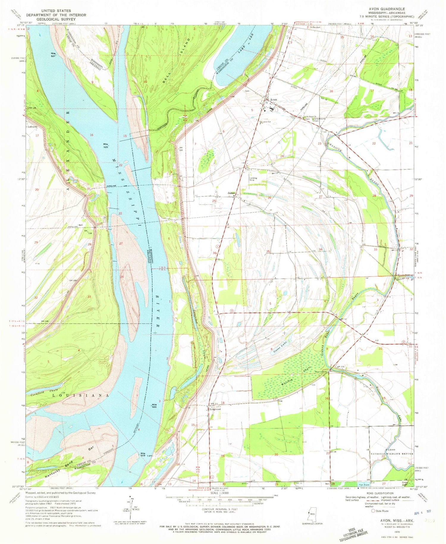
Classic USGS Avon Mississippi 7.5'x7.5' Topo Map
Couldn't load pickup availability
Historical USGS topographic quad map of Avon in the states of Mississippi, Arkansas. Map scale may vary for some years, but is generally around 1:24,000. Print size is approximately 24" x 27"
This quadrangle is in the following counties: Chicot, Washington.
The map contains contour lines, roads, rivers, towns, and lakes. Printed on high-quality waterproof paper with UV fade-resistant inks, and shipped rolled.
Contains the following named places: Alexander Memorial Baptist Church, American Cutoff Revetment, Auburn Landing, Avon, Avon Elementary School, Avon Post Office, Avon United Methodist Church, Cornfield Chute, Ditch Number Eleven, Ditch Number Fourteen, Ditch Number Nine A, Ditch Number Nine B, Ditch Number Ten, Eggs Point, Eggs Point Landing, Glenora Landing, Goose Lake, Granny Baker Bayou, Graymound Cemetery, Island Number 86, James, Kentucky Bend, Kentucky Bend Bar, Lake Washington, Lakeport Landing, Lakeport Towhead, Little Sister Church, Longwood, Longwood Chute, Longwood Landing, Mississippi Power and Light Company Lake Dam, Riverside Attendance Center, Saint James Church, Seven Oaks Landing, Silver Lake, Silver Lake Church, Steele Farms Airport, Stella Landing, Supervisor District 1, Whiskey Chute, ZIP Code: 38723


