MyTopo
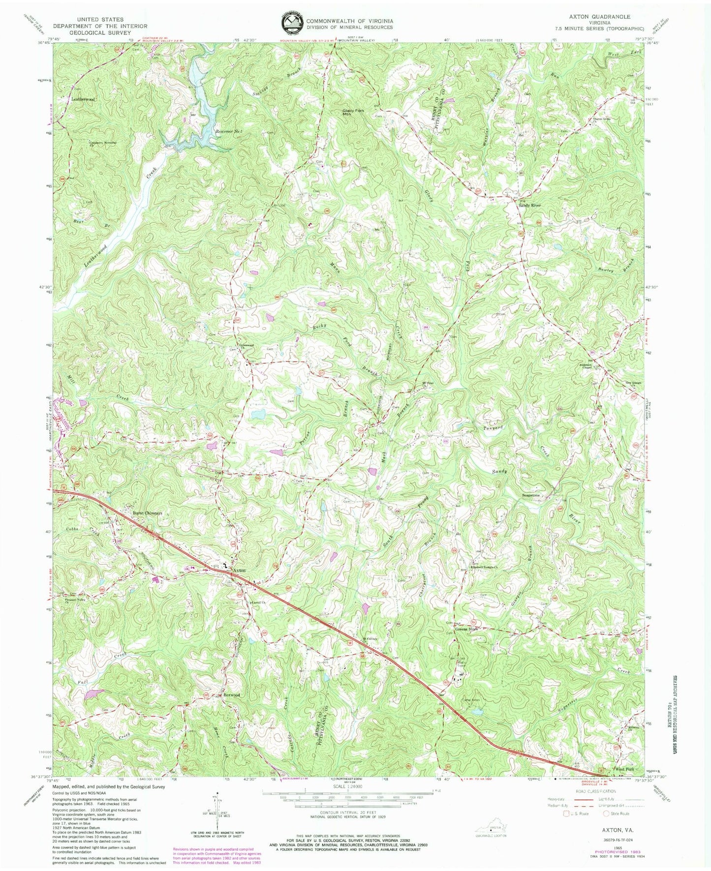
Classic USGS Axton Virginia 7.5'x7.5' Topo Map
Couldn't load pickup availability
Historical USGS topographic quad map of Axton in the state of Virginia. Map scale may vary for some years, but is generally around 1:24,000. Print size is approximately 24" x 27"
This quadrangle is in the following counties: Henry, Pittsylvania.
The map contains contour lines, roads, rivers, towns, and lakes. Printed on high-quality waterproof paper with UV fade-resistant inks, and shipped rolled.
Contains the following named places: Anderson Chapel, Axton, Axton Baptist Church, Axton Elementary School, Axton Life Saving Crew, Axton Post Office, Axton School, Axton Volunteer Fire Department, Bear Branch, Boxwood, Boxwood Hunt Club Dam, Boxwood Hunt Club Lake, Burnt Chimneys, Camp Axton, Carroll Church, Cherrytree Branch, Cranberry Memorial Church, Cranberry School, Crooked Run, Davis Field Airport, Davis Store, Elect School, Elizabeth Temple Church, Emerson School, Fishing Fork, Frith Equipment Corporation Dam, Georgia Branch, Glady Fork, Glady Fork Mountain, Greens Store, Greenwood Church, Iriswood District, Leatherwood, Leatherwood Creek Number Five Dam, Mann Creek, Mash Branch, Midway Church, Mount Calvary Church, Mount Sinai Church, New Design Church, Petras Branch, Pleasant Valley Church, Reservoir Number 5, Robinson Dam, Robinson Lake, Rocky Ford Branch, Sandy River, Sandy River School, Sharon Grove Church, Soapstone, Soapstone School, Stockton, Suckegg Branch, Tanyard Creek, Watkins Branch, Watkins School, ZIP Code: 24054