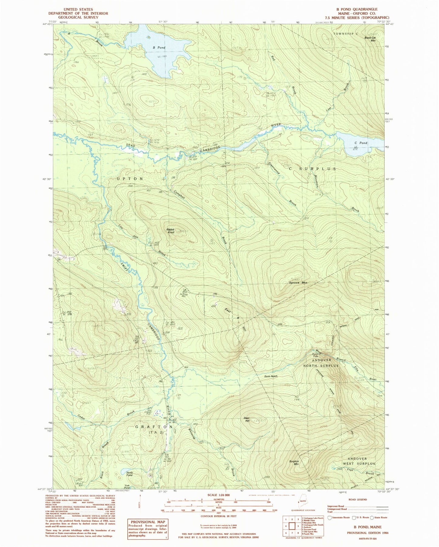
MyTopo
Classic USGS B Pond Maine 7.5'x7.5' Topo Map
Couldn't load pickup availability
Historical USGS topographic quad map of B Pond in the state of Maine. Typical map scale is 1:24,000, but may vary for certain years, if available. Print size: 24" x 27"
This quadrangle is in the following counties: Oxford.
The map contains contour lines, roads, rivers, towns, and lakes. Printed on high-quality waterproof paper with UV fade-resistant inks, and shipped rolled.
Contains the following named places: B Pond, Black Brook, Black Cat Mountain, C Pond, Campbell Brook, Cedar Brook, Deer Hill, Dunn Notch, East B Hill, Greenwood Brook, Lost Brook, Lou Ann Brook, Mountain Brook, North Pond, Rabbit Knoll, Red Brook, Spruce Mountain, Surplus Mountain, Swift Cambridge River, Whitecap Brook, Town of Upton, Dunn Falls, C Surplus