MyTopo
Classic USGS Babson Park Florida 7.5'x7.5' Topo Map
Couldn't load pickup availability
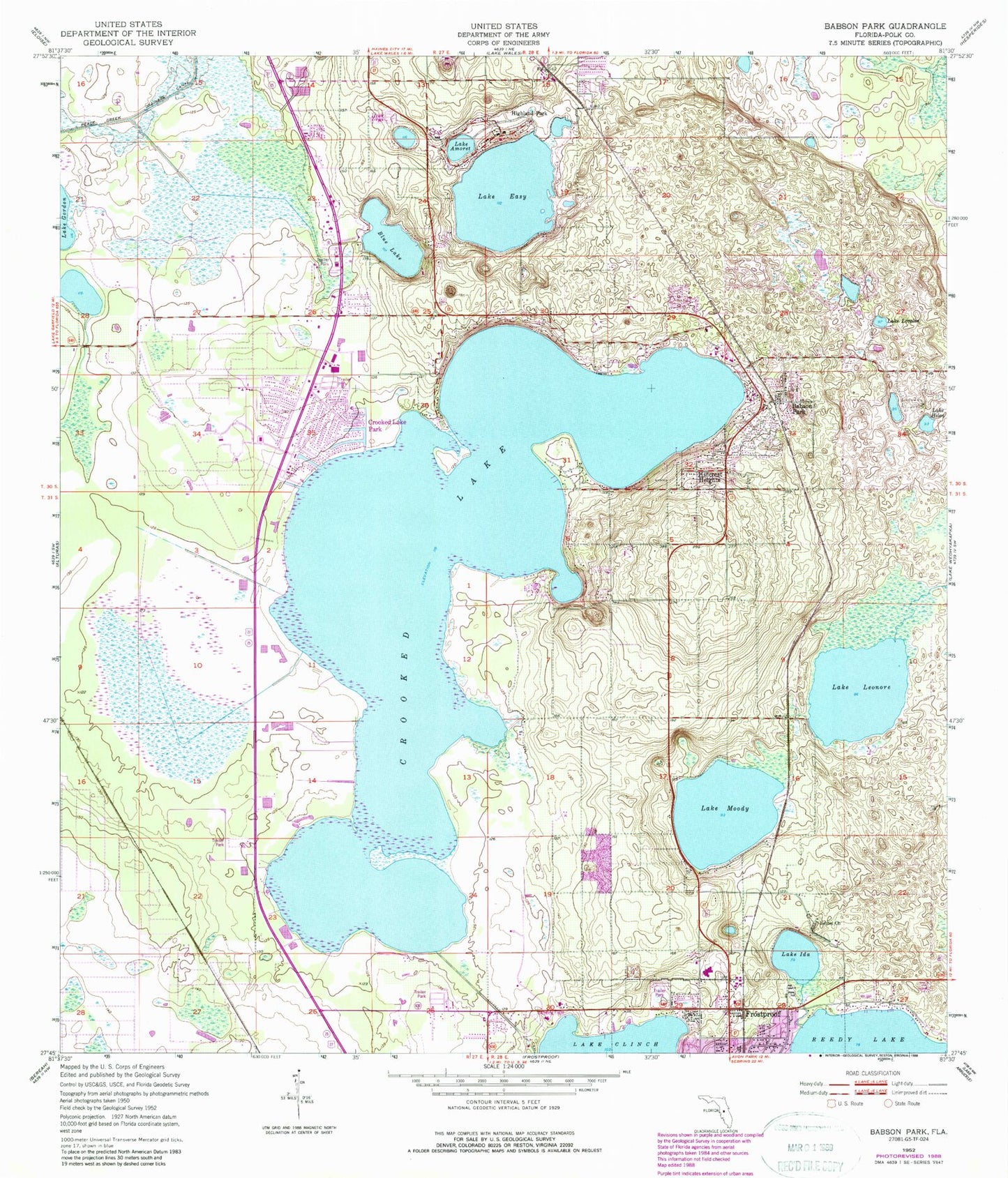
Historical USGS topographic quad map of Babson Park in the state of Florida. Typical map scale is 1:24,000, but may vary for certain years, if available. Print size: 24" x 27"
This quadrangle is in the following counties: Polk.
The map contains contour lines, roads, rivers, towns, and lakes. Printed on high-quality waterproof paper with UV fade-resistant inks, and shipped rolled.
Contains the following named places: Lake Amoret, Babson Park, Bethel Church, Blue Lake, Crooked Lake Park, Lake Easy, Lake Helen, Highland Park, Hillcrest Heights, Lake Ida, Lake Leonore, Lake Loralin, Lake Moody, Crooked Lake, Sun Ray Shopping Center, Frostproof Middle Senior High School, Dale R Fair Babson Park Elementary School, Webber College, WXPQ-AM (Babson Park), Lake Clinch Airpark, Goddard Seadrome, Polk County Fire Department Station 6 Caloosa Lake, Polk County Fire Rescue Station 1, Polk County Sheriff's Office - Community Policing Unit Babson Park, Polk County Sheriff's Office - Community Policing Unit Highland Park Manor, Babson Park Census Designated Place, Crooked Lake Park Census Designated Place, Town of Hillcrest Heights, Village of Highland Park, Reed Mobile Home Park, Bobs Landing Mobile Home Park, Southern Pines Recreational Vehicle Park, Whidden Mobile Home Park Number 2, Frostproof Mobile Home Park, Lake Clinch Manor Mobile Home Park, Pleasant View Mobile Home Park, Southern Pines Mobile Home Resort, Sunrise Trailer Park, Whidden Mobile Home Park, Lakeside Gardens Mobile Home Park, College Park Mobile Home Park, Ridge Landing, South Lake Gordon, Babson Park Post Office, Little Crooked Lake, Lake Biscuit