MyTopo
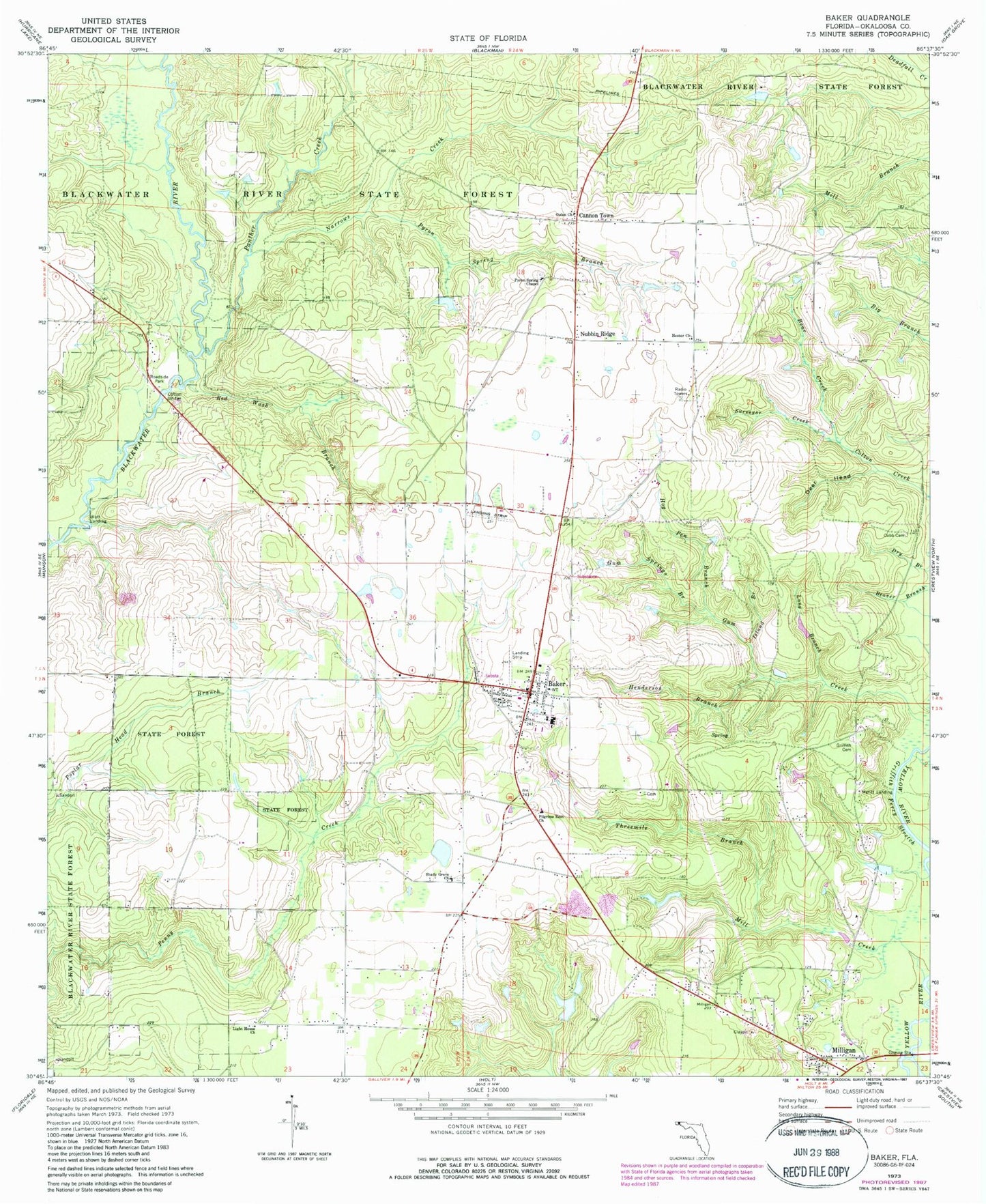
Classic USGS Baker Florida 7.5'x7.5' Topo Map
Couldn't load pickup availability
Historical USGS topographic quad map of Baker in the state of Florida. Map scale is 1:24000. Print size is approximately 24" x 27"
This quadrangle is in the following counties: Okaloosa.
The map contains contour lines, roads, rivers, towns, and lakes. Printed on high-quality waterproof paper with UV fade-resistant inks, and shipped rolled.
Contains the following named places: A A Hilton Pond, Baker, Baker Division, Baker Fire District, Baker Post Office, Baker School, Bear Creek, Bluff Landing, Cannon Town, Cobb Cemetery, Cotton Bridge, Deer Head, Dotson Airport, Golan Church, Griffith Cemetery, Griffith Ferry Stretch, Gum Springs Branch, Gunn Creek, Henderson Branch, Hester Church, Hog Pen Branch, Island Branch, Light House Church, Lighthouse Church, Lonesome Pines Airport (historical), Long Branch, Meritt Landing, Mill Creek, Milligan, Narrows Creek, North Okaloosa Fire Department Station 83, Nubbin Ridge, Okaloosa County Emergency Medical Services Station 5, Panther Creek, Pilgrims Rest Church, Pyron Spring Branch, Pyron Spring Chapel, Red Wash Branch, Shady Grove Church, Skypark Estates Owners Association Airport, Surveyor Creek, Tan Vat Branch, Threemile Branch, WJUS-FM (Fort Walton Beach), WJUS-FM (Fort Walton Beach), WTJT-FM (Baker), WTJT-FM (Crestview)