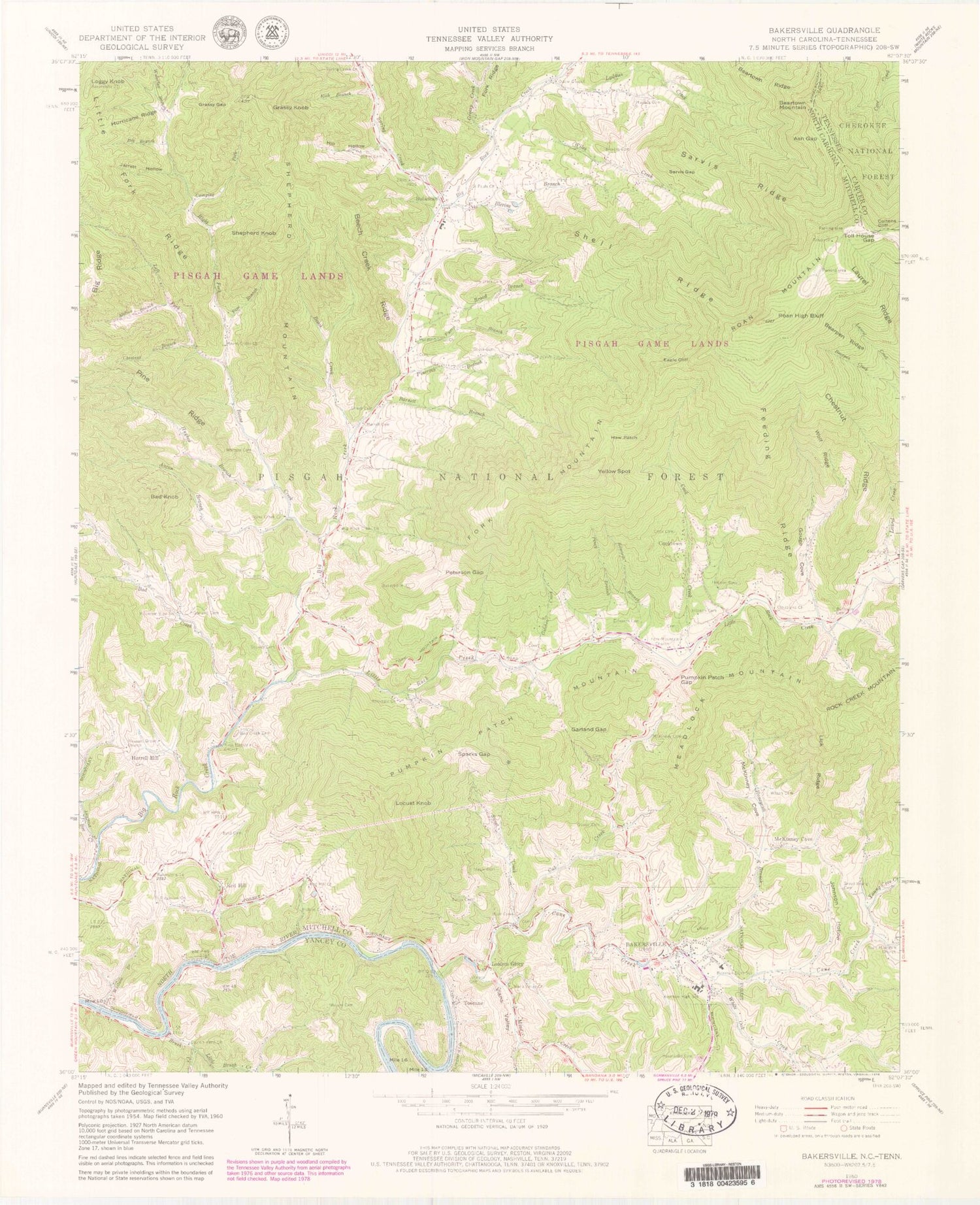
MyTopo
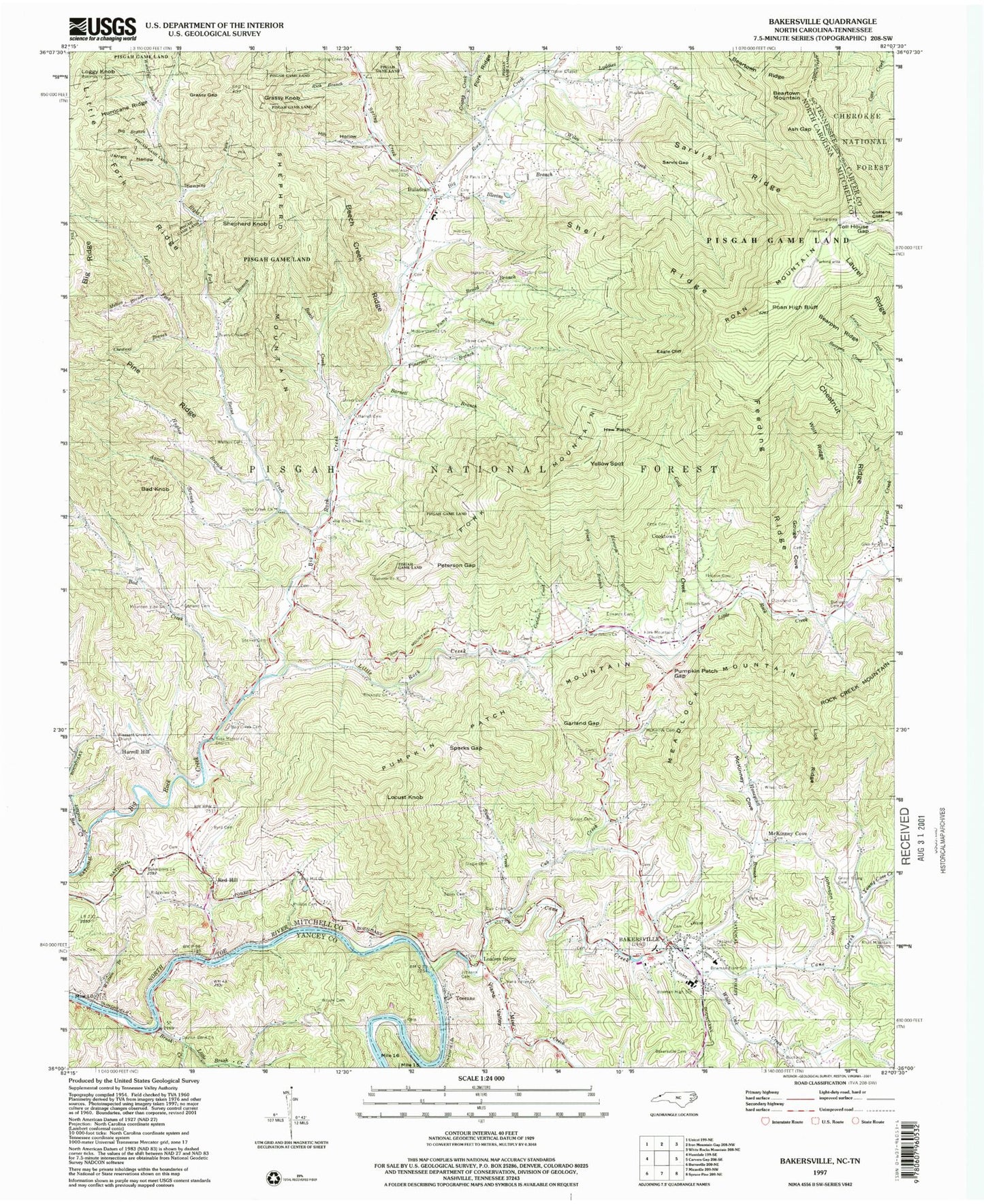
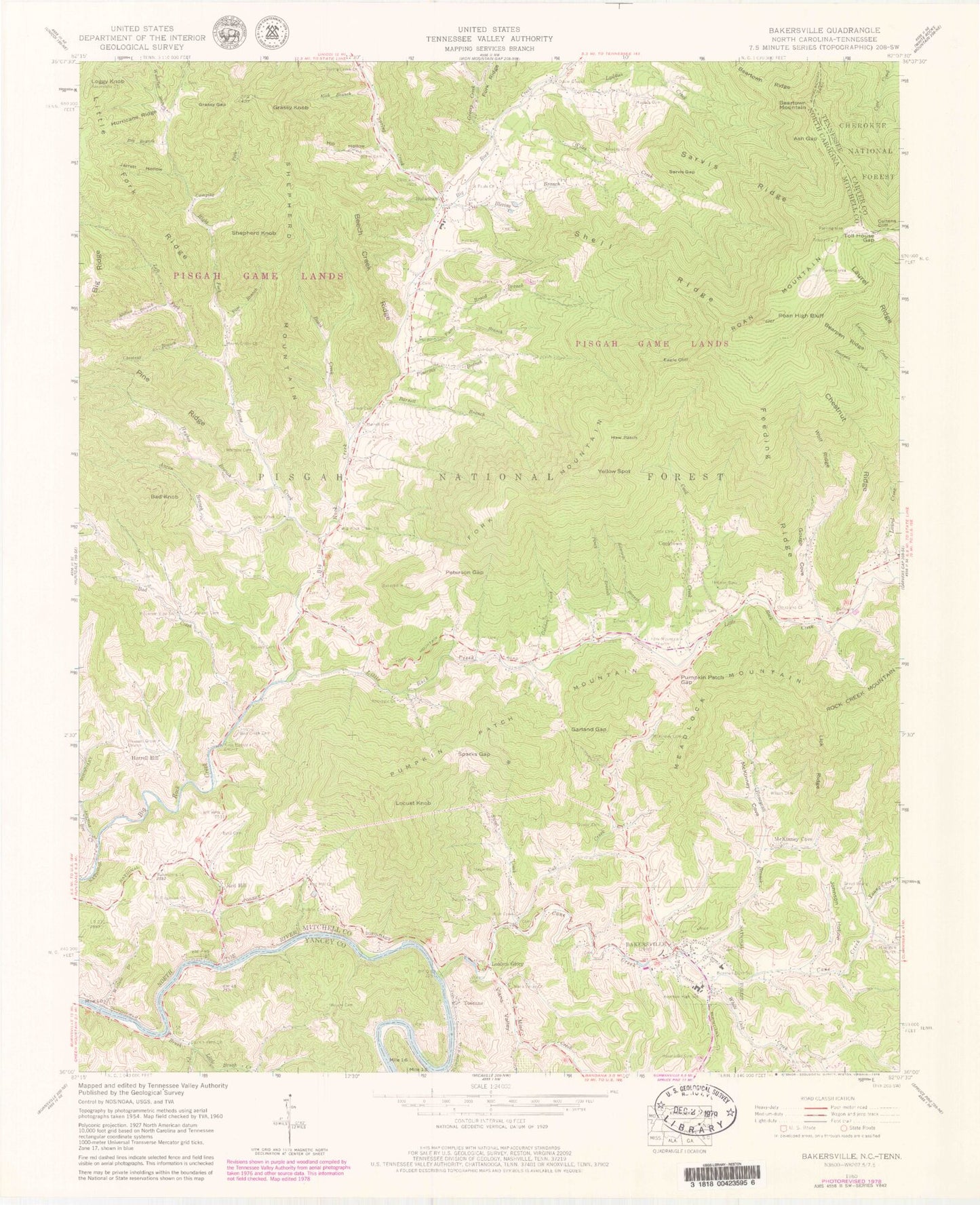
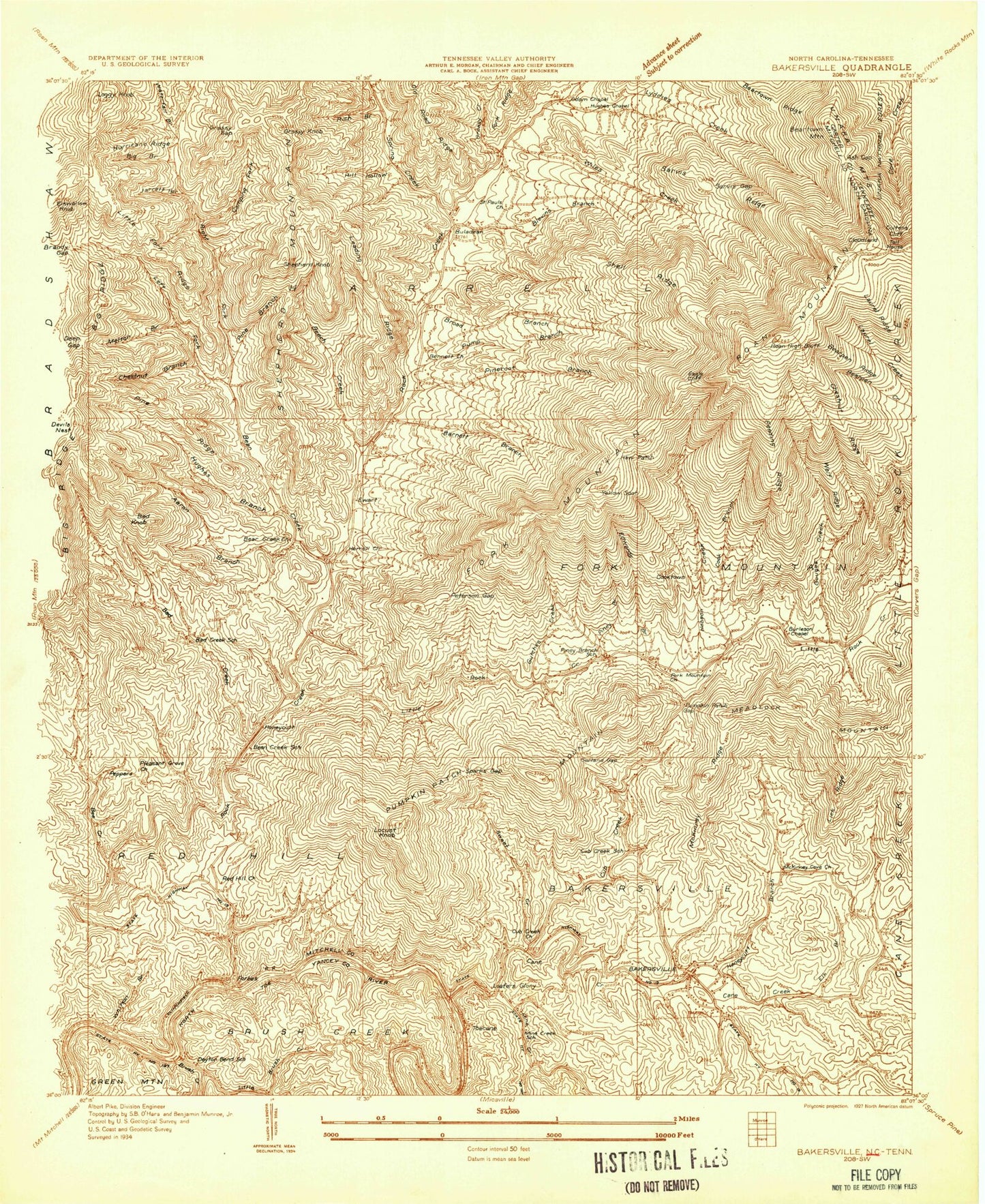
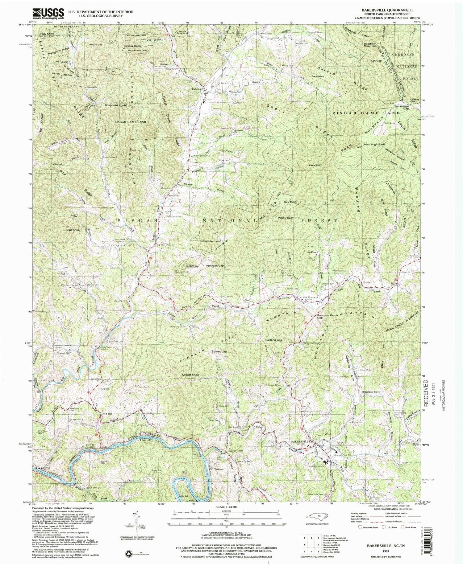
Classic USGS Bakersville North Carolina 7.5'x7.5' Topo Map
Couldn't load pickup availability
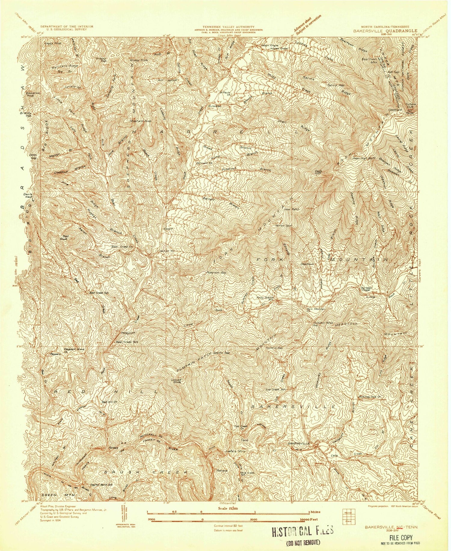
Historical USGS topographic quad map of Bakersville in the states of North Carolina, Tennessee. Typical map scale is 1:24,000, but may vary for certain years, if available. Print size: 24" x 27"
This quadrangle is in the following counties: Carter, Mitchell, Yancey.
The map contains contour lines, roads, rivers, towns, and lakes. Printed on high-quality waterproof paper with UV fade-resistant inks, and shipped rolled.
Contains the following named places: Mitchell County, Aaron Branch, Ash Gap, Bad Creek, Bad Creek Cemetery, Bailey Cemetery, Bakersville Memorial Cemetery, Barnett Branch, Beans Creek, Beans Creek Church, Beans Creek Church, Bearpen Ridge, Beartown Ridge, Bee Creek, Beech Creek, Beech Creek Ridge, Bethlehem Church, Big Branch, Big Rock Creek Church, Blevins Branch, Blevins Cemetery, Bowman Elem School, Bowman High School, Broad Branch, Brush Creek, Buchanan Cemetery, Burleson Cemetery, Butler Cemetery, Byrd Cemetery, Byrd Cemetery, Camping Fork, Cane Creek, Chestnut Branch, Chestnut Ridge, Cloudland Church, Cook Cemetery, Cook Creek, Cub Creek, Cub Creek Church, Dayton Bend Church, Eagle Cliff, Edwards Branch, Edwards Cemetery, Feeding Ridge, Fork Mountain Church, Garland Cemetery, Garland Gap, Glen Ayre School, Gouge Cemetery, Gouge Cove, Grassy Gap, Greasy Creek, Green Young Cemetery, Gutches Creek, Harrell Cemetery, Haw Patch, Hill Cemetery, Hill Hollow, Hobson Cemetery, Hobson Cemetery, Honeycutt Branch, Hughes Branch, Hughes Cemetery, Hurricane Ridge, Ingram Cemetery, Jarrett Hollow, Johnson Cemetery, Johnson Hollow, Laurel Creek, Laurel Ridge, Ledford Cemetery, Left Fork Beans Creek, Lick Ridge, Little Brush Creek, Little Rock Creek, Lyddies Creek, McKinney Cemetery, McKinney Cove, Melton Branch, Middle District Church, Mine Creek, Mountain View Church, Odom Chapel, Penland Cemetery, Peterson Gap, Phillips Cemetery, Pine Branch, Pine Ridge, Pineroot Branch, Piney Branch, Pleasant Grove Church, Pump Branch, Pumpkin Patch Gap, Red Hill Church, Rich Branch, Ridgeview Church, Right Fork Beans Creek, Roan High Bluff, Roan Mountain Church, Rockdale Church, Russ Memorial Church, Saint Pauls Church, Sarvis Gap, Sarvis Ridge, Shell Ridge, Slagle Cemetery, Spring Creek, Spring Creek Church, Stanley Cemetery, Street Cemetery, Street Cemetery, Sweet Creek, Toll House Gap, Vians Valley, Vians Valley Church, Waterfall Branch, White Oak Creek, Whitson Branch, Whitson Cemetery, Wiles Creek, Wilson Cemetery, Wolf Ridge, Woody Cemetery, Young Cove Creek, Bowman Middle School, Buladean Elementary School, Cloudland (historical), Ewart (historical), Herrell (historical), Little Rock Creek (historical), Roan Mountain Gardens Picnic Area Forest Service, Roan Mountain Information Center, Campbell Cemetery, Sparks Gap, Bad Knob, Bakersville, Buladean, Cooktown, Fork Mountain, Grassy Knob, Harrell Hill, Loafers Glory, Locust Knob, Loggy Knob, McKinney Cove, Meadlock Mountain, Pumpkin Patch Mountain, Red Hill, Shepherd Knob, Shepherd Mountain, Toecane, Yellow Spot, Peppers, Honeycutt, Township of Bakersville, Fork Mountain Township (historical), Township of Harrell, Township of Red Hill, Cloudland Post Office (historical), Township of Fork Mountain-Little Rock Creek, Town of Bakersville, Fork Mountain Fire Department and Rescue Squad, Buladean Volunteer Fire Department, Bakersville Volunteer Fire and Rescue Station 2, Bennett Cemetery, Bakersville Post Office, Bakersville Police Department, Mitchell County Sheriff's Office, Beartown Mountain, Coltens Cliff, Cloudland Mountain, Mitchell County, Aaron Branch, Ash Gap, Bad Creek, Bad Creek Cemetery, Bailey Cemetery, Bakersville Memorial Cemetery, Barnett Branch, Beans Creek, Beans Creek Church, Beans Creek Church, Bearpen Ridge, Beartown Ridge, Bee Creek, Beech Creek, Beech Creek Ridge, Bethlehem Church, Big Branch, Big Rock Creek Church, Blevins Branch, Blevins Cemetery, Bowman Elem School, Bowman High School, Broad Branch, Brush Creek, Buchanan Cemetery, Burleson Cemetery, Butler Cemetery, Byrd Cemetery, Byrd Cemetery, Camping Fork, Cane Creek, Chestnut Branch, Chestnut Ridge, Cloudland Church, Cook Cemetery, Cook Creek, Cub Creek, Cub Creek Church, Dayton Bend Church, Eagle Cliff, Edwards Branch, Edwards Cemetery, Feeding Ridge, Fork Mountain Church, Garland Cemetery, Garland Gap, Glen Ayre School, Gouge Cemetery, Gouge Cove, Grassy Gap, Greasy Creek, Green Young Cemetery, Gutches Creek, Harrell Cemetery, Haw Patch, Hill Cemetery, Hill Hollow, Hobson Cemetery, Hobson Cemetery, Honeycutt Branch, Hughes Branch, Hughes Cemetery, Hurricane Ridge, Ingram Cemetery