MyTopo
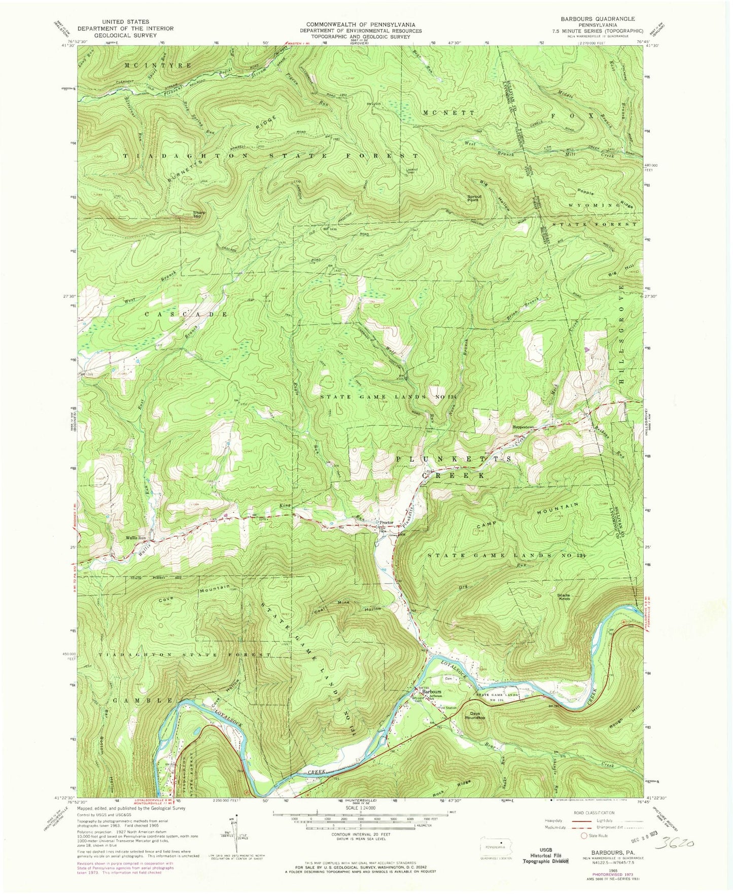
Classic USGS Barbours Pennsylvania 7.5'x7.5' Topo Map
Couldn't load pickup availability
Historical USGS topographic quad map of Barbours in the state of Pennsylvania. Typical map scale is 1:24,000, but may vary for certain years, if available. Print size: 24" x 27"
This quadrangle is in the following counties: Lycoming, Sullivan.
The map contains contour lines, roads, rivers, towns, and lakes. Printed on high-quality waterproof paper with UV fade-resistant inks, and shipped rolled.
Contains the following named places: Bear Creek, Big Hill, Big Hollow, Bovier Run, Brian Branch, Butternut Run, Camp Mountain, Coal Mine Hollow, Cove Hollow, Cove Mountain, Days Roundtop, Dry Run, East Branch Mill Creek, East Branch Wallis Run, Hoppestown, Jefferson School, King Run, Middle Branch Mill Creek, Mock Creek, Noon Branch, Pigeon Run, Plunketts Creek, Popple Ridge, Reibsan Run, Rock Spring Run, Scalte Knob, Sharp Top, Shingle Run, Short Run, Snake Run, Sprout Point, State Game Lands Number 134, West Branch Mill Creek, West Branch Wallis Run, Whipple Cemetery, Wolf Run, Engle Run, Sharp Top Vista, Barbours, Proctor, Wallis Run, Sprout Point Fire Tower, Nolands Trail, Big Hill Trail, Hickory Trail, Township of Plunketts Creek, Plunketts Creek Township Volunteer Fire Department Station 25, Barbours Cemetery