
MyTopo
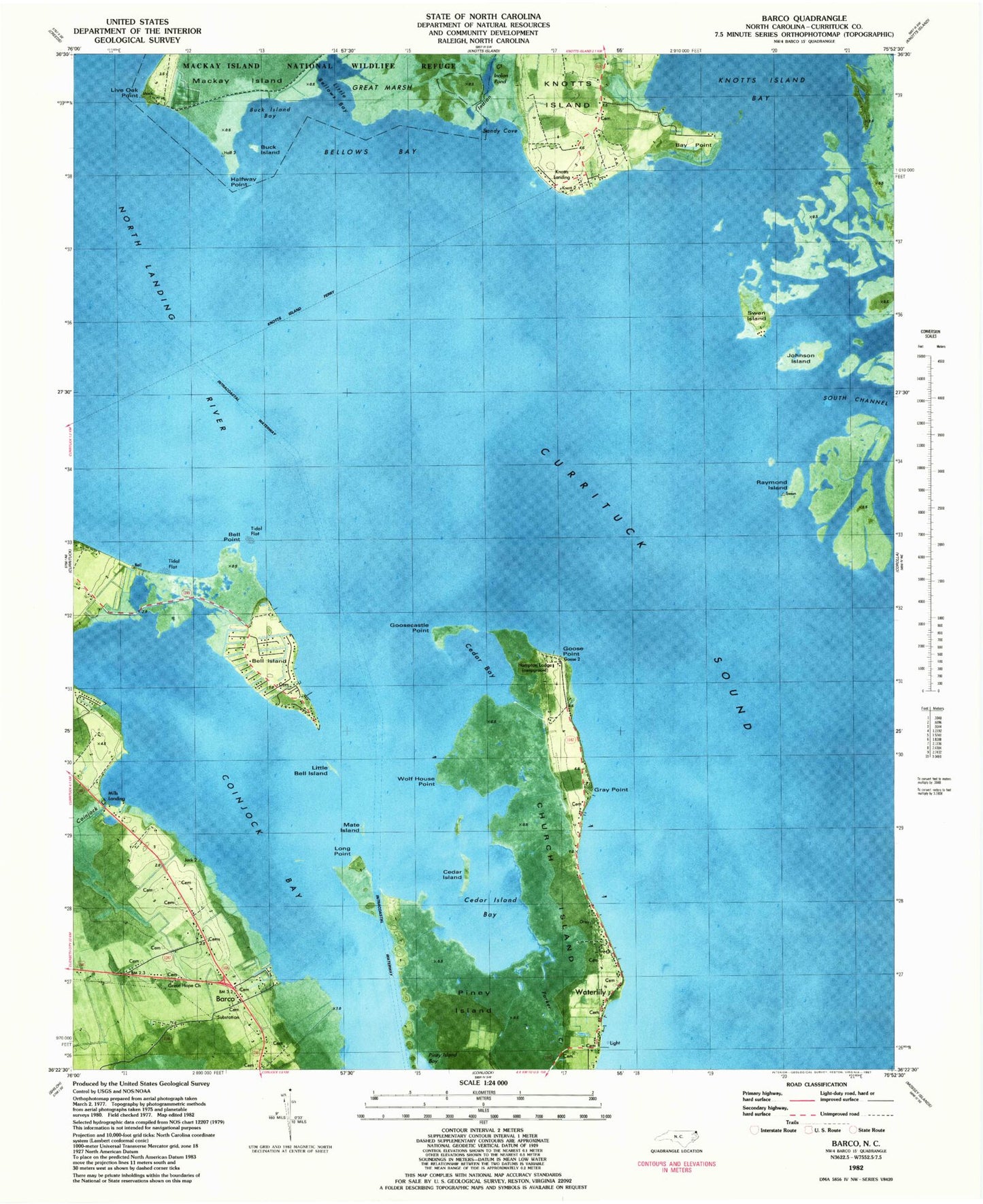
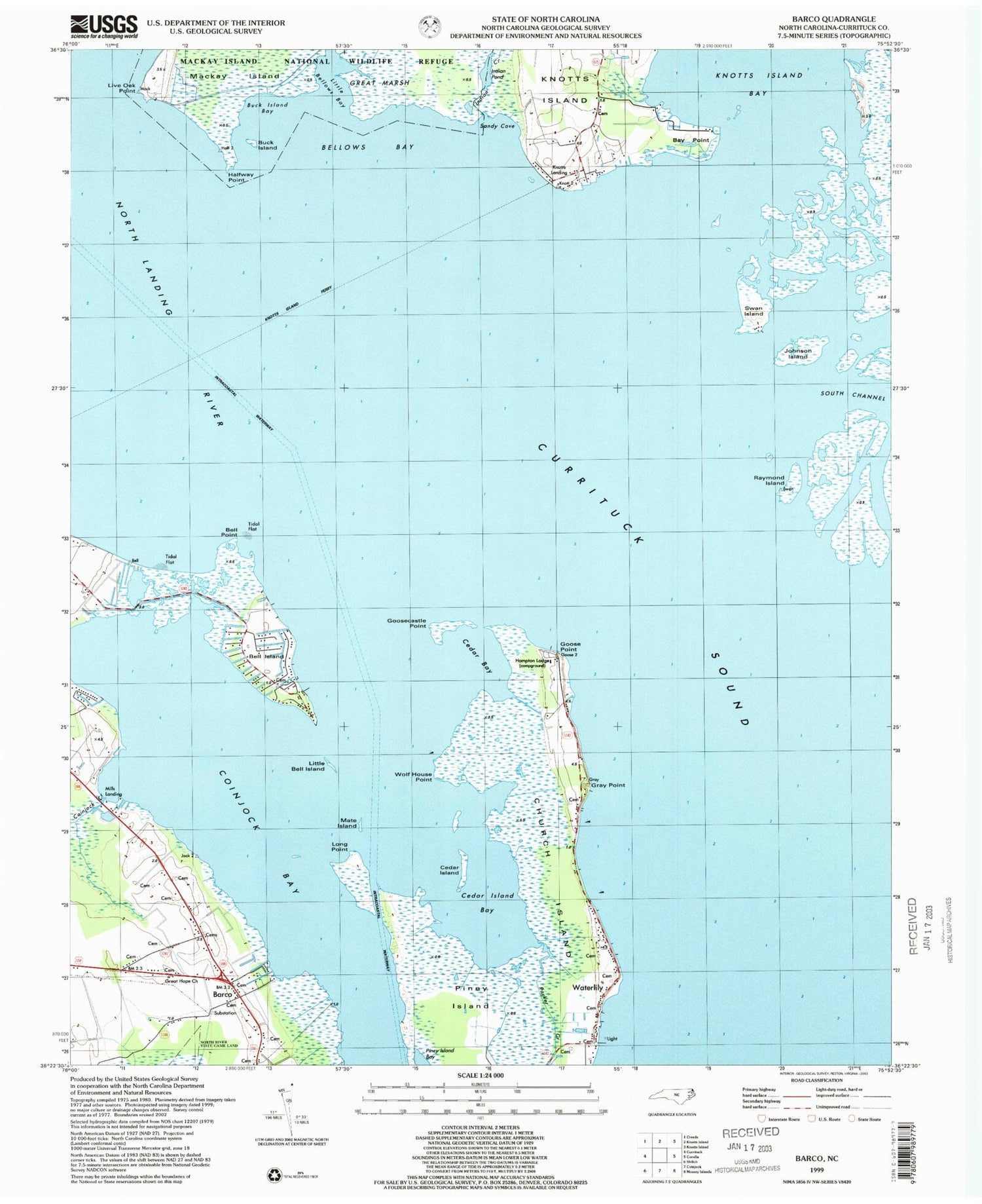
Classic USGS Barco North Carolina 7.5'x7.5' Topo Map
Couldn't load pickup availability
Historical USGS topographic quad map of Barco in the state of North Carolina. Map scale is 1:24000. Print size is approximately 24" x 27"
This quadrangle is in the following counties: Currituck.
The map contains contour lines, roads, rivers, towns, and lakes. Printed on high-quality waterproof paper with UV fade-resistant inks, and shipped rolled.
Contains the following named places: Ballance Cemetery, Barco, Barco Post Office, Bay Point, Bell Island, Bell Point, Bellows Bay, Buck Island, Buck Island Bay, Cedar Bay, Cedar Island, Cedar Island Bay, Church Island, Church Island Channel, Claudia Capps Home Place Cemetery, Coinjock Bay, Coinjock Creek, Crow Island, Currituck Bay, Currituck National Wildlife Refuge, Goose Castle, Goose Point, Goosecastle Point, Gray Point, Great Hope Church, Halfway Point, Hampton Family Cemetery, Hampton Lodge, Hills Landing, Indian Creek, Indian Pond, Johnson Island, Knotts Island Ferry, Knotts Landing, Little Bell Island, Little Bellows Bay, Live Oak Point, Long Point, Mate Island, North Landing River, Parker Creek, Piney Island, Raymond Island, Sandy Cove, Sentara Nursing Center of Currituck, South Channel, Swan Island, Township of Fruitville, Waterlily, Wolf House Point