MyTopo
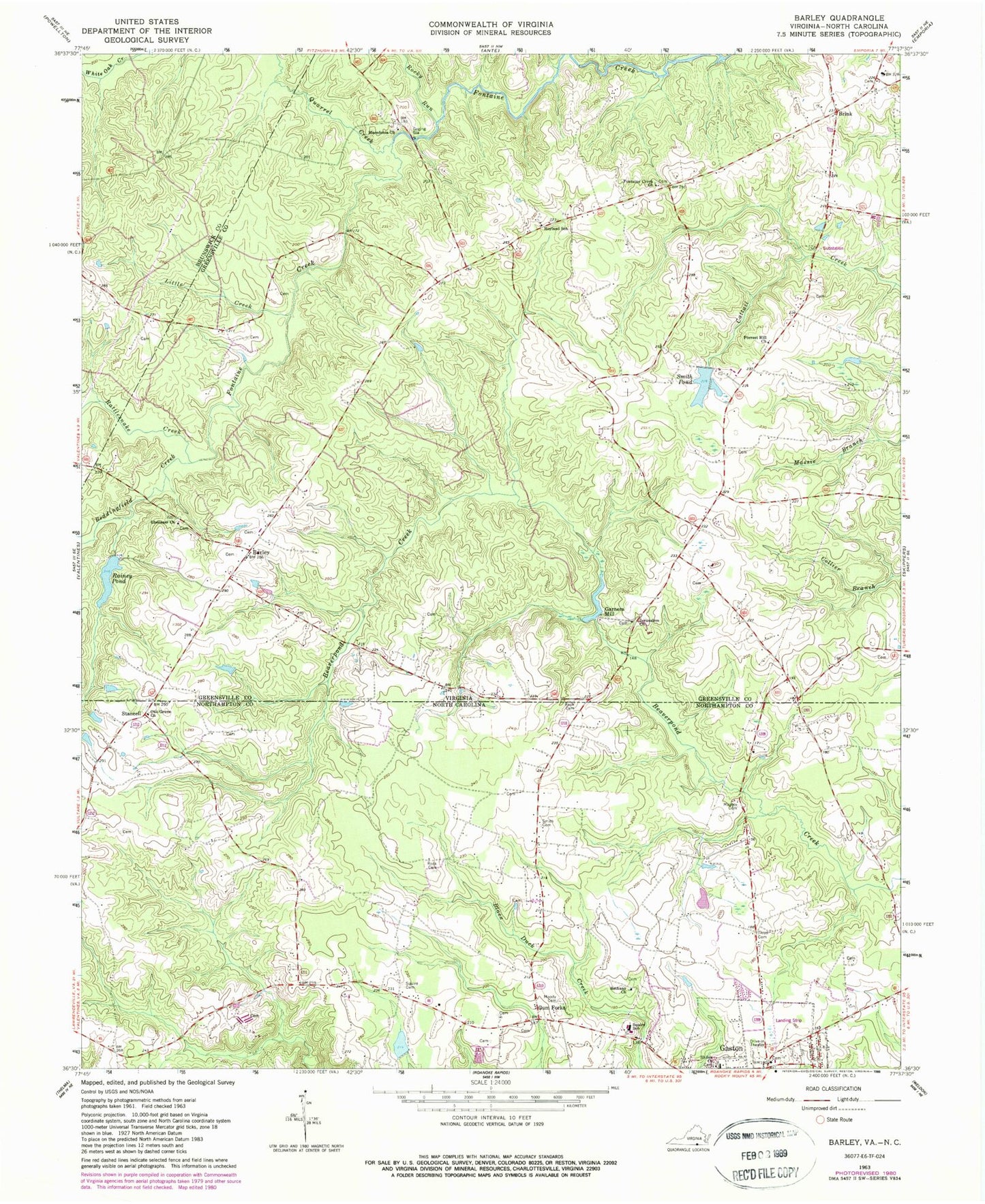
Classic USGS Barley Virginia 7.5'x7.5' Topo Map
Couldn't load pickup availability
Historical USGS topographic quad map of Barley in the states of Virginia, North Carolina. Map scale may vary for some years, but is generally around 1:24,000. Print size is approximately 24" x 27"
This quadrangle is in the following counties: Brunswick, Greensville, Northampton.
The map contains contour lines, roads, rivers, towns, and lakes. Printed on high-quality waterproof paper with UV fade-resistant inks, and shipped rolled.
Contains the following named places: Barley, Beddingfield Creek, Bethany Church, Brink, District 2, Ebenezer Church, Floyd Cemetery, Fontaine Creek Church, Forrest Hill Church, Garners Dam, Garners Mill, Garners Millpond, Gaston, Gaston Fire Department, Gum Forks, Hicksford District, Jerusalem Church, Little Creek, Macedonia Church, Massey Cemetery, Moody Cemetery, Oak Grove Church, Paris Store, Quarrel Creek, Rainey Dam, Rainey Pond, Rattlesnake Creek, Rocky Run, Rook Cemetery, Royland School, Shiloh Church, Slates Corner, Smith Cemetery, Smith Pond, Smiths Dam, Squire Cemetery, Squire School, Stancell, Township of Gaston, ZIP Code: 27832