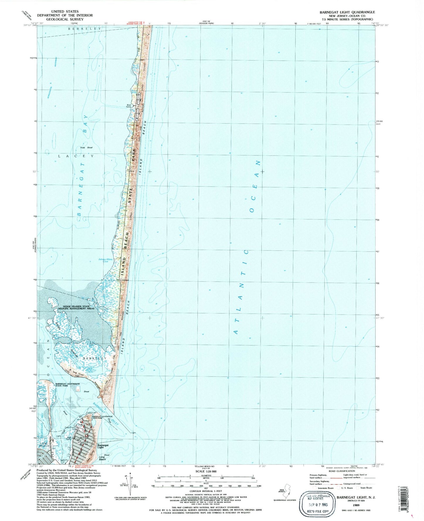
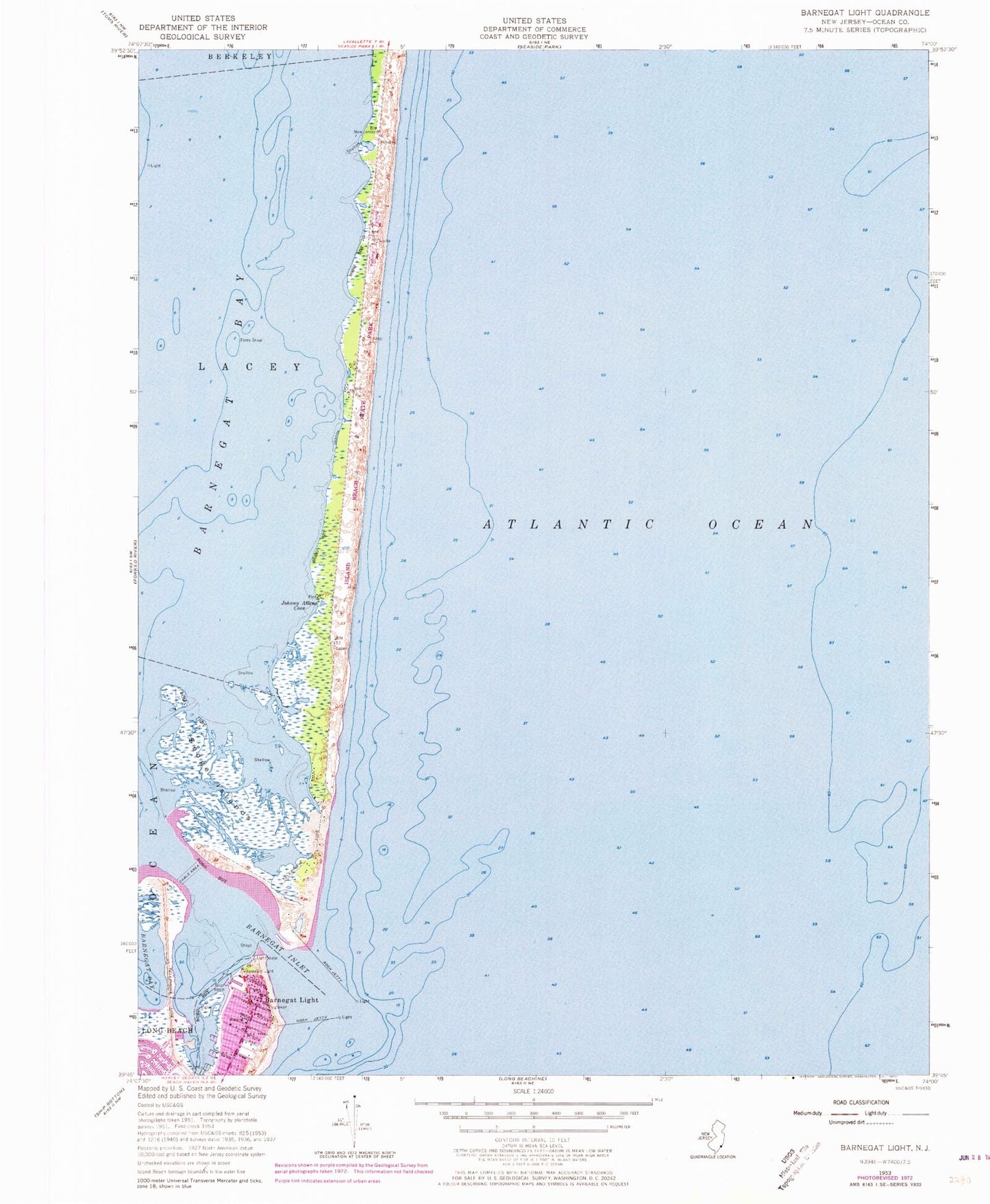
MyTopo
Classic USGS Barnegat Light New Jersey 7.5'x7.5' Topo Map
Couldn't load pickup availability
Historical USGS topographic quad map of Barnegat Light in the state of New Jersey. Map scale may vary for some years, but is generally around 1:24,000. Print size is approximately 24" x 27"
This quadrangle is in the following counties: Ocean.
The map contains contour lines, roads, rivers, towns, and lakes. Printed on high-quality waterproof paper with UV fade-resistant inks, and shipped rolled.
Contains the following named places: Barnegat, Barnegat Inlet, Barnegat Light, Barnegat Light First Aid Squad, Barnegat Light Post Office, Barnegat Light Volunteer Fire Company Station 13, Barnegat Lighthouse State Park, Borough of Barnegat Light, Island Beach, Island Beach State Park, Johnny Allens Cove, Sedge Islands, Sedge Islands State Wildlife Management Area, The Dike, Tices Shoal, ZIP Codes: 08006, 08752