
MyTopo
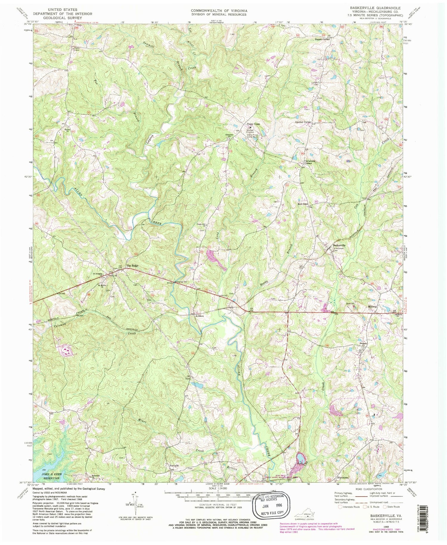
Classic USGS Baskerville Virginia 7.5'x7.5' Topo Map
Couldn't load pickup availability
Historical USGS topographic quad map of Baskerville in the state of Virginia. Map scale may vary for some years, but is generally around 1:24,000. Print size is approximately 24" x 27"
This quadrangle is in the following counties: Mecklenburg.
The map contains contour lines, roads, rivers, towns, and lakes. Printed on high-quality waterproof paper with UV fade-resistant inks, and shipped rolled.
Contains the following named places: Antlers, Baskerville, Baskerville Census Designated Place, Baskerville Correctional Center, Baskerville Post Office, Bethany Baptist Church Cemetery, Bethany Church, Blalock Dam, Blalock Pond, Callahans Corner, Christ Church, Coleman Creek, District 6, Dunns Corner, Easter Church, Easters Cemetery, Easters School, Ebenezer Cemetery, Ebenezer Church, Ebenezer School, El Bethel Church, Elamtown, Farrar Sod Farm, Fox Branch, Gills, Gordon Corner, Grove Church, Johnsons Dam, Johnsons Pond, Kidwell Dam, Kidwell Pond, Layton Creek, Let Alone Creek, Long Branch, Mecklenburg Correctional Center, Mecklenburg County, Midway, Mines Creek, Muck Cross, Newmans, Norvello, Pole Branch, Red Gate, Reedy Branch, Rehoboth Cemetery, Rehoboth Church, Saint Andrews Cemetery, Saint Douglas Church, Saint Marks Church, Sawmill Branch, Sharon Church, Smith School, State Prison Camp Number 4, Stony Cross, Tapped Branch, The Ridge, Union Hill Church, Young School, ZIP Codes: 23915, 23917


