
MyTopo
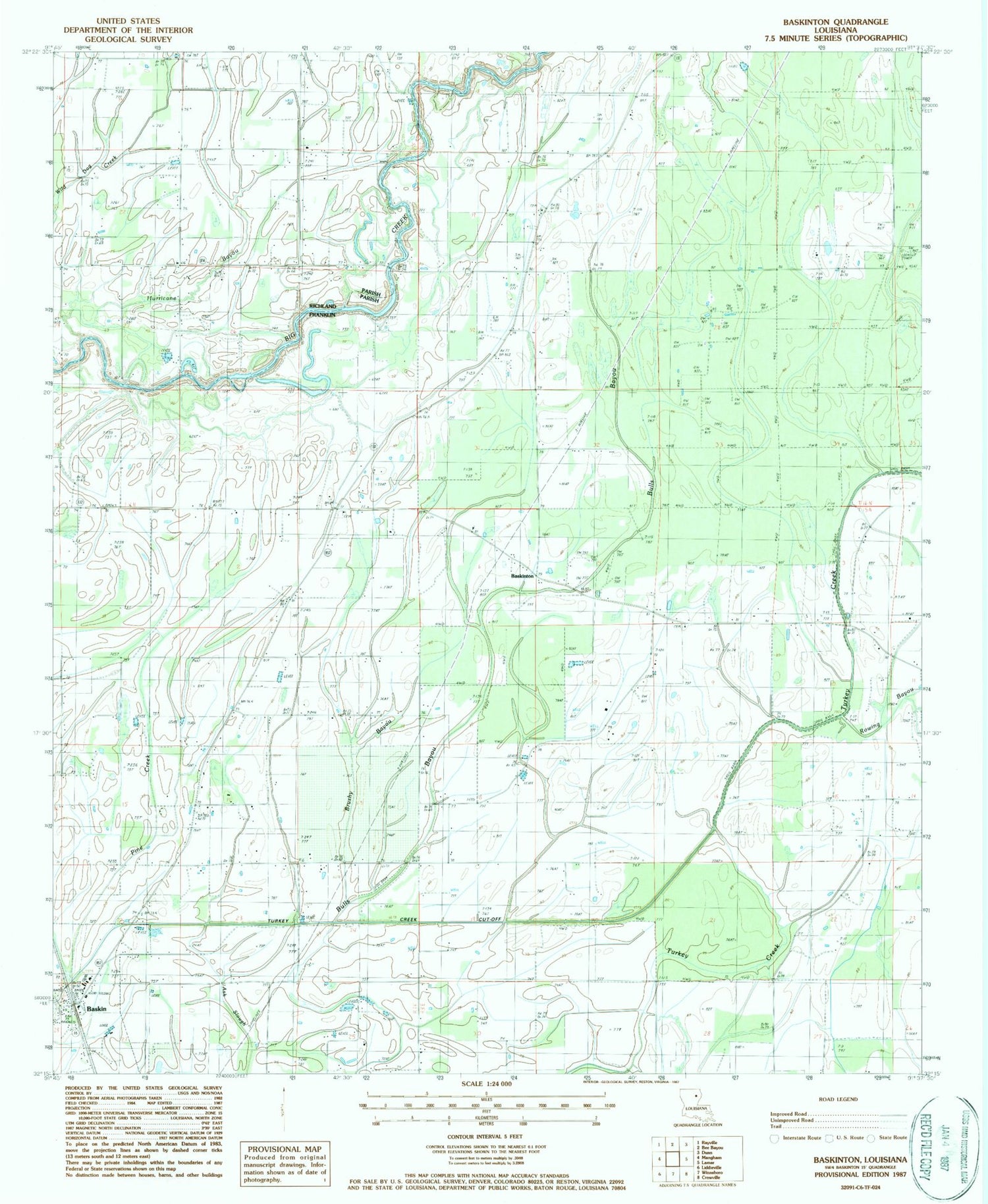
Classic USGS Baskinton Louisiana 7.5'x7.5' Topo Map
Couldn't load pickup availability
Historical USGS topographic quad map of Baskinton in the state of Louisiana. Map scale may vary for some years, but is generally around 1:24,000. Print size is approximately 24" x 27"
This quadrangle is in the following counties: Franklin, Richland.
The map contains contour lines, roads, rivers, towns, and lakes. Printed on high-quality waterproof paper with UV fade-resistant inks, and shipped rolled.
Contains the following named places: Archibald - Alto Fire Station, Baskin, Baskin Chapel, Baskin Post Office, Baskin School, Baskin Volunteer Fire Department, Baskinton, Baskinton Oil Field, Bethel Church, Brushy Bayou, Bulls Bayou, Church of Christ, Friendship Cemetery, Friendship Church, Greg's Flying Service, Hurricane Bayou, Oliair Airport, Parish Governing Authority District 6, Pine Creek, Pleasant Hall Baptist Church, Pleasant Hall Cemetery, Rowing Bayou, South Baskinton Oil Field, South Big Creek Oil Field, Turkey Creek Cut-Off, Union Cemetery, Union Church, Union Valley Church, Village of Baskin, Ward Six, West Baskinton Oil Field, ZIP Code: 71219


