MyTopo
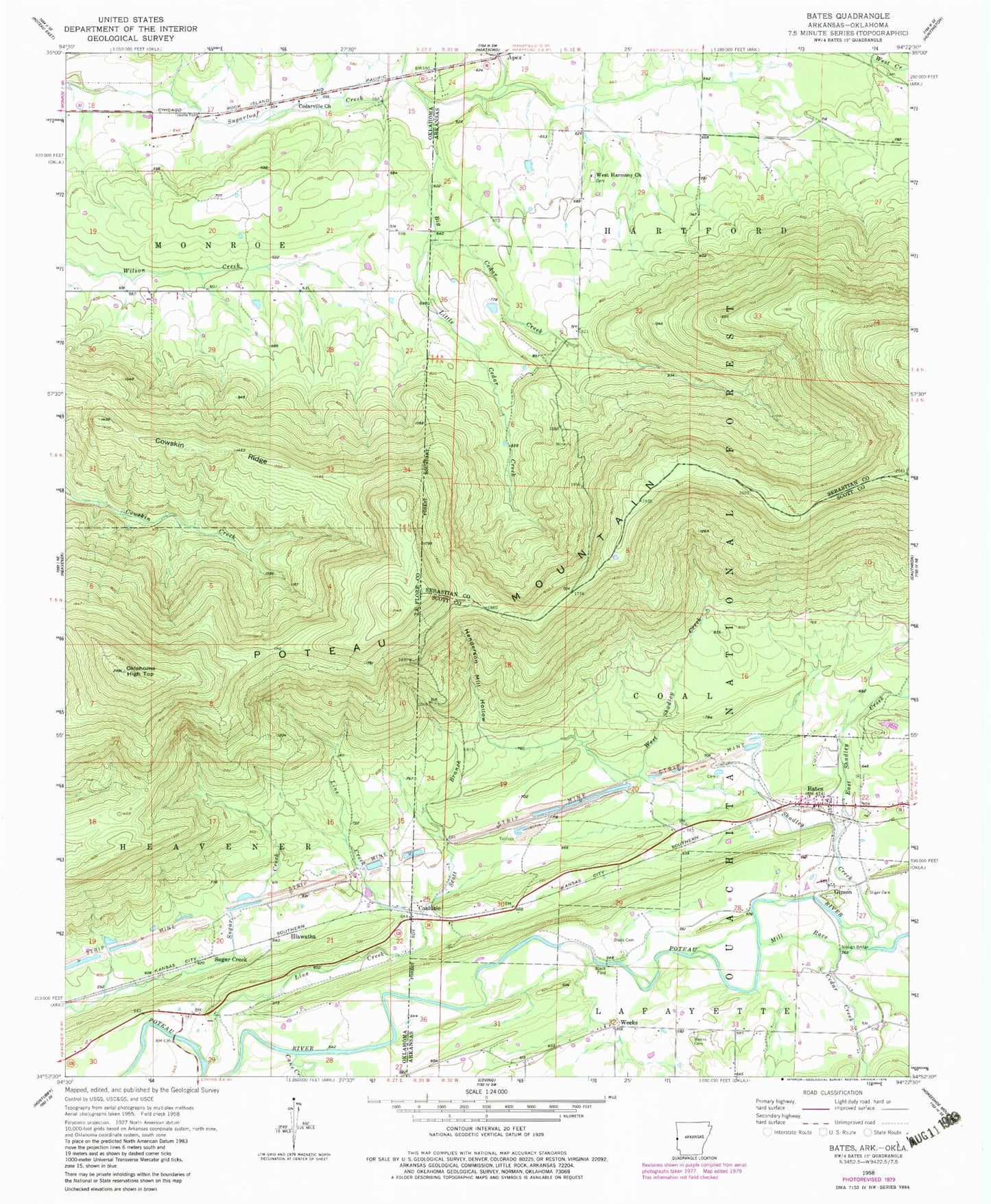
Classic USGS Bates Arkansas 7.5'x7.5' Topo Map
Couldn't load pickup availability
Historical USGS topographic quad map of Bates in the states of Arkansas, Oklahoma. Map scale may vary for some years, but is generally around 1:24,000. Print size is approximately 24" x 27"
This quadrangle is in the following counties: Le Flore, Scott, Sebastian.
The map contains contour lines, roads, rivers, towns, and lakes. Printed on high-quality waterproof paper with UV fade-resistant inks, and shipped rolled.
Contains the following named places: Apex, Bates, Bates Post Office, Big Cedar Creek, Black Cemetery, Cane Creek, Cedar Creek, Cedarville Church, Coaldale, Cowskin Ridge, East Shadley Creek, Gipson, Gipson Cemetery, Henderson Mill Hollow, Hiawatha, KLMK-FM (Poteau), Line Creek, Little Cedar Creek, Mill Race, Oklahoma High Top, Scott Branch, Shadley Creek, Sliger Cemetery, Slough Bridge, State Line Bates Volunteer Fire Department, Sugar Creek, Township of Coal, Township of Lafayette, Trestle Ford, Weeks, Weeks Cemetery, West Harmony Church, West Shadley Creek