MyTopo
Classic USGS Bayou Pierre Lake Louisiana 7.5'x7.5' Topo Map
Couldn't load pickup availability
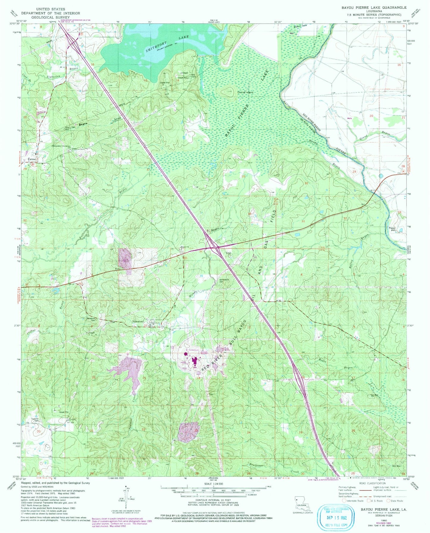
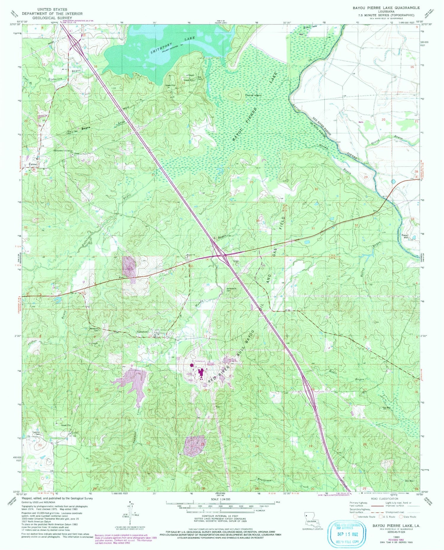
Historical USGS topographic quad map of Bayou Pierre Lake in the state of Louisiana. Map scale may vary for some years, but is generally around 1:24,000. Print size is approximately 24" x 27"
This quadrangle is in the following counties: De Soto, Red River.
The map contains contour lines, roads, rivers, towns, and lakes. Printed on high-quality waterproof paper with UV fade-resistant inks, and shipped rolled.
Contains the following named places: Bailey Bayou, Bayou Loup, Bayou Pierre Lake, Bethlehem Cemetery, Buffalo Bayou, Carmel, Carmel School, Chicot Island, Clifton Bayou, Coon Branch, Dill Cemetery, Goss, Immaculate Conception Church, Mount Carmel Church, Mundy Bayou, Mundy Church, Naborton, Paps Hill, Parish Governing Authority District 4C, Red River - Bull Bayou Oil and Gas Field, Rock Chapel, Sampson Channel, Sawlog Lake, Sawmill Creek, Siphorien Bayou, Smithport Dam, Smithport Lake, Truevine Cemetery, Truevine Church, Ward Five, Willow Lake, Woodvine Cemetery