MyTopo
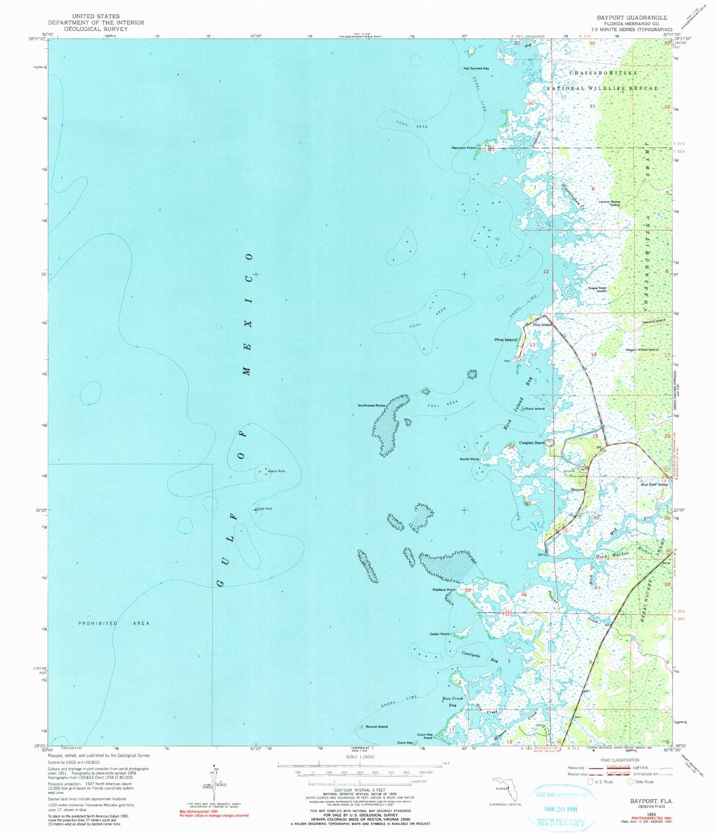
Classic USGS Bayport Florida 7.5'x7.5' Topo Map
Couldn't load pickup availability
Historical USGS topographic quad map of Bayport in the state of Florida. Map scale may vary for some years, but is generally around 1:24,000. Print size is approximately 24" x 27"
This quadrangle is in the following counties: Hernando.
The map contains contour lines, roads, rivers, towns, and lakes. Printed on high-quality waterproof paper with UV fade-resistant inks, and shipped rolled.
Contains the following named places: Bayport, Bayport Census Designated Place, Beacon Rock, Cedar Point, Centipede Bay, Cooglers Beach, Coon Key, Coon Key Point, Eagle Nest Island, Fiddlers Point, Hernando Beach Division, Higgenbotham Creek, Jenkins Creek, Lemon Grove Island, Mud River, Mud River Spring, Net Spread Key, North Point, Northwest Rocks, Palm Grove Colony, Pine Island, Pine Island Census Designated Place, Raccoon Point, Rice Creek, Rice Creek Bay, Rock Creek, Rock Island, Rock Island Bay, Round Island, Sawmill Island, South Rock, Stapleton Creek, Wagon Wheel Island, Wall Creek, Weeki Wachee Gardens, Weeki Wachee River