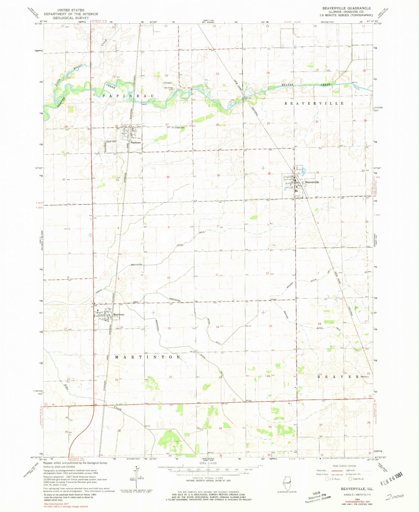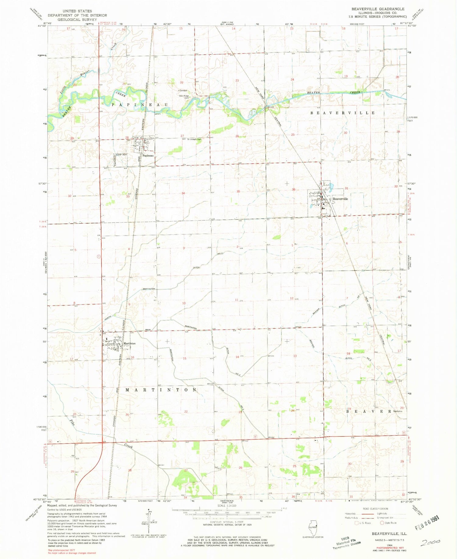
MyTopo
Classic USGS Beaverville Illinois 7.5'x7.5' Topo Map
Couldn't load pickup availability
Historical USGS topographic quad map of Beaverville in the state of Illinois. Map scale may vary for some years, but is generally around 1:24,000. Print size is approximately 24" x 27"
This quadrangle is in the following counties: Iroquois.
The map contains contour lines, roads, rivers, towns, and lakes. Printed on high-quality waterproof paper with UV fade-resistant inks, and shipped rolled.
Contains the following named places: Beaverville, Beaverville Fire Protection District, Beaverville Post Office, Benoit School, Gagnon School, Jarvis School, Little Beaver Creek, Main Martinton Ditch Number 3, Martinton, Martinton Ditch Number 3, Martinton Fire Protection District, Martinton Post Office, Mount Olivet Cemetery, North Martinton Ditch Number 2, Nourie School, Oak Bank School, Oak Ridge Cemetery, Papineau, Papineau Cemetery, Papineau Fire Protection District, Papineau Post Office, Regnier School, Saint Joseph Cemetery, Saint Mary's Cemetery, Township of Martinton, Township of Papineau, Village of Beaverville, Village of Martinton, Village of Papineau, Weygandt School