MyTopo
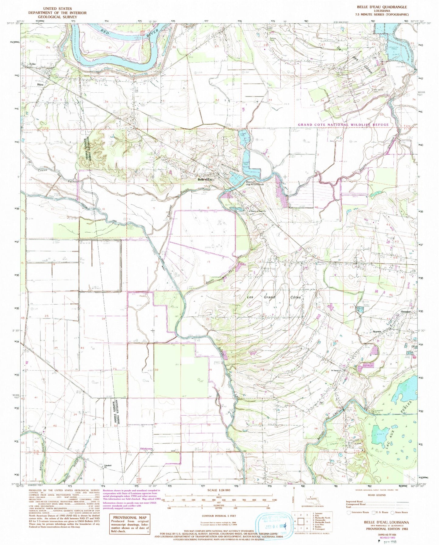
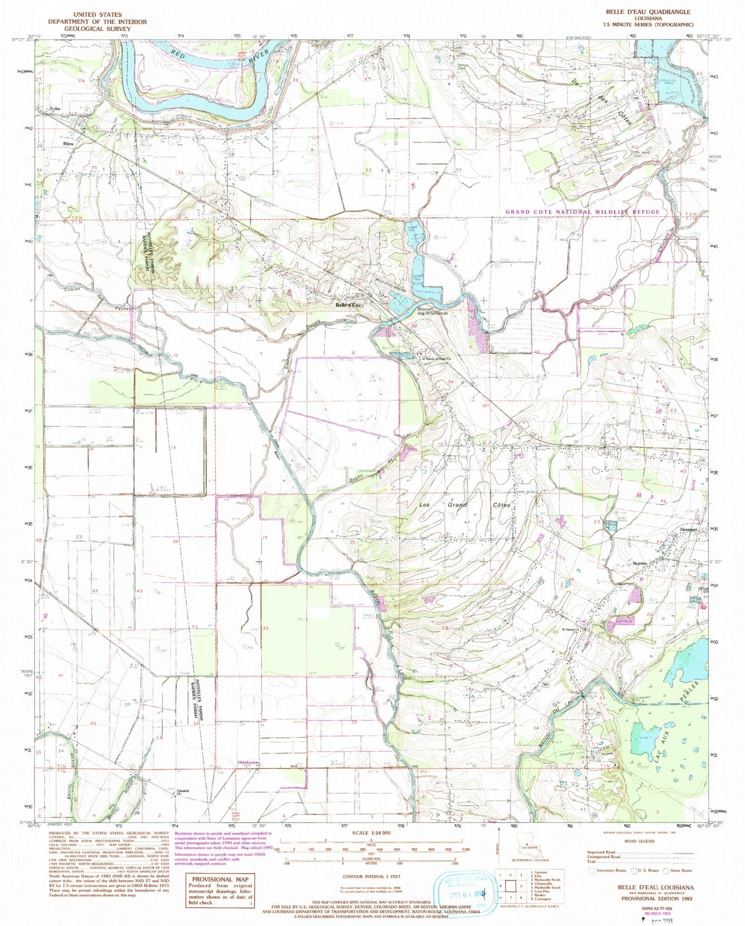
Classic USGS Belle d'Eau Louisiana 7.5'x7.5' Topo Map
Couldn't load pickup availability
Historical USGS topographic quad map of Belle d'Eau in the state of Louisiana. Map scale may vary for some years, but is generally around 1:24,000. Print size is approximately 24" x 27"
This quadrangle is in the following counties: Avoyelles, Rapides.
The map contains contour lines, roads, rivers, towns, and lakes. Printed on high-quality waterproof paper with UV fade-resistant inks, and shipped rolled.
Contains the following named places: Bayou Choctaw, Bayou des Allemands, Belle d'Eau, Belle D'Eau Airstrip, Bijou, Coulee du Pecheur, Detel Airport, Echo, Echo Census Designated Place, Echo Landing, Echo Post Office, Edgefield Church, Fifth Ward Census Designated Place, Grand Cote National Wildlife Refuge, Ile des Cotes, Les Grandes Cotes, Louisiana Noname 54 Dam, Louisiana School for the Agricultural Sciences, Norma, Oklahoma, Old Island Cemetery, Our Lady of Lourdes Catholic Church Cemetery, Parish Governing Authority District 12, Parish Governing Authority District 2, Saint Daniel Church, Saint Martin of Tours Church, Ward Five, Ward Four, ZIP Code: 71341