MyTopo
Classic USGS Bellwood Louisiana 7.5'x7.5' Topo Map
Couldn't load pickup availability
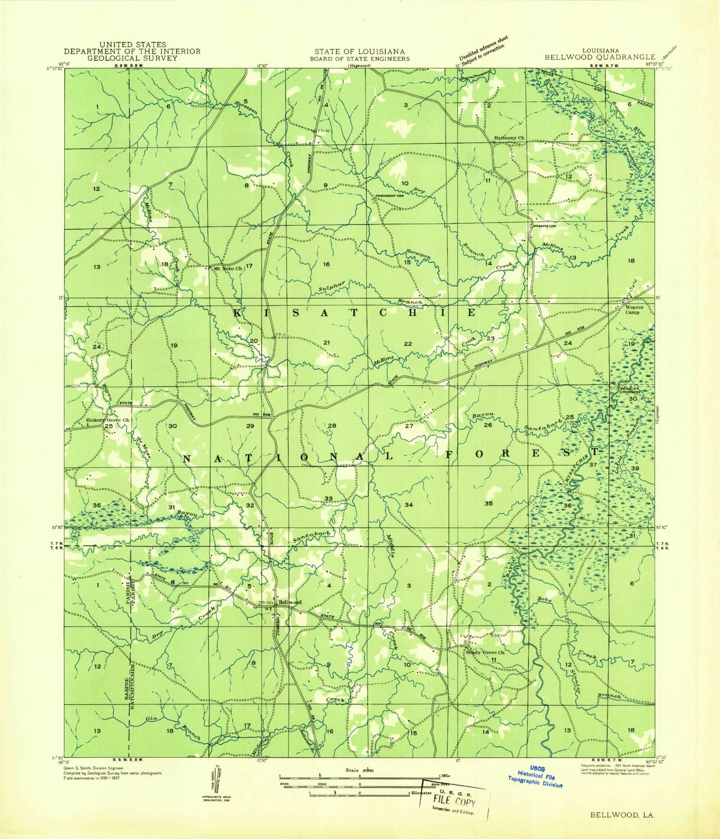
Historical USGS topographic quad map of Bellwood in the state of Louisiana. Map scale may vary for some years, but is generally around 1:24,000. Print size is approximately 24" x 27"
This quadrangle is in the following counties: Natchitoches, Sabine.
The map contains contour lines, roads, rivers, towns, and lakes. Printed on high-quality waterproof paper with UV fade-resistant inks, and shipped rolled.
Contains the following named places: Antioch Cemetery, Antioch Church, Batina Branch, Bayou de Muse, Bayou Santabarb, Beasley Crossing, Bellwood, Bellwood Branch, Blue Spring School, Bobs Creek, Clear Branch, Cunningham Brake, Dry Branch, Dry Creek, Foshee Cemetery, Friendship Cemetery, Gibbs Slough, Gin Branch, Hardamon Cemetery, Harmony Church, Hickory Grove Church, Hickoryville Grove Church, Horsepen Creek, Jackson Cemetery, Longville Lake Dam, Middle Creek, Moss Cemetery, Moss Coulee, Mount Nebo Church, Roberts Cemetery, Shady Grove Church, Stanley Branch, Sulphur Branch