MyTopo
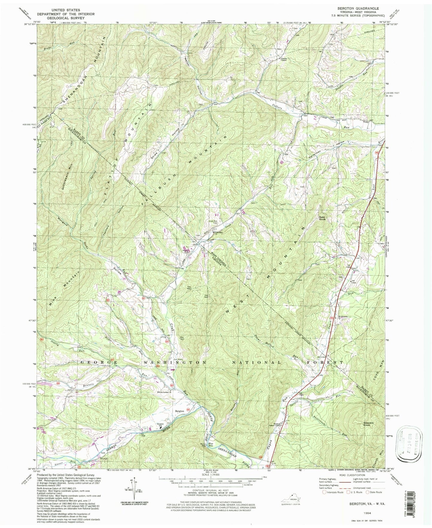
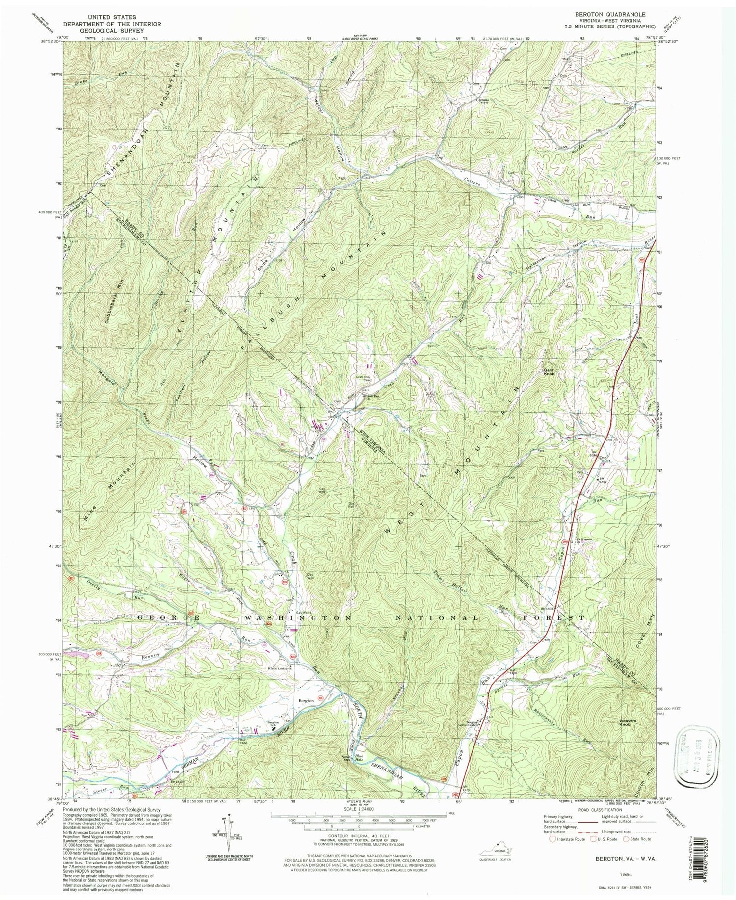
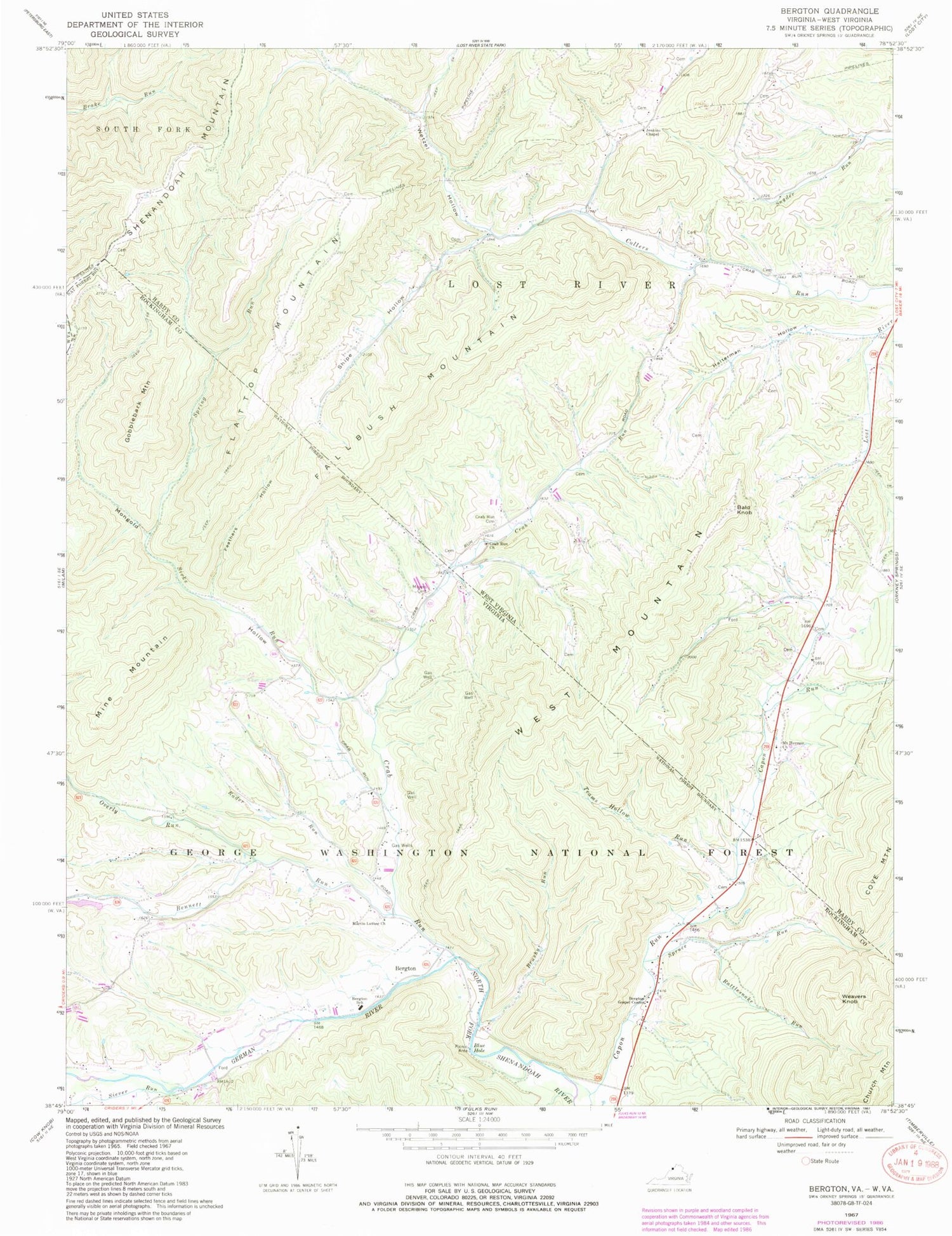
Classic USGS Bergton Virginia 7.5'x7.5' Topo Map
Couldn't load pickup availability
Historical USGS topographic quad map of Bergton in the states of Virginia, West Virginia. Typical map scale is 1:24,000, but may vary for certain years, if available. Print size: 24" x 27"
This quadrangle is in the following counties: Hardy, Rockingham.
The map contains contour lines, roads, rivers, towns, and lakes. Printed on high-quality waterproof paper with UV fade-resistant inks, and shipped rolled.
Contains the following named places: Bennett Run, Bergton Gospel Center, Bergton Elementary School, Blue Hole, Brushy Run, Crab Run, Feathers Hollow, German River, Gobblebark Mountain, Martin Lick Run, Mongold Hollow, Moyers Cemetery, Overly Run, Rader Run, Rattlesnake Run, Siever Run, Sirks Run, Spring Run, Spruce Run, Teams Hollow Run, Weavers Knob, Martin Luther Church, Blue Hole Campground, Bergton, Mine Mountain, West Mountain, Bergton Emergency Squad, Bergton Volunteer Fire Company, Bergton Post Office, Fallbush Mountain, Bald Knob, Crab Run, Crab Run Cemetery, Crab Run Church, Halterman Hollow, Jenkins Chapel, Mount Hermon Church, Shipe Hollow, Spring Run, Spruce Run, Wetzel Hollow, Flattop Mountain, Caldwell School (historical), Cleaves School (historical), Crab Run School (historical), Culler Run School (historical), Halterman School (historical), Saint Johns Church (historical), Snyder Springs School (historical)