MyTopo
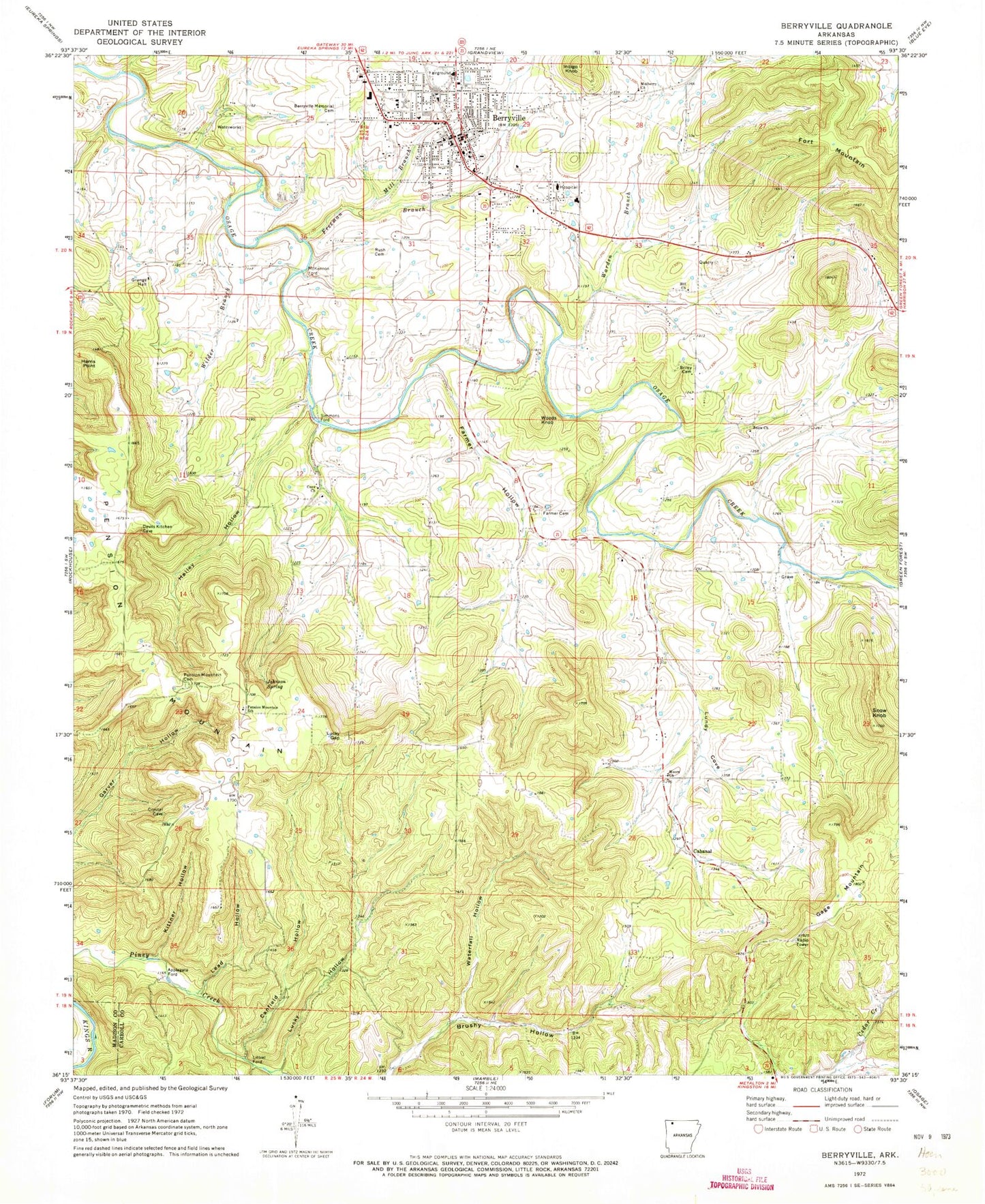
Classic USGS Berryville Arkansas 7.5'x7.5' Topo Map
Couldn't load pickup availability
Historical USGS topographic quad map of Berryville in the state of Arkansas. Map scale may vary for some years, but is generally around 1:24,000. Print size is approximately 24" x 27"
This quadrangle is in the following counties: Carroll, Madison.
The map contains contour lines, roads, rivers, towns, and lakes. Printed on high-quality waterproof paper with UV fade-resistant inks, and shipped rolled.
Contains the following named places: Applegate Ford, Berryville, Berryville Elementary School, Berryville Fire Department Chafin Station, Berryville High School, Berryville Memorial Cemetery, Berryville Middle School, Berryville Police Department, Berryville Post Office, Berryville United Methodist Church, Briley Cemetery, Cabanal, Canfield Hollow, Carroll County, Carroll County Courthouse, Carroll County Sheriff's Office, Carroll General Hospital Heliport, Carroll Regional Medical Center, City of Berryville, Cove Church, Farmer Cemetery, Farmer Hollow, First Baptist Church, First Christian Church, First Freewill Baptist Church, First Presbyterian Church, Fort Mountain, Freeman Branch, Freeman Heights Baptist Church, Gage Mountain, Hailey Hollow, Harris Point, Hill Church, Indigo Knob, Jackson Lake, Jackson Lake Dam, Johnson Spring, Kittner Hollow, KTHS-AM (Berryville), Lead Hollow, Littrel Ford, Lucky Gap, Lucky Hollow, McKennon Ford, Mercy Hospital Berryville, Mill Branch, Moore Cemetery, Moore Church, Moore School, Mulberry Church, Pension Mountain, Pension Mountain Cemetery, Pension Mountain School, Rush Cemetery, Simmons Ford, Snow Cemetery, Snow Church, Snow Knob, Sugarcamp Hollow, Township of Cabanal, Township of Prairie, Trigger Gap Airport, Warden Branch, Waterfall Hollow, Westside Christian Church, Wilder Branch, Woods Knob, ZIP Code: 72616