
MyTopo
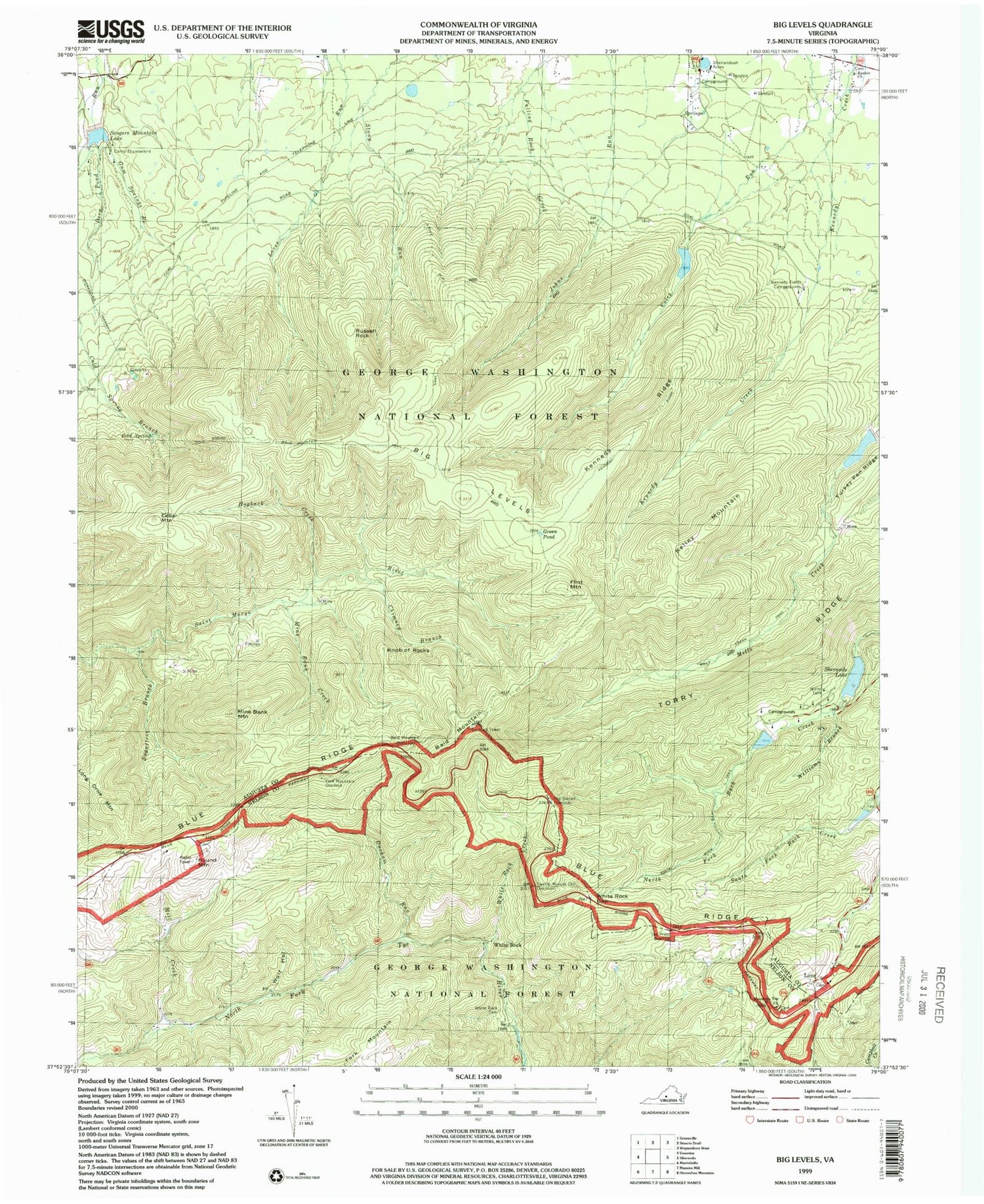
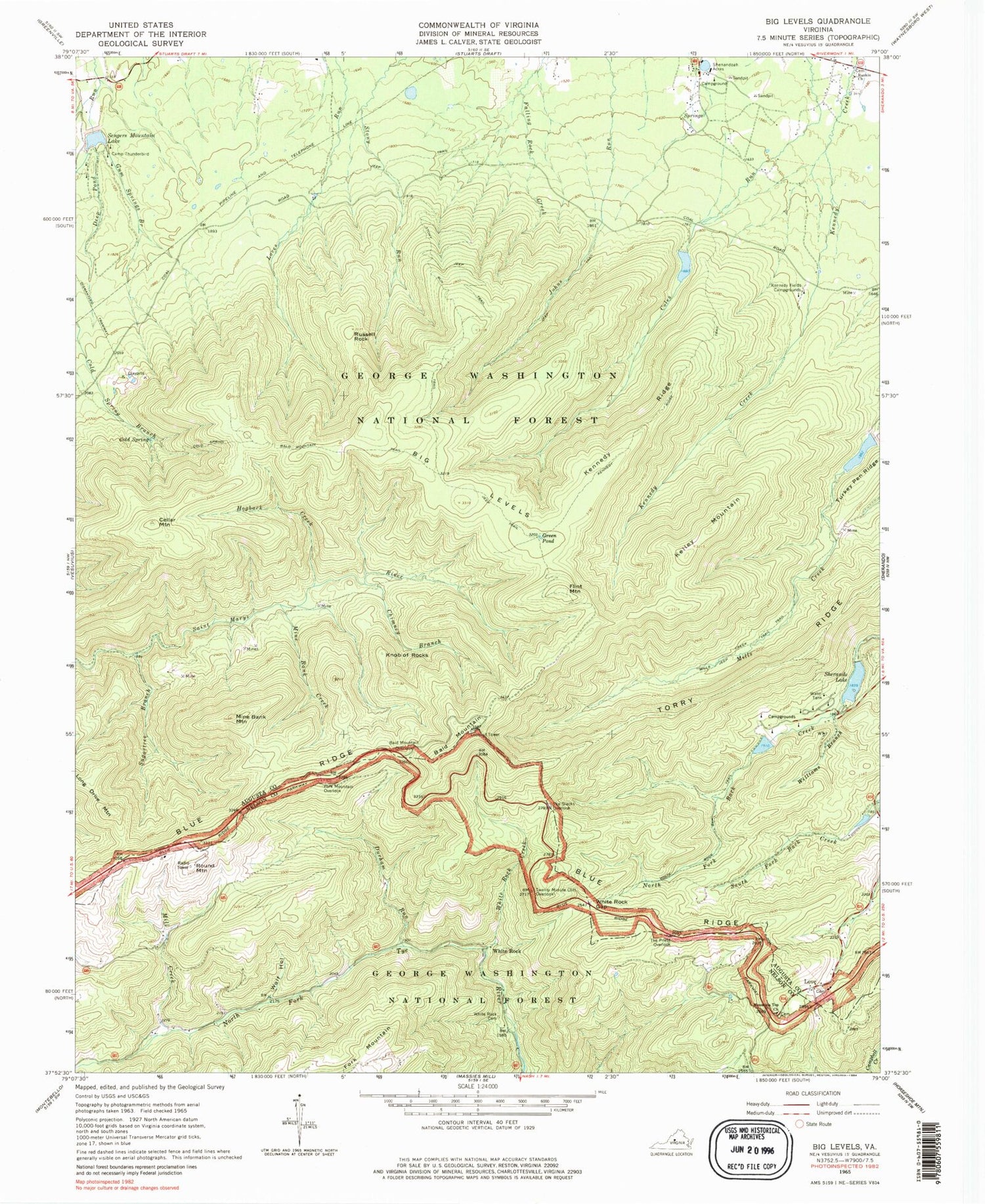
Classic USGS Big Levels Virginia 7.5'x7.5' Topo Map
Couldn't load pickup availability
Historical USGS topographic quad map of Big Levels in the state of Virginia. Typical map scale is 1:24,000, but may vary for certain years, if available. Print size: 24" x 27"
This quadrangle is in the following counties: Augusta, Nelson.
The map contains contour lines, roads, rivers, towns, and lakes. Printed on high-quality waterproof paper with UV fade-resistant inks, and shipped rolled.
Contains the following named places: Bald Mountain, Bald Mountain Overlook, Big Levels, Camp Thunderbird, Chimney Branch, Cold Spring, Cold Spring Bald Mountain Trail, Cold Spring Branch, Durham Run, Fork Mountain Overlook, Green Pond, Gum Springs Branch, Hogback Creek, Kennedy Fields Campgrounds, Kennedy Ridge, Kennedy Ridge Trail, Mill Creek, Mills Creek Trail, Mine Bank Creek, Mine Bank Mountain, Mountain Top Church, Rankin Church, Russell Rock, Shenandoah Acres, Stony Run Trail, Sugartree Branch, The Priest Overlook, The Slacks Overlook, Torry Ridge, Turkey Pen Ridge, Twenty Minute Cliff Overlook, White Rock Cemetery, White Rock Creek, White Rock Gap, White Rock Gap Trail, Williams Branch, Wolf Hollow, Copelands Rocks, Sherando Lake Campground, Donald Fauber Mountain, Bear Branch, South River Number 27 Dam, Upper Sherando Lake, South River Number 10a Dam, South River Number Six Dam, Sengers Mountain Lake, Coles Run Dam, Coles Run Reservoir, Sherando Dam, Cellar Mountain, Flint Mountain, Kelley Mountain, Knob of Rocks, Long Drive Mountain, Love, Round Mountain, White Rock, Sherando Lake, Hunting Camp, Kennedy Mine, Mountain Lake, Pine Spring Camp (historical), Lake Quarles, Rankin Run, Red Mountain Mine, Saint Mary's Wilderness


