MyTopo
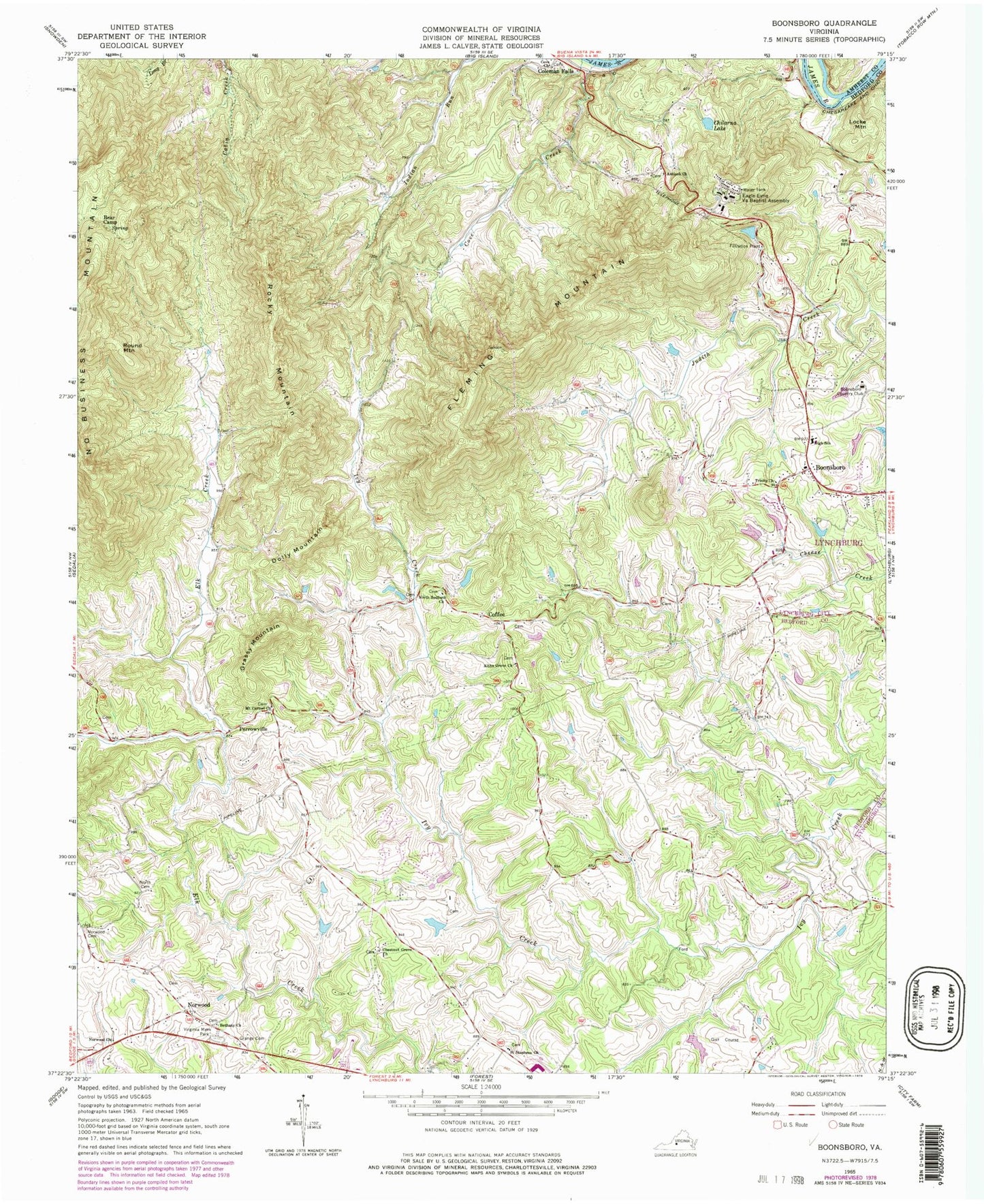
Classic USGS Boonsboro Virginia 7.5'x7.5' Topo Map
Couldn't load pickup availability
Historical USGS topographic quad map of Boonsboro in the state of Virginia. Typical map scale is 1:24,000, but may vary for certain years, if available. Print size: 24" x 27"
This quadrangle is in the following counties: Amherst, Bedford, Lynchburg (city).
The map contains contour lines, roads, rivers, towns, and lakes. Printed on high-quality waterproof paper with UV fade-resistant inks, and shipped rolled.
Contains the following named places: Altha Grove Church, Antioch Church, Bear Camp, Bethany Church, Chestnut Grove Church, Chilarna Lake, Cove Church, Cove Creek, Eagle Eyrie Virginia Baptist Assembly, Fleming Mountain, Grange Cemetery, Mount Carmel Church, North Bedford Church, North Cemetery, Norwood Cemetery, Norwood Church, Rocky Mountain, Round Mountain, Saint Stephens Church, Trinity Church, Virginia Memorial Park, Coffee, Norwood, Perrowville, Ramsey Dam, Boonsboro Country Club, Boonsboro, Dolly Mountain, Grassy Mountain, Locke Mountain, Ivy Hill Airport (historical), WYYD-FM (Amherst), Antioch School (historical), Boonsboro Elementary School, Colonial Hills Golf Course, Eagles Eyrie, Ivy Hills Golf Club, Moseley School (historical), Norwood Church (historical), Whitten Road School (historical), Boonsboro United Methodist Church, Meriwether School (historical), Jefferson District, Boonsboro Volunteer Fire and Rescue Company 3, Forest Elementary School, Jefferson Forest High School