MyTopo
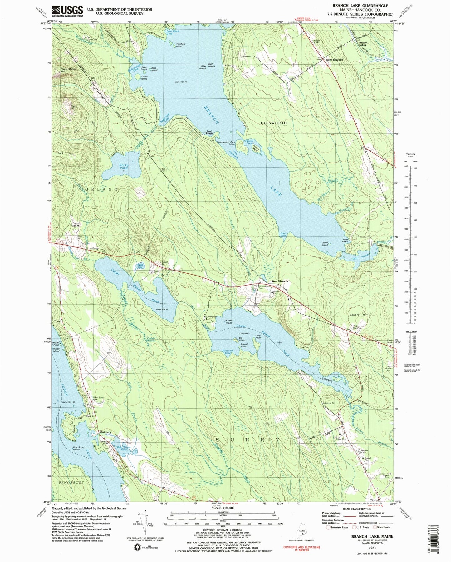
Classic USGS Branch Lake Maine 7.5'x7.5' Topo Map
Couldn't load pickup availability
Historical USGS topographic quad map of Branch Lake in the state of Maine. Map scale is 1:24000. Print size is approximately 24" x 27"
This quadrangle is in the following counties: Hancock.
The map contains contour lines, roads, rivers, towns, and lakes. Printed on high-quality waterproof paper with UV fade-resistant inks, and shipped rolled.
Contains the following named places: Big Island, Birch Grove Cemetery, Bowden Hill Brook, Boy Scout Island, Branch Lake, Branch Lake Dam, Calf Island, Carlisle Brook, Carlisle Meadow, Carters Brook, Cow Island, Cunningham Ridge Cemetery, Cunningham Ridge Cemetery, Dean Brook, Dean Brook Cove, Dees Island, Dollard Hill, Dorr Thompson Cemetery, Flag Hill, Flying Moose Mountain, Gold Stream Pond, Gott Brook, Hales Beach, Haney Point, Haney Point, Happytown Cemetery, Hillside Cemetery, Howards Brook, Hurds Corner, Indian Island, Jesse Bog, John Gray Brook, Johns Island, Long Point, Loon Cove, Lower Patten Pond, Lower Patten Pond Dam, Merrill Point, Mill Brook, Mill Pond, Moore Brook, Musquash Cove, Nicolin (historical), Nicolin Cemetery, Nicolin Siding, North Ellsworth, North Ellsworth Cemetery, Patten Pond Camping Resort, Pickeral Cove, Pickerel Island, Rock Island, Rocky Pond, Rocky Pond Brook, Rocky Pond Cove, Sand Beach, Snake Island, Steres Island, Teachers Island, The Narrows, Thompson Brook, Toddy Pond, Twenty Acre Island, Upper Patten Pond, West Ellsworth, West Surry, West Surry Cemetery, Winkumpaugh Brook, Winkumpaugh Cove